


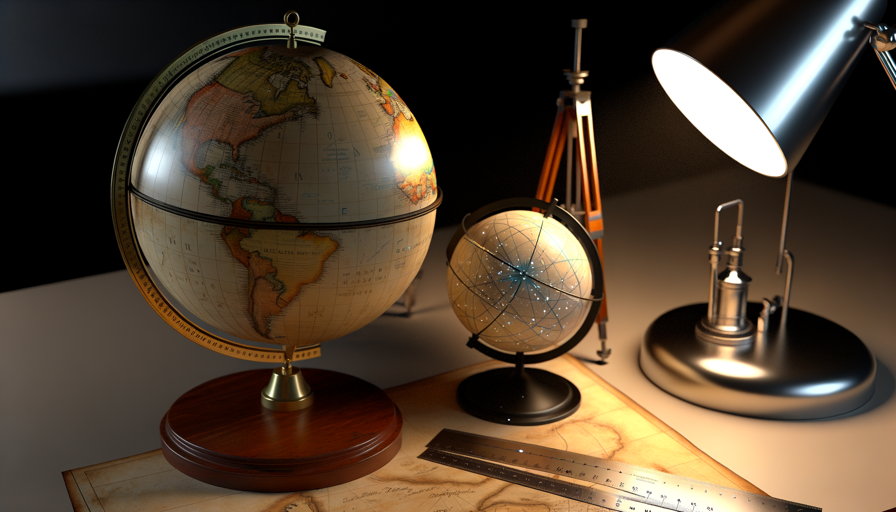
Understanding Scale and Distance with Globes: Your Essential Guide
Welcome back to our series on mastering geographic concepts. In our previous discussions, we laid the groundwork for understanding maps and representations of the Earth. Now, we turn our attention to a fundamental tool often overlooked in the digital age: the globe. While flat maps are ubiquitous and convenient, they inherently suffer from distortions when representing a spherical world, particularly affecting our understanding of scale and distance. This distortion can lead to misconceptions about the size of countries, the true shortest paths between locations, and the sheer vastness of our planet.
This post aims to demystify how globes work and why they remain unparalleled for accurately visualizing scale and distance on Earth's surface. We will explore the concept of scale as applied to a sphere, detail practical methods for measuring true distances on a globe, and introduce the crucial concept of Great Circle Distance. By the end of this guide, you will possess a deeper appreciation for the globe as a powerful geographic tool and gain confidence in interpreting our world without the distortions inherent in most two-dimensional representations. Let us embark on this journey to see the world more accurately, one measurement at a time.
The Fundamental Advantage: Globes vs. Flat Maps
To truly grasp why globes are superior for understanding scale and distance, we must first confront the fundamental challenge of representing a sphere on a flat surface. Imagine trying to flatten an orange peel perfectly without tearing or stretching it. It is simply impossible; some part of the peel will inevitably be distorted. This is the same problem cartographers face when creating flat maps of the Earth. They must use mathematical projections, which inevitably stretch, compress, or tear the surface data to lay it flat. Different projections prioritize preserving different properties – some aim to preserve area, some shape, some direction, but none can preserve all of them simultaneously across the entire map.
This results in distortions of size, shape, direction, and crucially for our topic, scale and distance. For example, the Mercator projection, common in many world maps, severely exaggerates the size of landmasses far from the equator, making Greenland appear larger than Africa when Africa is, in reality, approximately 14 times larger. Distances and shortest paths also become distorted; a straight line on a Mercator map is a line of constant compass bearing (a rhumb line), not the shortest distance between two points on the sphere. Globes, on the other hand, are three-dimensional models of the Earth, designed to mimic its spherical shape as closely as possible at a reduced size. They are not projections but miniature representations. This simple fact means that the relationships between points on the globe – their relative sizes, shapes, distances, and directions – remain true to those on the real Earth, scaled down proportionally.
Because a globe is a scaled model of a sphere representing another sphere (the Earth), it avoids the geometric distortions inherent in flat map projections. The angles, areas, and distances are preserved relative to each other across the entire surface of the globe. This makes the globe the most accurate tool for visualizing the Earth as it truly is, offering an undistorted view of continents, oceans, and the spatial relationships between them. Understanding this core difference is the first step in appreciating the power of the globe as a tool for geographic literacy.
What Exactly is Scale? Decoding Geographic Representation
Before we delve deeper into using globes, let us ensure we have a firm grasp on the concept of scale itself. In geography and cartography, scale represents the relationship between a distance on a map or globe and the corresponding distance on the Earth's actual surface. It is essentially the ratio of reduction used to shrink the real world down to a manageable size for study. Understanding scale is fundamental because it allows us to translate measurements taken from the model back into real-world dimensions. Without knowing the scale, a map or globe is just an interesting pattern of shapes and lines without any practical spatial meaning.
Scale is typically expressed in several ways:
1. Representative Fraction (RF): This is a ratio or fraction, such as 1:1,000,000 or 1/1,000,000. It means that one unit of measurement on the map or globe represents 1,000,000 of the *same* units on the ground. For example, 1 inch on the globe represents 1,000,000 inches on Earth, or 1 centimeter represents 1,000,000 centimeters. The RF is unitless, which makes it universally applicable regardless of the measurement system being used (inches, centimeters, etc.), as long as the same unit is applied to both parts of the ratio. This form of scale is particularly important for globes because it represents a consistent ratio across the entire model.
2. Verbal Scale: This expresses the scale in words, stating the relationship between map/globe units and ground units directly, using different units. For example, "one inch represents 16 miles." This is often easier for interpretation by non-experts as it provides a direct conversion between a common measurement unit on the map/globe and a familiar distance unit on the ground. While straightforward, it is less precise than the RF because it is tied to specific units.
3. Graphic Scale (or Bar Scale): This is a visual representation of the scale, usually a line marked with distances that represents corresponding distances on the ground. You can directly measure a distance on the map or globe and then compare it to the bar scale to determine the real-world distance. Bar scales are convenient because they remain accurate even if the map is enlarged or reduced (e.g., photocopied), although this is less relevant for a physical globe which isn't typically resized. For globes, the RF is the most common and useful representation of its inherent, consistent scale. Understanding these different formats helps in using any geographic representation effectively.
Scale on a Globe: A Constant and True Representation
One of the most significant advantages of a globe over most flat maps is that its scale is constant across its entire surface. Unlike flat maps where distortion varies depending on the projection and location (e.g., distortion increases away from standard parallels or lines), a globe maintains the same representative fraction everywhere. This consistency arises directly from the fact that the globe is a scaled-down model of the Earth's actual spherical shape. Every point on the globe is reduced by the same proportion relative to its corresponding point on Earth.
This means that if a globe has a scale of 1:40,000,000, then one inch on the globe represents 40,000,000 inches on the real Earth, and one centimeter on the globe represents 40,000,000 centimeters on the real Earth. This ratio holds true whether you are measuring distances near the equator, over the poles, or across continents and oceans. This uniform scale is precisely why globes are invaluable for accurate comparisons of size and distance between different regions of the world. You can visually compare the area of Brazil to the area of Australia directly on a globe and get a much truer sense of their relative sizes than you would on many flat maps.
The scale of a globe is usually indicated somewhere on its surface, often near the base or in the legend. It is almost always given as a representative fraction (RF). While a verbal scale might also be included, the RF is the fundamental indicator of the globe's scale. Knowing this single ratio is sufficient to calculate any real-world distance from a measurement taken anywhere on the globe's surface, a feat that is much more complex and often impossible to do accurately everywhere on a single flat map projection. This consistent scale is the key that unlocks accurate distance measurement on a globe, bringing us closer to understanding the true spatial relationships on our planet.
Measuring Distance on a Globe: Finding the True Path
Equipped with an understanding of scale and the globe's true representation, we can now tackle the practical task of measuring distances. Measuring distance on a globe is fundamentally different from measuring on most flat maps because the globe allows us to find the shortest path between two points on a sphere – what is known as the Great Circle Distance. While a straight line drawn on a flat map might *look* like the shortest route, it very often is not the true shortest path on the curved surface of the Earth. On a globe, a straight line connecting two points *on the surface of the globe* (not through the interior) represents the scaled-down version of this true shortest path.
Think about flying on an airplane across the ocean; the route often appears curved on a flat map, especially on projections like Mercator. This is because the plane is following a path that is the shortest distance over the curved surface of the Earth, which translates to a curved line on a flat map but a relatively "straight" path on a globe's surface. Measuring this path accurately is a core function of using a globe for distance.
Let us break down the process into why it works, the tools needed, and the steps to take. This practical skill provides a tangible way to interact with geographic scale and distance. It reinforces the lessons about distortion and the value of a spherical model.
Why Measurement Works Directly on a Globe
Measurement on a globe works because the globe is a miniature, scaled replica of the Earth's surface. When you measure the distance between two points on the globe's surface, you are directly measuring the corresponding path on the scaled-down sphere. If you stretch a string taut between two points on a globe, that string follows the path of a Great Circle arc between those points. A Great Circle is any circle on the surface of a sphere whose plane passes through the center of the sphere. The equator and all lines of longitude are segments of Great Circles. Any other circle on the sphere's surface whose plane does not pass through the center is a Small Circle (lines of latitude other than the equator are Small Circles). The shortest distance between any two points on the surface of a sphere is always along the arc of the Great Circle connecting them.
By measuring the shortest path between two points on the globe's surface, you are directly capturing the scaled length of the Great Circle distance on Earth. This is a fundamental geometric property of spheres. This capability is unique to spherical models like globes and distinguishes them sharply from distorted flat maps when considering true point-to-point distances over long ranges. The accuracy depends only on the precision of your measurement and the accuracy of the globe itself.
Tools of the Trade
Measuring distance on a globe requires simple tools that can conform to the curved surface. You cannot effectively use a standard rigid ruler directly on a globe for anything but very short distances along specific lines (like a meridian). The curvature quickly makes a straight ruler inaccurate.
The most common and effective tools are:
1. String or Thread: A piece of non-stretchy string or thread is ideal. It is flexible enough to follow the globe's curvature and can be easily stretched between two points. Once marked, the string can be straightened and measured against a linear ruler or the globe's graphic scale (if available).
2. Flexible Ruler or Measuring Tape: A soft, flexible measuring tape (like a tailor's tape) can also work, allowing you to lay it directly along the curved surface between your two points. However, string is often easier to keep precisely on the shortest path, especially over long distances.
3. Dividers or Compass (for small distances): For very short distances, a pair of dividers or a compass can be used. Set the points to cover the distance between two close locations, then step the dividers along the desired path. This method is less practical for long, curved Great Circle distances but useful for comparing distances on a local level on the globe.
4. Specialized Globe Measuring Tools: Some globes come with or can be used with specialized flexible rulers or curved devices designed to match the globe's specific curvature. These offer convenience but are essentially refined versions of the basic string method. Having a standard straight ruler is also essential for measuring the length of your string or using the RF scale for calculation.
Step-by-Step Guide to Measuring Distance
Here is a practical guide on how to measure the Great Circle distance between two points on your globe:
Step 1: Identify Your Points. Locate the two places on your globe between which you want to measure the distance. For example, let us say we want to measure the distance between London, UK, and New York City, USA. Find these cities on the globe's surface.
Step 2: Stretch the String. Take your piece of string or thread. Hold one end firmly on the location of London. Stretch the string taut across the surface of the globe directly towards New York City. Ensure the string lies flat against the globe's surface along the shortest visible path between the two points.
Step 3: Mark the Distance. While keeping the London end secure, stretch the string until it reaches New York City. Hold the string against the New York City location and make a clear mark on the string (e.g., with a pen, or simply pinch the string firmly with your finger and thumb) at the exact point that corresponds to New York City. You now have the length of the Great Circle path between the two cities represented on the string.
Step 4: Measure the String. Carefully lift the string off the globe, keeping the marked length. Straighten the string out and measure the distance between the starting end (London) and the mark you made (New York) using a standard ruler or measuring tape. Record this measured distance in a convenient unit (e.g., inches or centimeters).
Step 5: Use the Globe's Scale. Now you need to convert this measured distance on the globe into the actual distance on Earth. Find the scale of your globe, which is typically given as a representative fraction (RF), like 1:40,000,000. This means that 1 unit of measurement on the globe represents 40,000,000 of the same units on Earth.
Calculating Actual Distance
With your measured distance from the globe and the globe's RF scale, calculating the actual distance is a straightforward multiplication.
Let:
D_globe = The distance you measured on the globe (e.g., in centimeters or inches).
RF = The Representative Fraction of the globe's scale (e.g., 1:40,000,000).
Scale Denominator = The second number in the RF (e.g., 40,000,000).
The actual distance on Earth (D_earth) in the *same units* as D_globe is calculated as:
D_earth = D_globe * Scale Denominator
Example: Suppose your globe's scale is 1:40,000,000 and you measured the string distance between London and New York City as 14.2 cm.
D_earth (in cm) = 14.2 cm * 40,000,000 = 568,000,000 cm
To convert this to a more practical unit like kilometers:
There are 100 centimeters in 1 meter, and 1000 meters in 1 kilometer. So, there are 100 * 1000 = 100,000 centimeters in 1 kilometer.
D_earth (in km) = D_earth (in cm) / 100,000 = 568,000,000 cm / 100,000 cm/km = 5,680 km.
Alternatively, if you measured in inches and want the distance in miles:
Suppose the measured distance was 5.6 inches and the scale is still 1:40,000,000.
D_earth (in inches) = 5.6 inches * 40,000,000 = 224,000,000 inches
There are 63,360 inches in 1 mile (5280 feet/mile * 12 inches/foot).
D_earth (in miles) = D_earth (in inches) / 63,360 inches/mile = 224,000,000 / 63,360 ≈ 3,535 miles.
Note: Actual Great Circle distance between London and NYC is approximately 5,585 km or 3,470 miles. The small difference in our examples is due to rounding and potential measurement imprecision on the globe, but the calculation method is correct. This exercise demonstrates the power of combining a simple physical measurement on a scaled model with its known scale to derive significant real-world distances. It is a powerful illustration of the relationship between the globe and the Earth it represents.
The Significance of Great Circle Distance
We have touched upon Great Circle Distance as the shortest path on a sphere, but its significance extends far beyond a geometric curiosity. Understanding Great Circle paths is fundamental to efficient long-distance travel and navigation across the Earth's surface. Any path that follows a Great Circle arc between two points is the shortest route a ship or aircraft can take to get from one point to the other. This is why transoceanic and transcontinental flights often appear to take northerly routes (in the Northern Hemisphere) on typical flat maps, even for journeys that seem to be primarily east-west. For example, a flight from New York to Beijing appears to go way up over Canada and Alaska on a Mercator map, but this is the Great Circle path, representing the shortest distance over the Earth's curved surface.
Pilots and ship navigators use complex calculations based on spherical geometry to determine these Great Circle routes. Historically, celestial navigation also relied on understanding positions and paths relative to the celestial sphere, which mirrors the geometry of the Earth's sphere. Even in the age of GPS, the underlying principle of calculating the shortest distance between two points on the Earth's ellipsoidal model (a more accurate shape than a perfect sphere) is based on the concept of a geodesic, which is the equivalent of a Great Circle path on a non-perfect sphere.
Viewing these paths on a globe makes their efficiency immediately apparent. If you stretch a string between two distant cities, you will see the path often curves towards the poles relative to lines of latitude (Small Circles). A path along a line of latitude (except the equator) would be significantly longer. Thus, the globe serves not just as a tool for measuring distance, but also as a powerful visual aid for understanding why travel routes are planned the way they are, revealing the true nature of global connectivity and the geometry that governs it.
Limitations of Globes
While globes excel at representing scale and distance without the distortions of flat map projections, they are not without limitations. The most significant limitation is their practical size. To represent the entire Earth on a globe that is manageable for a classroom or office desk, the scale must be very small (meaning the denominator of the RF is very large). A typical 12-inch diameter globe has a scale of approximately 1:42,000,000. This means a vast area on Earth is compressed into a small space on the globe.
Consequently, globes cannot show a high level of detail. You can see continents, countries, major cities, and perhaps major rivers and mountain ranges. However, details like small towns, local roads, individual buildings, or intricate coastlines are impossible to represent clearly at such a small scale. For studying these smaller features or regions, large-scale flat maps (maps covering a small area but showing a lot of detail, like a city map or topographic map) are necessary. These large-scale maps have relatively large RFs (e.g., 1:10,000) and can show much finer detail, though they too will have some distortion, which is less noticeable over the small area they cover.
Therefore, globes and flat maps serve different purposes. Globes are best for understanding global perspective, relative size, true distance, and Great Circle paths. Flat maps, particularly large-scale ones, are essential for detailed study of smaller areas, planning local navigation, and representing thematic data. Recognizing the limitations of a globe helps us appreciate when to use it and when a different cartographic tool might be more appropriate for the task at hand. No single map or model can do everything perfectly, and understanding their respective strengths and weaknesses is key to effective geographic analysis.
Practical Applications and Modern Connections
The skills and concepts we have discussed regarding understanding scale and measuring distance on a globe have tangible applications, both historical and contemporary. In education, the globe is an indispensable tool for teaching fundamental geographic concepts. It provides students with an intuitive sense of the Earth's spherical nature, helping them visualize continents, oceans, and poles in their true relative positions and sizes. This foundational understanding helps correct common misconceptions fostered by distorted flat maps and lays the groundwork for more advanced spatial reasoning. Learning to measure on a globe provides a hands-on experience with scale and distance calculation.
Historically, celestial globes and early terrestrial globes were vital tools for astronomers and navigators. Understanding the relative positions of stars and planets on a celestial sphere, or the positions of landmasses and seas on a terrestrial sphere, was crucial for exploration and trade. While modern navigation relies heavily on satellite technology, the underlying principles of spherical geometry and Great Circle paths remain relevant; GPS receivers calculate positions and distances based on the Earth's true shape.
Furthermore, the principles of Great Circle distance are applied in digital mapping and navigation software. When you use online map services or GPS apps to get directions for long-distance travel, especially flights, the calculated routes are based on finding the shortest path over the Earth's curved surface – the Great Circle path. Even though you are looking at a flat screen, the calculations being performed behind the scenes are using spherical geometry, conceptually similar to stretching that string across a digital globe model. Understanding how to measure and interpret distances on a physical globe provides valuable insight into how these modern digital tools function and why they propose the routes they do, reinforcing the enduring relevance of these geographic principles. The physical globe serves as a tangible model that makes these abstract digital calculations understandable.
Deepening Your Geographic Understanding
Mastering the concepts of scale and distance measurement with a globe is more than just a technical exercise; it is a pathway to a more profound understanding of our world's geography. It empowers you to look at maps and global representations with a critical eye, recognizing their inherent strengths and limitations. It helps you appreciate the vastness of the distances between continents and the efficiency of the routes that connect them. This knowledge builds spatial literacy, a crucial skill in an increasingly interconnected world.
Continue to explore your globe, measuring distances between places that interest you. Compare the distances between cities in the Northern Hemisphere versus comparable distances in the Southern Hemisphere. Observe how seemingly roundabout Great Circle routes on a flat map appear as direct paths on the globe. This active engagement will solidify your understanding. Consider exploring different types of globes, such as physical globes that show topography, or even celestial globes that model the stars. Each offers a unique perspective on spatial relationships and scaling.
Conclusion
In this post, we have journeyed through the essential concepts of understanding scale and distance using a globe. We have established that the globe, as a scaled-down spherical model of the Earth, offers an unparalleled advantage over flat maps by providing a true and constant representation of geographic scale and relative positions. We have explored what geographic scale means, particularly the representative fraction which is key to globe interpretation. Crucially, we detailed how to measure the true, shortest distance – the Great Circle Distance – between any two points on Earth by using simple tools like string on a globe and applying its scale. This process reveals why many real-world travel routes follow paths that might appear counter-intuitive on traditional flat map projections.
While acknowledging the globe's limitations in displaying fine detail, we highlighted its irreplaceable value for gaining a global perspective, understanding true spatial relationships, and appreciating the significance of Great Circle navigation. These fundamental geographic skills, honed through interaction with a physical globe, remain relevant in navigating and interpreting our world, complementing modern digital tools by providing the core conceptual framework. By utilizing a globe, you equip yourself with a powerful tool for accurate geographic visualization and measurement. We encourage you to continue exploring the world through the accurate lens that a globe provides, fostering a deeper and more precise understanding of our planet's geography.