
Mount Rainier
A glacier-clad stratovolcano above evergreen valleys.

Experience America’s wild landscapes in sculpted 3D relief.
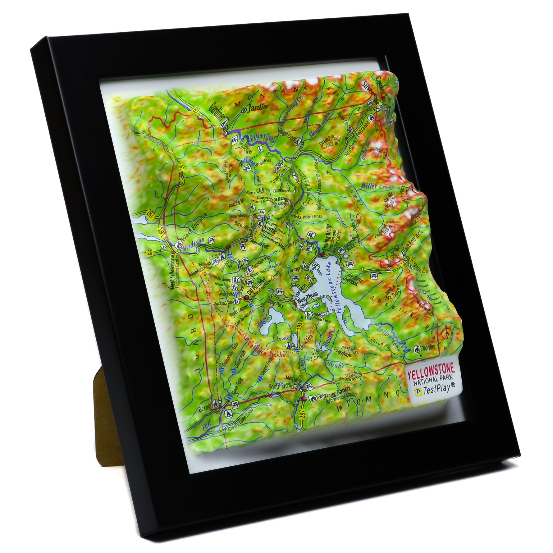
Our thermoformed relief turns cartography into connection. Mountains lift, canyons fall, and the memory of the trail returns to your hands. These are maps designed to be felt—not just seen.
Every summit, valley, and watershed is molded from accurate terrain data, finished for modern spaces—homes, cabins, studios, and classrooms.
“A museum-quality way to keep the parks close. The texture and depth make every ridge unforgettable.”
— Customer review
A glacier-clad stratovolcano above evergreen valleys.

Rainforests, peaks, and rugged coast in one park.

Granite walls, glacial valleys, and timeless trails.

Knife-edge ridges, ice-carved valleys, endless horizon.

Jagged granite towers rising from sage flats.

High passes, alpine lakes, and tundra country.

Geysers, canyons, and a supervolcano-shaped plateau.

Sandstone fins, windows, and gravity-defying spans.

A mile-deep geologic library etched in stone.

Sheer Navajo sandstone walls and river-cut canyons.

Granite shores, carriage roads, Atlantic light.

Canal paths, hardwood forests, midwest quiet.

Blue ridgelines, biodiverse coves, Appalachian soul.

Skyline Drive vistas and folded Blue Ridge terrain.
Ideal for gift shops near National Parks and gateway towns. Tactile maps that turn browsers into buyers.
A thermoformed 3D map where elevation is physically molded—so you can see and feel the terrain with true depth.
Crafted in Ukraine by skilled mapmakers, then shipped to you from the USA for fast delivery.
We currently feature: Acadia, Arches, Cuyahoga Valley, Glacier, Grand Canyon, Grand Teton, Great Smoky Mountains, Mount Rainier, Olympic, Rocky Mountain, Shenandoah, Yellowstone, Yosemite, Zion.
Yes—gift shops and outfitters near National Parks love our tactile 3D maps. Start a wholesale inquiry.
TestPlayNA: Your Memories, Elevated: National Park & Ski Maps.