


Feel the adventure in your fingertips with TestPlayNA's tactile maps. These aren't just souvenirs; they're a heartfelt journey back to your outdoor adventures. Each raised relief map brings the landscapes of North America's national parks and ski resorts to life, connecting you to cherished memories. Dive into the artistry and relive those moments every time you touch these maps. Don't just remember your travels—experience them again. Explore our collection today and enjoy a 10% discount with code NOSTALGIA10. Learn more about the emotional impact of travel nostalgia.
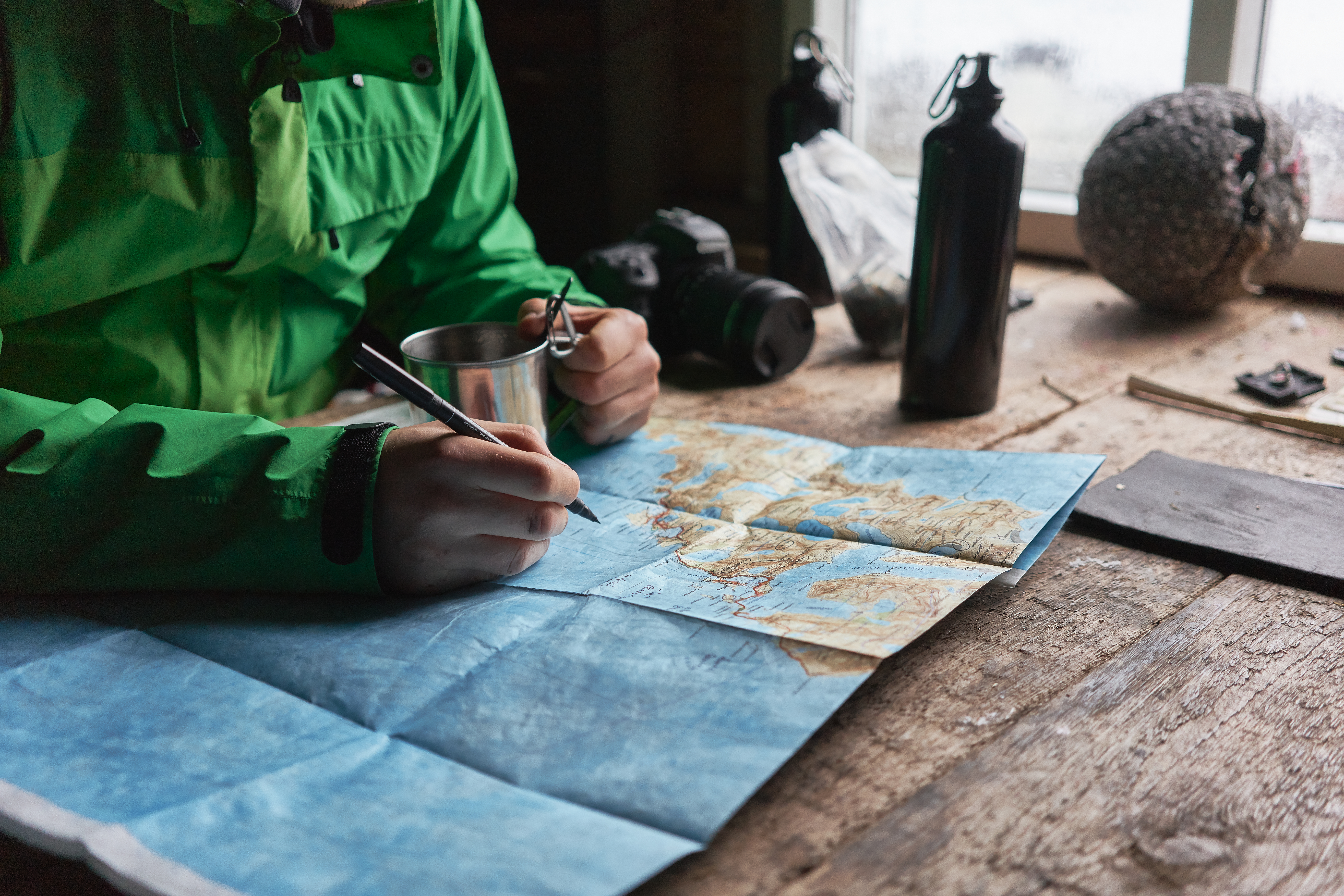
Travel memories hold a special place in our hearts, and tactile maps offer a unique way to reconnect with these cherished moments. They serve as more than just keepsakes, transforming into emotional anchors that help us relive past adventures. This section explores how tactile maps influence travel nostalgia and create connections through raised relief designs.
Tactile maps have an extraordinary ability to evoke emotions and transport us back to the places we once explored. They offer a tangible connection to our past, allowing us to feel the contours of the landscapes that shaped our experiences. According to a study on the importance of nostalgic emotions in tourism, these maps can trigger memories that enhance our appreciation for past journeys.
The raised relief features of tactile maps stimulate our senses, providing a multi-dimensional experience that traditional maps lack.
This sensory engagement strengthens our emotional ties to the places we've visited.
By engaging both sight and touch, tactile maps create a deeper, more personal connection to our travel memories.
Real-world examples include the use of tactile maps in educational settings, where they help students understand geographical features through interaction. These experiences highlight the power of touch in recalling and retaining information.
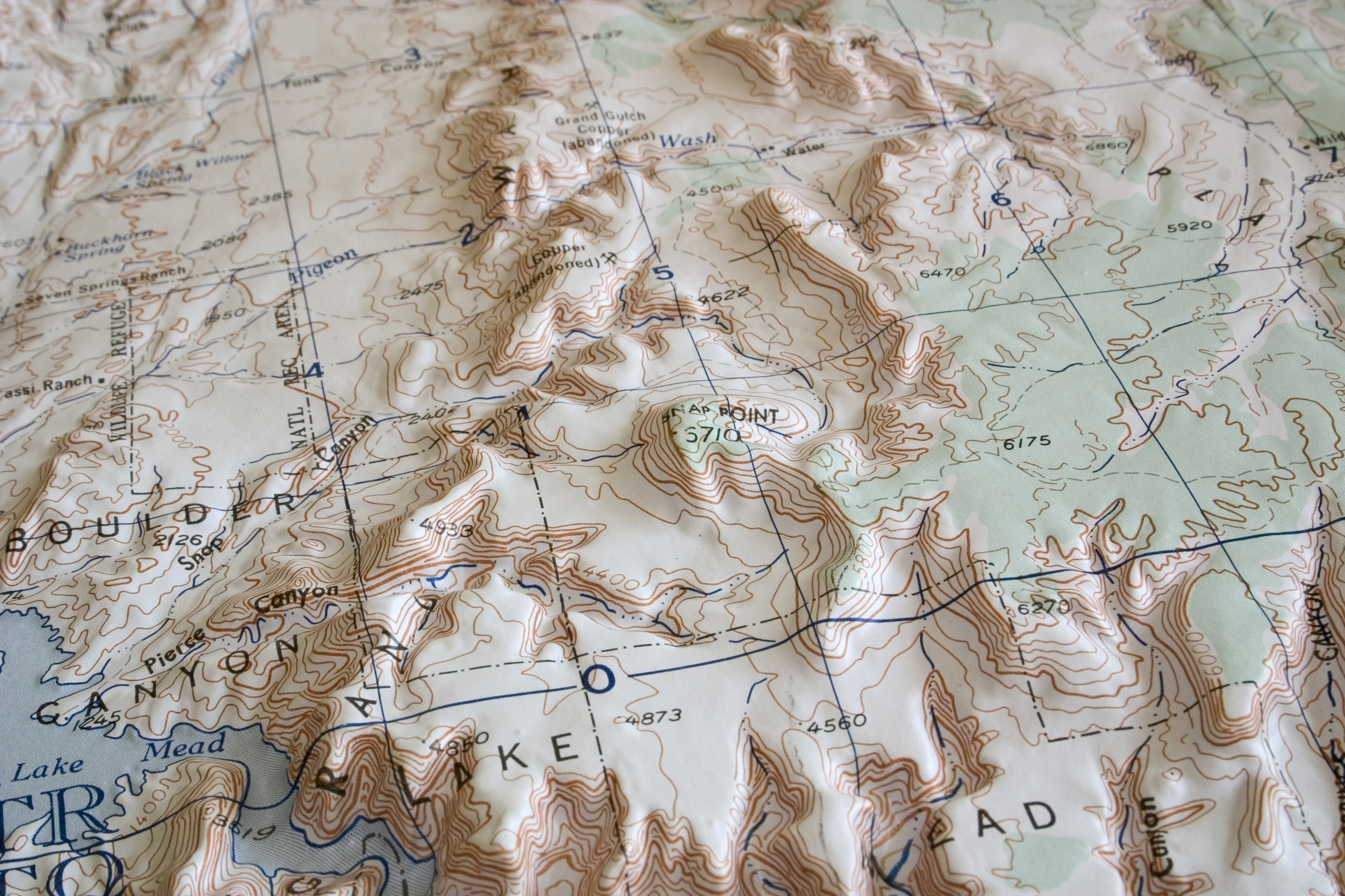
Raised relief maps offer a distinct way to bridge the gap between memory and reality. They transform flat images into three-dimensional experiences, offering a more immersive way to revisit past adventures. The art of mapmaking is not just about depicting geography but also about capturing the essence of a place.
Raised relief maps provide topographical details that help us visualize and remember specific aspects of our travels.
This detailed representation allows travelers to reconnect with the nuances of their journeys, from mountain peaks to winding trails.
These maps serve as conversation starters, inviting others to share in our adventures and sparking discussions about shared experiences.
Case studies show that when people engage with raised relief maps, they often recall specific stories associated with those landscapes, demonstrating the power of tactile interaction in preserving travel memories.
The creation of tactile maps is not just a technical process; it's an art form. Each map is a testament to the craftsmanship and creativity involved in capturing the world's beauty. This section delves into the artistic aspects of map-making and the stories behind each piece.
Map artistry involves meticulous attention to detail, ensuring that each map is an accurate representation of the terrain. The process of crafting these souvenirs combines traditional techniques with modern technology to create pieces that are both visually stunning and touchable.
Artisans use specialized tools to carve out the contours of the landscape, capturing every ridge and valley.
Modern technology enhances accuracy, allowing for precise elevation and geographical depiction.
The finished product is a map that not only captures the physical features but also the spirit of the place.
An example of this artistry can be seen in the intricate maps of iconic national parks, where the craftsmanship brings the natural beauty of these locations to life. These maps are more than just guides; they are works of art that celebrate the landscapes they represent.
Every tactile map tells a story, weaving together the elements of geography, adventure, and personal experience. The narratives embedded within these maps are as varied as the landscapes they depict, offering a unique perspective on our own travel stories.
Each map is designed with the intention of capturing not just a place, but also the emotions tied to it.
The craftsmanship involved ensures that no two maps are exactly alike, reflecting the individuality of each adventure.
By preserving the topography of these locations, tactile maps keep the memories of our journeys alive, allowing us to share these stories with others.
This storytelling aspect is what makes tactile maps such powerful tools for reminiscing and sharing travel memories, creating a lasting impact on those who interact with them.

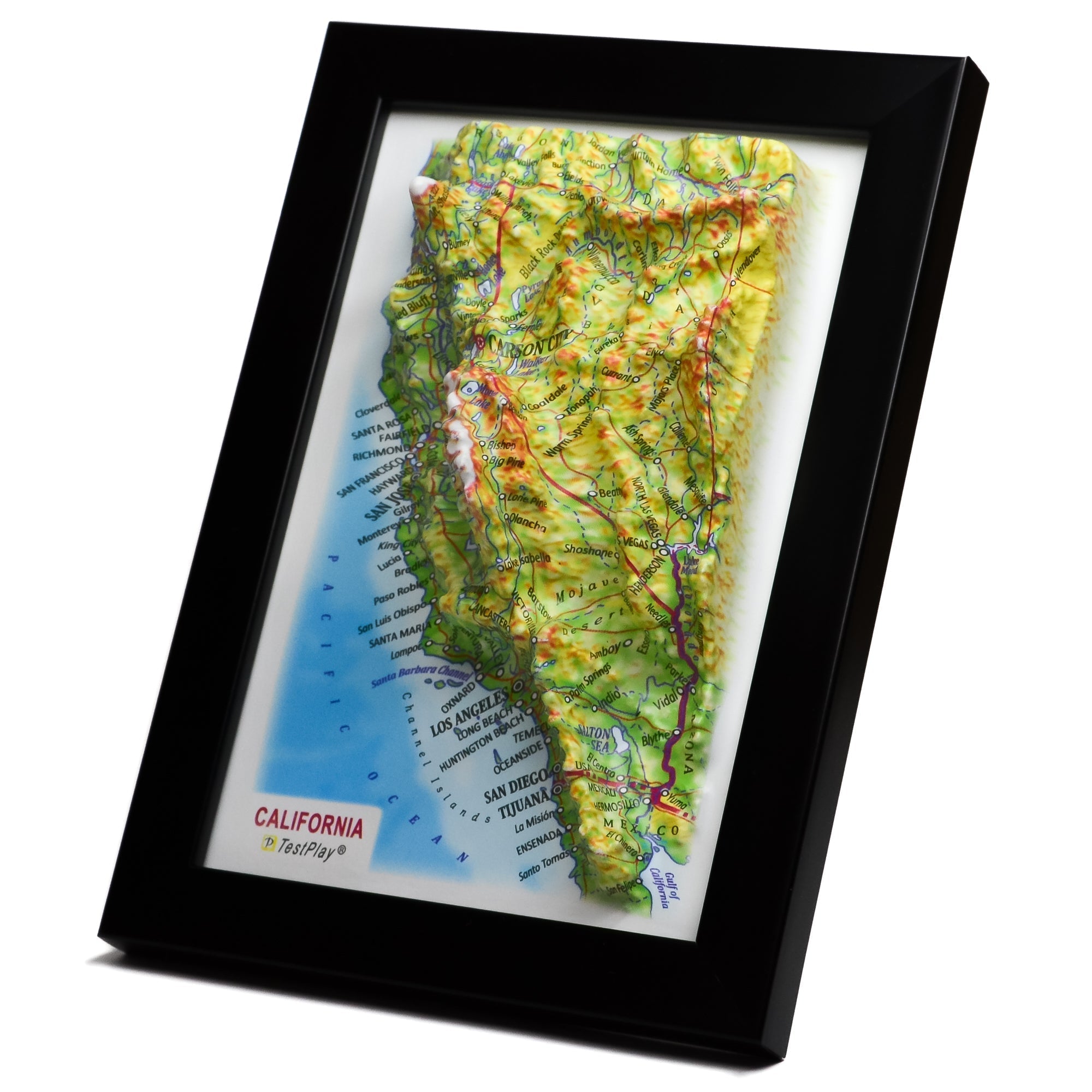
Tactile maps offer an immersive way to relive the beauty and adventure of the great outdoors. By capturing the essence of national parks and ski resorts, these maps allow us to hold the world in our hands. This section highlights how tactile maps bring landscapes to life.
National parks are celebrated for their breathtaking scenery and natural wonders. Tactile maps allow us to relive these experiences in a tangible way, providing a connection to the places we love. These maps capture the majesty of the parks' landscapes, from towering mountains to serene valleys.
The tactile features of these maps enhance our understanding of the parks' geography, offering a hands-on way to explore their features.
They serve as educational tools, helping us learn about the natural formations and ecosystems within the parks.
By bringing the parks to life, these maps inspire us to explore and protect these treasured landscapes.
As seen in studies, engaging with tactile maps of national parks can deepen our appreciation for these natural wonders, emphasizing the importance of conservation and stewardship.
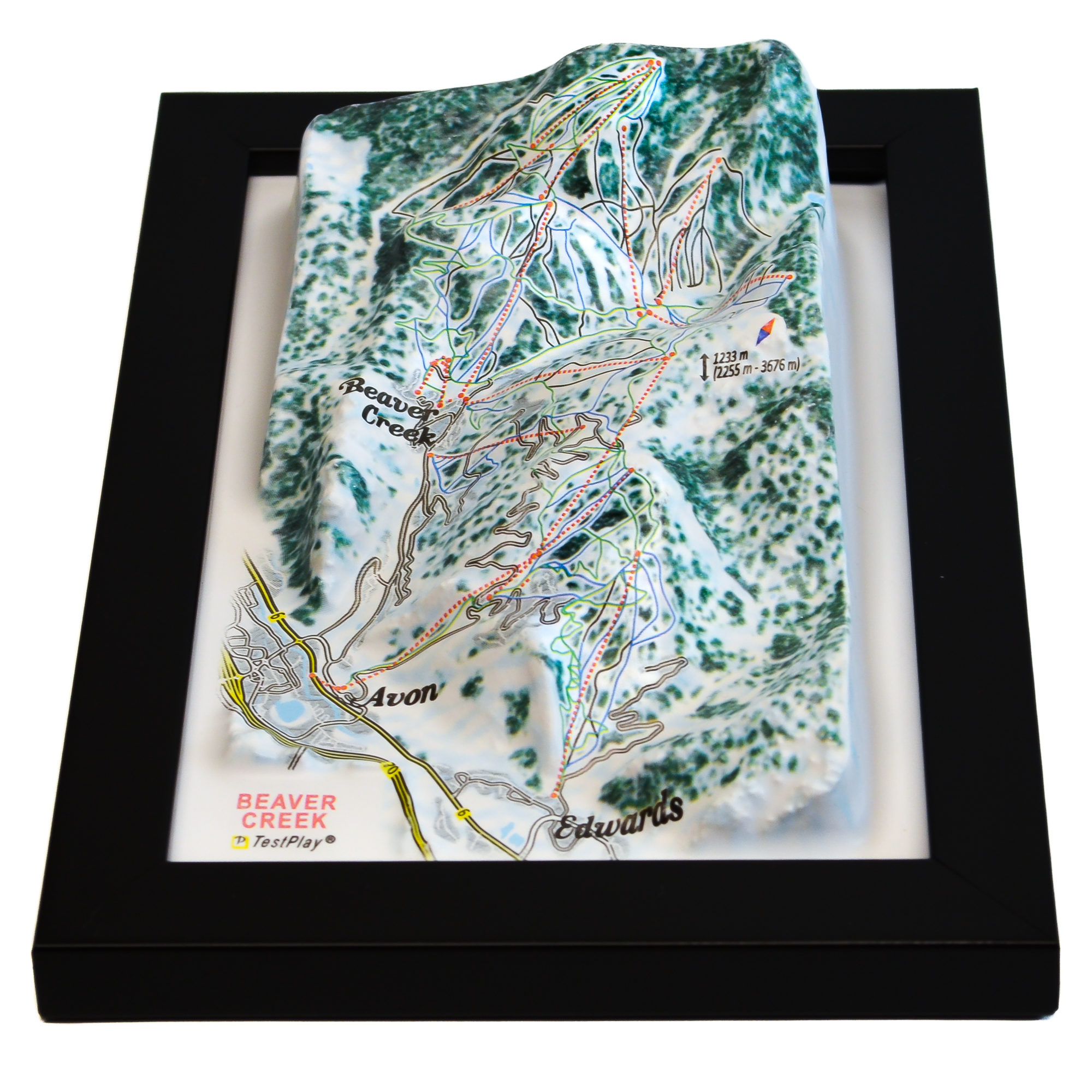
Ski resorts hold a special allure for outdoor enthusiasts, offering thrilling adventures on snow-covered slopes. Tactile maps of these resorts capture the excitement of skiing and snowboarding, providing a sensory connection to these experiences.
Ski resort maps highlight the trails, elevations, and unique features of each location, offering a comprehensive view of the terrain.
The raised relief design adds a layer of authenticity, allowing us to visualize the slopes and imagine the thrill of the ride.
These maps serve as reminders of unforgettable experiences, making them cherished souvenirs for those who visit these winter wonderlands.
By capturing the essence of ski resorts, tactile maps allow us to relive the excitement of our adventures, keeping the joy of winter sports alive long after the snow has melted.
TestPlayNA: Your Memories, Elevated: National Park & Ski Maps.