


Unlock Breckenridge: Your Expert Guide to Exploring the Ski Resort in 3D
Breckenridge Ski Resort is a world-class destination, renowned for its vast size, high elevation, and incredible variety of terrain spread across multiple peaks.
For first-time visitors and seasoned experts alike, navigating this sprawling mountain landscape can feel like an adventure in itself, sometimes even a little overwhelming.
Traditional 2D trail maps are essential tools, providing a flat representation of runs and lifts.
However, they often fail to capture the true essence of the mountain's topography – the steepness of a pitch, the expansive feel of an alpine bowl, or the relative elevation gain between different areas.
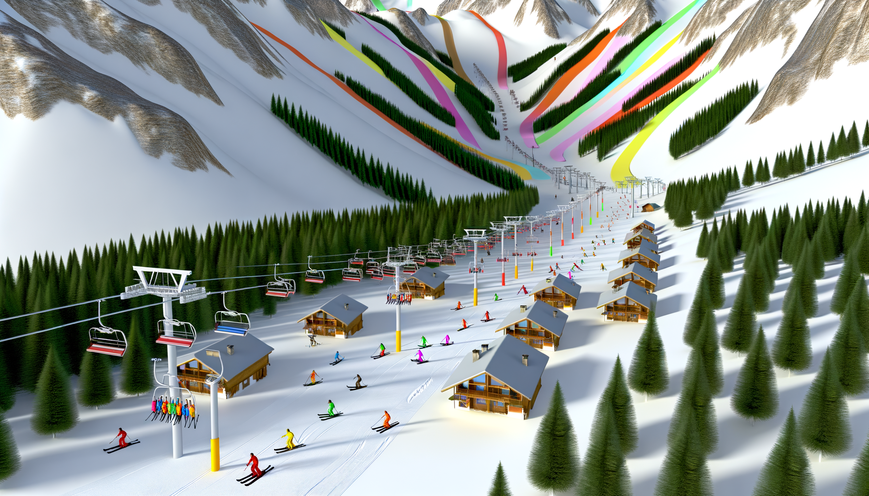
This is where the power of a 3D perspective comes in.
Imagine being able to virtually soar over the resort, seeing how Peak 9 slopes gently from its base compared to the dramatic, wind-scoured ridges of Peak 6.
A 3D map or visualization offers a dynamic way to understand the resort's layout, terrain characteristics, and flow like never before.
It transforms the abstract lines on a paper map into a tangible, navigable space.
This deep dive explores how using a 3D approach to studying the Breckenridge map can dramatically enhance your planning and on-mountain experience.
We will navigate the resort peak by peak, dissecting key terrain features and understanding the lift infrastructure, all through the lens of a three-dimensional view.
By the end, you'll have a powerful new way to visualize Breckenridge, enabling you to make informed decisions, discover hidden gems, and maximize your time on the snow.
Understanding the Beast: Breckenridge at a Glance in Three Dimensions
Before diving into the specifics of each area, it's crucial to grasp the sheer scale and unique vertical layout of Breckenridge.
The resort spans over 2,900 acres and is famous for having the highest chairlift in North America, the Imperial SuperChair, reaching an elevation of 12,840 feet.
This massive vertical drop and the spread across five distinct peaks – Peaks 9, 8, 7, 6, and 10 – are defining features.
While a 2D map shows these peaks side-by-side, a 3D map immediately highlights the elevation differences and how the terrain changes dramatically as you move horizontally across the resort and vertically up the mountain.
From the gentle, sprawling slopes near the base on Peak 9 to the steep, wide-open bowls above the treeline on Peak 6, the variation is immense.
A 3D view gives you an intuitive sense of this progression, making it easier to understand why different areas are suited for different skill levels.
You can see the defined tree lines, the ruggedness of the alpine terrain, and the groomed pathways carved into the mountainside.
This initial three-dimensional overview sets the stage for a more detailed exploration, providing context for the scale of your adventure.
Why 3D Makes a Difference: Beyond the Flat Map
So, specifically, what advantages does a 3D map offer over its traditional 2D counterpart for a complex resort like Breckenridge?
The benefits are numerous and significantly impact your ability to plan and navigate effectively.
Here are some key advantages:
- Intuitive Terrain Understanding: A 3D map provides a realistic representation of slopes and pitches. You can see the steepness of a black diamond run versus a blue cruiser, the undulations of the terrain, and how fall lines truly behave.
- Visualizing Elevation Gain and Drop: Instead of just seeing contour lines, you experience the vertical rise of lifts and the descent of runs. This helps manage expectations about effort and speed.
- Spatial Awareness: Understanding the relationship between different peaks, lifts, and base areas is much easier. You can see how runs funnel into lift bases, how lifts connect different zones, and the proximity (or distance) between points of interest.
- Identifying Landmarks: Treelines, rock formations, specific lift towers, or prominent buildings become visible landmarks in a 3D view, aiding orientation on the mountain.
- Planning Based on Aspect and Sun: Depending on the 3D tool, you might be able to see the orientation of slopes relative to the sun, helping you chase soft snow or avoid icy patches.
- Navigating Off-Piste and Gladed Areas: While always requiring caution and local knowledge, a 3D map can offer a better visual sense of the density of trees in gladed runs or the openness of bowls compared to a 2D representation.
- Pre-Visualizing Runs: You can virtually ski or ride a run before you even get there, gaining familiarity with its twists, turns, and pitches.
In essence, a 3D map brings Breckenridge to life, transforming abstract lines into a dynamic, navigable environment that significantly enhances your preparedness and confidence.
Navigating the Peaks in 3D: A Deep Dive
Let's take our 3D lens and apply it to each of Breckenridge's five iconic peaks.
Understanding the character and layout of each peak from a three-dimensional perspective is key to unlocking the full resort experience.
Peak 9: The Learning Zone and Southern Gateway
In a 2D map, Peak 9 looks like the southernmost peak with a good concentration of green runs.
In 3D, you immediately see its relatively gentle slope rising directly from the Village at Breckenridge base area.
The expansive lower mountain terrain, visible as wide, consistently pitched slopes, confirms its status as an ideal learning area.
As you virtually ascend the lifts like the QuickSilver SuperChair or Beaver Run SuperChair in 3D, you observe the terrain gradually steepen towards the top, offering longer, enjoyable blue cruisers like Volunteer and Columbia.
A 3D view also clarifies how the Peak 9 base area is nestled directly alongside the town, showcasing its convenience.
You can see how runs funnel down towards the main lift loading areas and easily spot the location of ski school meeting points relative to the slopes.
Peak 8: The Heart and History
Peak 8 is the historic core of Breckenridge and its most diverse peak.
Viewing Peak 8 in 3D showcases its dramatic vertical rise, starting from the Gondola Plaza base and extending all the way up to the rugged alpine terrain around the Imperial Express SuperChair.
The transition from the lower mountain's groomed blues and blacks (like Duke's Run and Four O'Clock) to the challenging steeps and bowls higher up is visually striking in 3D.
You can clearly see the layout of the Freeway and Park Lane terrain parks, their jumps and features standing out in relief.
Ascending the Colorado or Rocky Mountain SuperChairs in a 3D simulation allows you to appreciate the length and consistent pitch of classic runs like Centennial.
The most dramatic view is from the top of the Imperial Express, where a 3D perspective reveals the vast, open expanse of the Imperial Bowl and the extreme pitch leading into it – a view impossible to truly appreciate on a flat map.
Seeing how the lift reaches almost the very summit is awe-inspiring in three dimensions.
Peak 7: Cruiser's Paradise
Peak 7 is often characterized as a paradise for intermediate skiers and riders, and a 3D map instantly explains why.
Viewing this peak from the side, you see its consistent, moderate pitch from top to bottom.
The long, wide blue runs – like Angel's Rest, Monte Cristo, and Wire Patch – are visible as beautifully consistent strips of terrain, perfect for high-speed carving.
The Independence SuperChair and Zendo Express lifts appear as smooth ascents covering significant vertical and horizontal distance.
A 3D view helps distinguish the slightly different fall lines and widths of these runs, aiding in choosing which one might be less crowded or offer a different carving experience.
You also get a better sense of how Peak 7 connects to Peak 8 via the Pioneer Crossing trail and lift, seeing the slight dip and rise of the traverse.
Peak 6: The High Alpine Frontier
Peak 6 is where Breckenridge truly reaches into the alpine.
A 3D map is arguably most impactful here, showcasing terrain that is often abstract on a 2D representation.
The elevation gain from the base of the Kensho SuperChair is vividly displayed.
More importantly, the dramatic, rocky contours of the upper mountain, well above the treeline, come into sharp focus.
The expansive bowls – Whales Tail, Upper and Lower Beyond Bowl – are visible in their full, sweeping glory, their steepness and openness clearly depicted.
You can see the wind-scoured ridges, potential cornices, and the rocky entrances to some of the more challenging lines.
Understanding the scale and angle of this terrain from a 3D view helps prepare you for the exposure and challenge of skiing or riding in this zone.
The steep, ungroomed nature of the runs is immediately apparent.
Peak 10: Steep and Deep
Located on the southern edge of the resort map, Peak 10 is known for its challenging groomed black diamond runs and access to expert bowls.
Viewing Peak 10 in 3D highlights its consistent, steep pitch from the top of the Falcon SuperChair down to the base.
Runs like Abyss, Burn, and Faust are clearly visible as direct, fall-line descents, making their black diamond rating instantly understandable from their angle.
While the groomed runs are prominent, a 3D map also reveals the adjacent, often unpatrolled, expert terrain of the Peak 10 bowls, showcasing their steep walls and complex features.
You can see how this peak sits slightly isolated from the main flow of the resort compared to the interconnected Peaks 7, 8, and 9, reinforcing the feeling of a dedicated, challenging zone.
Key Terrain Features Visualized in 3D
Beyond the broad character of each peak, a 3D map excels at depicting specific types of terrain.
Understanding these features visually aids in choosing runs that match your skill level and desired experience.
Bowls: Vast Alpine Playgrounds
Breckenridge is famous for its high alpine bowls, particularly on Peaks 8, 7, and 6.
A 2D map shows these as large, open areas above the treeline.
A 3D map, however, allows you to truly grasp their immense scale, the lack of trees for navigation (making spatial awareness critical), and the typical variable snow conditions you might encounter in such exposed areas.
You can see the curvature of the bowl walls, the steepness of the entries, and how they eventually funnel down towards lower runs or traverses.
Viewing the Imperial Bowl or the vast expanse of Peak 6's bowls in 3D gives you a realistic sense of the challenge and freedom they offer.
Glades: Navigating the Trees
Tree skiing and riding are popular at Breckenridge, with gladed areas available on multiple peaks.
While a 2D map simply colors areas to indicate glades, a 3D map, depending on its detail, can give you a much better idea of tree density.
You can often see the spacing between trees, identify potential lines through the woods, and understand how the pitch changes within the gladed area compared to adjacent groomed runs.
This visualization helps you gauge whether a particular glade is tightly packed (expert only) or more open (suitable for advanced intermediates comfortable in trees).
Groomed Runs: The Corduroy Canvas
Breckenridge maintains an extensive network of groomed trails, from gentle greens to steep blacks.
In 3D, groomed runs stand out as smooth, defined pathways cutting through the natural terrain.
You can clearly see their width, their consistent pitch (or lack thereof, noting rollers or fall lines), and how they interact with the surrounding ungroomed areas.
This helps in selecting runs that match your desired speed and carving style.
Terrain Parks: Features in Relief
For park enthusiasts, seeing the terrain parks in 3D is invaluable.
The size and shape of jumps, rails, and boxes are much clearer than on a flat map.
You can see the run-ins and run-outs, the spacing between features, and the overall flow of the park.
This visual understanding helps riders assess the difficulty and layout before dropping in.
Understanding Lifts and Flow in 3D
Breckenridge's lift system is the circulatory system of the resort, connecting different peaks and terrain zones.
A 3D map provides a superior understanding of how this system functions.
Seeing a lift in 3D allows you to appreciate its length, the specific terrain it serves, and its vertical gain more realistically than just seeing a line on a map.
You can visualize how a lift like the Peak 8 SuperConnect rapidly moves people between the base area and mid-mountain zones or how the Kensho SuperChair on Peak 6 climbs dramatically above the treeline.
Crucially, a 3D perspective helps you understand the *flow* of the mountain.
You can see how runs lead to lift bases, how certain lifts become choke points, and how traverses connect different areas.
For example, visualizing the 4 O'Clock run in 3D shows its winding path all the way back to town, giving you a tangible sense of the journey.
Understanding these connections in three dimensions helps plan routes to avoid backtracking or getting stuck in areas you didn't intend to be.
It highlights bottleneck areas visually and helps identify less obvious ways to move around the resort efficiently.
Planning Your Day and Week with a 3D Map
Armed with the insights gained from a 3D exploration, planning your ski or snowboard trip to Breckenridge becomes much more effective.
Here’s how you can leverage this perspective:
Matching Terrain to Skill Level
Before you even arrive, use the 3D map to visually scout areas suitable for your group.
Clearly seeing the gentle pitches of lower Peak 9 confirms it for beginners, while the steep, open faces of the bowls on Peak 6 or 8 immediately scream "expert."
You can identify progression areas, like the transition from lower Peak 9 greens to upper Peak 9 or Peak 7 blues, seeing the gradual increase in pitch.
Optimizing Routes and Avoiding Crowds
Visualize popular routes and lifts.
Understanding the layout in 3D can help you find alternative ways to get from one peak to another, potentially using lifts or runs that are less obvious on a flat map and might have shorter lines.
Seeing how runs funnel into base areas helps anticipate congestion points.
Strategic Lunch and Rest Breaks
Identify on-mountain dining locations and warming huts in their spatial context.
Plan your routes so you end up near a lodge when you're ready for a break, rather than finding yourself far from amenities.
Seeing the lodge's position relative to nearby runs and lifts is much clearer in 3D.
Managing High Alpine Conditions
For days venturing into the high alpine (Peaks 6, 7, 8, 10 bowls), the 3D map reinforces the exposure and elevation.
It serves as a visual reminder of the commitment required to access and ski/ride this terrain.
Combine this with weather forecasts and avalanche reports for the safest planning.
Beyond the Slopes: Town Proximity and Base Areas in 3D
The resort experience isn't confined solely to the runs.
Breckenridge town is an integral part of the visit, and understanding its connection to the mountain is key.
A 3D map that includes the town can show how seamlessly the resort transitions into the urban environment.
You can see the location of the Gondola Plaza relative to Main Street, visualize the path of the 4 O'Clock run leading back to the edge of town, or see how the Peak 9 base area sits just blocks away from shops and restaurants.
This spatial understanding helps with logistics like parking, catching the bus, or simply knowing how long it might take to walk from the slopes to your favorite aprés-ski spot.
Base areas – like the Village at Breckenridge, Beaver Run, Peak 8, and the Gondola Plaza – are more than just lift loading areas; they contain ticketing, rentals, dining, and other services.
Visualizing these hubs in 3D helps you understand their size, layout, and connectivity, making arrival and departure days smoother.
Accessing Breckenridge in 3D
How can you actually access and utilize a 3D map for Breckenridge?
While a physical paper map is always 2D, there are several digital tools that provide a three-dimensional perspective.
- Resort Mobile Apps: Many modern ski resort apps, including the EpicMix app used by Breckenridge, feature interactive maps that often include a 3D viewing option. These are great for real-time navigation and visualization on the mountain.
- Online Mapping Services: Platforms like Google Earth or specialized outdoor mapping websites allow you to view satellite imagery draped over elevation data, creating a powerful 3D model of the resort and surrounding area. These are excellent for pre-trip planning.
- Dedicated Ski Map Platforms: Some websites and apps specialize in creating detailed, interactive 3D renderings of ski resorts. A quick online search can reveal these resources.
- Resort Websites: Check the official Breckenridge Ski Resort website. They may feature interactive map tools or links to partners that offer 3D views.
Experiment with different platforms to find the one that works best for your needs and offers the level of detail you desire.
Using these tools on your computer or mobile device allows you to pan, zoom, and rotate the mountain, gaining new perspectives that aren't possible with a flat piece of paper.
Conclusion: Elevate Your Breckenridge Experience
Breckenridge Ski Resort is a mountain of unparalleled beauty and complexity.
While a standard map is indispensable, incorporating a three-dimensional perspective into your planning and navigation process can truly elevate your experience.
By visualizing the resort in 3D, you gain a deeper, more intuitive understanding of its terrain, the relationships between its peaks, the flow of its lifts, and the sheer scale of the landscape.
This enhanced spatial awareness empowers you to make better decisions on the fly, find the runs that best suit your abilities, explore new areas with confidence, and appreciate the mountain in a whole new way.
Whether you are a beginner looking to safely navigate the learning areas or an expert seeking out the challenging bowls, exploring Breckenridge in 3D provides valuable insights that a flat map simply cannot offer.
So, before your next trip, take some time to dive into a 3D map of the resort.
Virtually explore the peaks, trace the lines of your favorite runs, and see how the entire mountain fits together.
You'll arrive better prepared, more confident, and ready to unlock all the incredible terrain that Breckenridge has to offer.
Happy planning, and enjoy the slopes!