


Unlocking the Landscape: The Powerful Benefits of Raised Relief Maps for Visualizing Terrain
In a world increasingly dominated by digital interfaces and flat, two-dimensional screens, there remains a powerful and intuitive tool for understanding the physical world: the raised relief map.
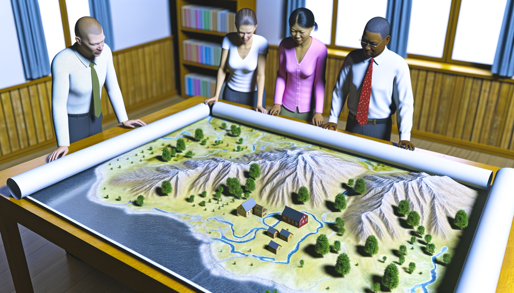
These tactile representations of terrain offer a unique perspective that goes far beyond what standard maps can convey, allowing us to literally feel the undulations, slopes, and elevations of the land.
For anyone who needs to understand the lay of the land – whether you are a hiker planning a route, a student learning geography, an urban planner assessing development sites, or simply someone captivated by the natural world – visualizing terrain accurately is absolutely crucial.
Flat maps, while excellent for showing locations and distances, inherently struggle to communicate the third dimension of elevation in a truly accessible way, relying on abstract symbols like contour lines that require interpretation.
Raised relief maps solve this fundamental challenge by providing a physical, three-dimensional model of the landscape, making complex topographical features immediately understandable and engaging.
This post will delve into the many compelling benefits of using raised relief maps, exploring how they enhance understanding, aid practical applications, and offer advantages that even advanced digital tools cannot fully replicate.
We will look at their fundamental strengths, their diverse uses across various fields, and why they continue to be invaluable tools for anyone seeking a deeper connection with the geographic world.
The Fundamental Advantage: Tangible Terrain Visualization
The most immediate and profound benefit of a raised relief map is its tangibility – you can touch it, feel it, and see the landscape rise and fall before your eyes.
This physical interaction transforms the abstract concept of elevation into a concrete reality, making it far easier to grasp the relationship between different points on the map.
Unlike studying contour lines on a flat surface, which requires cognitive effort to translate symbols into mental images of slopes and valleys, a raised relief map presents this information intuitively.
Bridging the Gap Between 2D Representation and 3D Reality
Standard topographic maps use contour lines to depict elevation, where each line connects points of equal height above a reference level.
While incredibly precise and vital for detailed analysis, interpreting these lines to build a coherent mental picture of the landscape's shape takes practice and spatial reasoning skills.
Closely spaced contour lines indicate steep slopes, while widely spaced lines suggest gentle gradients or flat areas, but visualizing the actual steepness or the form of a ridge from these lines alone can be challenging for many people.
Raised relief maps bridge this gap by providing a physical model that directly corresponds to the three-dimensional form of the terrain.
The map literally rises where the land rises and falls where the land falls, offering an immediate and accurate representation of slopes, peaks, valleys, and plateaus.
This direct physical representation bypasses the need for abstract interpretation, making the map accessible and understandable to a wider audience, regardless of their experience with contour lines.
Engaging Multiple Senses for Enhanced Understanding
Learning and understanding are significantly enhanced when multiple senses are involved, and raised relief maps excel in this regard.
Beyond just visual input, these maps engage our sense of touch, allowing us to feel the texture and form of the landscape.
Running your fingers along a mountain range, feeling the depth of a canyon, or tracing the path of a river through a valley provides a tactile understanding that complements and reinforces the visual information.
This multi-sensory engagement leads to a more robust and memorable understanding of the geographic area being studied.
It helps build a more complete mental model of the terrain, improving spatial reasoning and the ability to orient oneself within that landscape, whether in person or when planning activities.
Practical Benefits Across Various Applications
The unique advantages of raised relief maps translate into significant practical benefits across a wide array of fields and activities.
From leisure pursuits to professional planning and essential educational contexts, these maps prove to be invaluable tools.
For Outdoor Enthusiasts: Planning and Navigation
Hikers, backpackers, climbers, skiers, and anyone who ventures into varying terrain can gain tremendous insight and planning capability from a raised relief map.
While GPS devices and smartphone apps are useful for navigation, they often present the terrain data on a flat screen, which can make judging elevation changes and the overall difficulty of a route challenging.
A physical relief map provides a holistic view that is perfect for the crucial planning phase before you even step outside.
Trail Difficulty Assessment
Understanding the steepness of slopes is paramount when planning a hike or climb, as it directly impacts the physical exertion required and the time needed to cover a distance.
On a raised relief map, steep areas are immediately obvious because the map surface rises sharply.
You can visually and tactilely assess the gradient along potential routes, making it easier to choose trails that match your fitness level or skill set.
Comparing the rise and fall along different paths allows for a more intuitive assessment of difficulty than just looking at how close contour lines are on a flat map.
Route Finding and Strategic Planning
When planning a backcountry trip, finding the most efficient, safe, or scenic route often involves navigating complex terrain with ridges, valleys, and waterways.
A raised relief map allows you to visualize the overall flow of the landscape, identifying potential obstacles like steep cliffs or dense drainages, as well as advantageous features like long, gentle ridges or clearings.
You can trace potential routes with your finger, feeling the changes in elevation and gaining a better sense of the effort involved in traversing certain areas.
This comprehensive perspective is invaluable for making strategic decisions about campsites, water sources, and potential bailout points.
Understanding Watersheds and Drainage
Water flows downhill, and understanding drainage patterns is critical for outdoor safety and planning.
Raised relief maps clearly show how slopes converge to form valleys and how ridges divide different drainage basins.
Visualizing the shape of the land makes it easier to predict where water will collect, where streams and rivers are likely to be found, and where flash flood risks might exist.
This understanding is vital for finding reliable water sources, avoiding camping in low-lying areas prone to flooding, and navigating safely during or after precipitation.
For Educators and Students: A Powerful Teaching Tool
Geography, geology, and environmental science are subjects that inherently deal with the physical world and its three-dimensional nature.
Teaching these concepts effectively often requires helping students visualize complex spatial relationships, something raised relief maps are uniquely suited to do.
Making Geography Come Alive
For many students, especially younger ones, abstract concepts like mountain ranges, plateaus, and river systems on a flat map can be difficult to fully grasp.
A raised relief map transforms these abstract ideas into a tangible reality they can see and touch.
Students can literally feel the towering height of a mountain range, trace the winding path of a river through its valley, or understand the vastness of a plateau.
This hands-on interaction makes learning more engaging, memorable, and intuitive, sparking curiosity and fostering a deeper connection with the subject matter.
Teaching Contour Lines and Topographic Concepts
One of the greatest benefits in an educational setting is using a raised relief map to teach the very concept of contour lines themselves.
By placing a transparent overlay with contour lines directly onto the corresponding raised relief, students can visually and tactilely see the direct relationship between the abstract lines and the physical shape of the land.
They can observe how lines spaced far apart correspond to gentle slopes on the model and how lines close together indicate steep rises or falls.
This makes understanding concepts like elevation change, slope gradient, saddles, ridges, and valleys, as represented on a 2D map, much more accessible and less abstract.
Demonstrating Geological Processes
Raised relief maps can also be powerful tools for demonstrating geological processes over time.
While a static map shows the *result* of these processes, teachers can use the tangible nature of a raised relief model to discuss erosion, glaciation, tectonic uplift, and how these forces shape the landscape we see today.
Pointing to specific features on the map, such as a U-shaped valley carved by a glacier or a sharp peak formed by erosion, helps students visualize the scale and impact of these long-term geological forces.
For Professionals: Planning, Analysis, and Presentation
Various professional fields rely heavily on understanding terrain, and raised relief maps provide unique advantages for planning, analysis, communication, and presentation purposes.
Urban Planning and Development
When planning new infrastructure, housing developments, or parks, understanding the topography of a site is essential.
Steep slopes can impact construction costs, drainage patterns affect stormwater management, and elevation changes influence views and accessibility.
A raised relief map allows urban planners and developers to quickly assess the feasibility of different site layouts, visualize how a proposed project will integrate with the existing landscape, and identify potential challenges or opportunities presented by the terrain.
Resource Management and Conservation
Professionals working in forestry, agriculture, water management, and conservation need to understand how terrain influences natural resources.
Raised relief maps help in visualizing watershed boundaries, planning logging operations to minimize erosion, identifying suitable areas for crop irrigation, and understanding how habitat is distributed across elevation gradients.
They are also valuable for communicating conservation strategies and the importance of protecting specific topographical features or ecosystems to stakeholders and the public.
Emergency Response and Disaster Preparedness
In emergency situations, such as wildfires, floods, or search and rescue operations, a quick and accurate understanding of the terrain is critical for effective response.
Raised relief maps provide emergency responders with a clear, intuitive overview of the area, helping them to assess potential routes, identify safe zones, predict the movement of fires or water, and understand the challenges faced by ground teams.
They are excellent tools for briefing teams and coordinating efforts because everyone can easily visualize the operational area and key terrain features.
Geological and Environmental Surveys
Geologists and environmental scientists conducting field surveys use raised relief maps to plan their work, understand the geological context of an area, and visualize the distribution of different rock formations or soil types in relation to topography.
They help in identifying areas of potential instability, locating specific geological features, and interpreting how geological history has shaped the current landscape.
For environmental assessments, they aid in understanding how pollutants might spread via water flow or how different ecosystems are situated within the topographical structure.
For Collectors and Decorators: Aesthetic and Historical Value
Beyond their practical uses, raised relief maps also hold significant appeal for their aesthetic qualities and their ability to evoke a sense of place and history.
Unique Wall Art and Conversation Starters
A well-made raised relief map is not just a tool; it can be a stunning piece of art.
The textured surface, vibrant colors, and detailed representation of the landscape make them captivating focal points in homes, offices, or public spaces.
They serve as unique wall décor that is both beautiful and intellectually stimulating, often sparking conversations about geography, travel, and the natural world.
Preserving a Sense of Place and History
For individuals with a strong connection to a particular region – whether it's their hometown, a favorite vacation spot, or an area of personal significance – a raised relief map can be a powerful way to preserve and display that connection.
Holding and viewing a tactile representation of a beloved landscape evokes memories and reinforces a sense of place.
Older or vintage relief maps can also have historical value, representing past cartographic techniques and serving as fascinating artifacts that show how maps were created and used in previous eras.
Why Raised Relief Maps Stand Out from Digital Alternatives
In an age of sophisticated digital mapping tools like Google Earth, 3D modeling software, and advanced GIS systems, it's worth considering where raised relief maps still fit and why they remain relevant.
While digital tools offer immense power for analysis, data layering, and global reach, physical raised relief maps provide distinct advantages that digital platforms often cannot replicate.
Accessibility and Independence from Technology
One of the most practical benefits of a physical map, including a raised relief map, is its independence from technology.
You do not need battery power, an internet connection, or a specific device to use it.
It is always accessible, immediately viewable, and immune to software glitches or signal loss, making it a reliable tool in any situation, including remote or emergency contexts where technology might fail.
The Power of Physical Interaction and Memory Retention
As discussed earlier, the tactile nature of raised relief maps engages more senses than a screen-based map.
This physical interaction, touching the terrain, tracing routes with your finger, helps solidify spatial information in your memory.
Studies have shown that engaging multiple senses during learning leads to better retention and recall, meaning that interactions with a physical relief map can create a more lasting and intuitive understanding of the geography than simply viewing it on a screen.
A Non-Distracting, Focused View
Digital devices, while powerful, are often sources of distraction, with notifications, emails, and other apps vying for attention.
A physical raised relief map offers a focused, dedicated tool for understanding terrain.
There are no pop-ups, no loading delays, and no temptation to switch tasks; your full attention is on the landscape before you, facilitating deeper concentration and study.
Choosing the Right Raised Relief Map
If you are considering acquiring a raised relief map, whether for practical use, education, or decoration, several factors should influence your choice.
Selecting the right map ensures it meets your needs and provides the most accurate and useful representation of the area you are interested in.
Scale, Detail, and Area Coverage
Map scale determines the level of detail and the extent of the area covered.
A large-scale map (e.g., 1:24,000 or 1:50,000) covers a smaller geographic area but shows much finer detail in elevation and features, ideal for hiking or local planning.
A small-scale map (e.g., 1:250,000 or 1:1,000,000) covers a vast region like an entire state or country but with less detail, suitable for visualizing large mountain ranges or major river systems.
Consider the primary purpose of the map to determine the appropriate scale and the specific geographic area you need represented.
Materials and Durability
Raised relief maps are typically made from vacuum-formed plastic sheets printed with map data.
The thickness and quality of the plastic, as well as the printing process, affect the map's durability and how well it withstands handling and display.
Consider where the map will be used or displayed – a classroom map might need to be more robust than one for home decoration.
Some maps come framed for protection and ease of display.
Source and Accuracy
The accuracy of a raised relief map depends on the source data used to create it.
Look for maps produced by reputable cartographic companies or government agencies known for their topographic data, such as the U.S. Geological Survey (USGS) or national mapping agencies in other countries.
The relief itself is often exaggerated vertically to make the elevation changes more apparent on a map of manageable size; understand the exaggeration factor if precise proportional representation is critical for your use.
Caring for Your Raised Relief Map
Proper care will help preserve the condition and appearance of your raised relief map for many years.
These maps, especially the raised surface, require gentle handling to maintain their integrity.
Display and Storage Considerations
Avoid exposing your map to direct sunlight for extended periods, as this can cause the colors to fade over time.
Displaying or storing the map in a climate-controlled environment is ideal, protecting it from extreme temperature fluctuations or humidity that could affect the plastic.
If storing the map, lay it flat or roll it gently (if it was originally shipped rolled) to prevent creases or damage to the raised features.
Cleaning and Handling
To clean a raised relief map, gently dust the surface with a soft cloth or a soft brush.
For smudges or marks, use a slightly damp (not wet) cloth and mild soap, testing a small, inconspicuous area first.
Avoid abrasive cleaners or excessive moisture.
Handle the map by its edges as much as possible, and avoid pressing down hard on the raised areas, especially with sharp objects, which could deform or puncture the plastic.
Conclusion: The Enduring Value of Tactile Topography
In an age saturated with digital information, raised relief maps offer a refreshing and profoundly effective way to connect with and understand the physical world around us.
Their ability to transform abstract topographic data into a tangible, three-dimensional form provides unparalleled benefits for visualization and understanding.
From enhancing safety and strategic thinking for outdoor adventurers to making complex geographic concepts accessible and engaging for students, and providing critical insights for professional planning and analysis, the practical applications are vast and significant.
Furthermore, their independence from technology and their unique aesthetic appeal ensure their continued relevance and value.
Raised relief maps are more than just geographical tools; they are windows into the shape of our planet, inviting us to explore, understand, and appreciate the intricate beauty and complexity of its terrain in a truly hands-on way.