


Mastering the Map: Your Essential Guide to Orienteering and Navigation Sports
Orienteering and other navigation sports offer a unique blend of physical challenge and mental acuity. At the heart of these activities lies one fundamental tool: the map. Without the ability to read, understand, and effectively use the map, even the fittest athlete will struggle to find their way. This comprehensive guide is designed to demystify the orienteering map, transforming it from a complex piece of paper into your most powerful navigation companion.
Many newcomers find the detailed symbols, contour lines, and vibrant colours overwhelming at first glance. They might feel lost before even leaving the start line, unsure how to translate the abstract lines on the map into the real-world terrain around them. The solution lies in dedicated learning and practice, breaking down the map's components into manageable concepts and building your skills layer by layer. This post will walk you through the essential elements of an orienteering map and teach you fundamental techniques to interpret them, setting you on the path to confident and successful navigation. By the end, you will have a solid foundation for reading the language of the map and applying that knowledge in the forest or open terrain, significantly enhancing your performance and enjoyment in navigation sports.
The Foundation: Understanding Your Orienteering Map
Orienteering maps are not like the road maps you might use in your car; they are specifically designed for navigation on foot through varied terrain. They are incredibly detailed, providing a wealth of information about the landscape that is crucial for making informed route choices and maintaining situational awareness. Understanding the fundamental characteristics of these maps is the first step toward mastering their use.
They are produced to rigorous international standards, ensuring consistency in symbols and representation regardless of where you are competing. This standardisation helps competitors quickly adapt to new maps once they understand the core principles. Unlike topographic maps which may have different purposes, orienteering maps are laser-focused on features relevant to foot navigation, highlighting obstacles, passable terrain, and navigation features like small reentrants or rock details. Their purpose is to give you the information you need to make rapid, effective decisions on the move, often at high speed.
What Makes an Orienteering Map Unique?
Orienteering maps stand out due to their exceptional level of detail, their specific symbol set, and their typically larger scale compared to general topographic maps. Every rock, fence line, stream bend, and even subtle changes in vegetation type is often meticulously mapped. This level of detail is necessary because navigation in orienteering often relies on identifying very small, distinct features to confirm your location or guide your direction.
The symbols used are standardised by the International Orienteering Federation (IOF) and are intuitive once learned, representing terrain, vegetation, water features, man-made objects, and rocky ground. The colours also carry significant meaning, representing different types of terrain or features. Combined with the high level of detail and specific symbols, these maps provide a rich, visual representation of the area that allows experienced navigators to "see" the terrain in their mind before they even encounter it on the ground.
Deciphering Map Scale: Bringing the Terrain to Your Fingertips
Map scale is one of the most critical pieces of information on any map; it tells you the relationship between a distance measured on the map and the corresponding distance on the ground. For orienteering, common scales are 1:15,000, 1:10,000, or even 1:7,500 or 1:5,000 for sprint orienteering. A scale of 1:15,000 means that 1 unit of measurement on the map represents 15,000 of the same units on the ground.
In practical terms, on a 1:15,000 map, 1 centimetre on the map represents 150 metres on the ground. On a 1:10,000 map, 1 centimetre is 100 metres, and on a 1:7,500 map, 1 centimetre is 75 metres. The larger the second number in the ratio (e.g., 1:15,000), the smaller the scale and the less detail is shown for a given area; a larger area is covered on the map. Conversely, a smaller second number (e.g., 1:5,000) indicates a larger scale map that shows more detail but covers a smaller geographic area.
Understanding the map scale is vital for estimating distances, which helps in planning how long a leg might take or how far you need to travel in a specific direction before looking for a feature. It also influences the perceived density of features; a highly detailed area on a 1:15,000 map might be even more cluttered with symbols on a 1:10,000 map of the same location. Experienced navigators become adept at visually estimating distances on the map based on the scale and translating that to their movement on the ground, often calibrating their pace count (how many steps per 100 metres) to different terrain types and scales.
The Language of the Map: Symbols and Colours
Orienteering maps communicate information through a standardised set of symbols and colours. Learning this language is essential for interpreting the terrain and planning your route effectively. Each symbol represents a specific type of feature or terrain, and the colours provide broad classifications of the landscape. Mastery of these elements allows for rapid understanding of the environment depicted on the map.
There are hundreds of official IOF map symbols, but a core set is used on almost every map you will encounter. These symbols depict everything from small depressions and earth walls to streams, marshes, individual boulders, fences, and distinct trees. Familiarity with these symbols allows you to quickly identify key navigation features that can serve as attack points, check points, or collecting features. Learning these symbols is akin to learning vocabulary in a new language; the more symbols you know, the richer your understanding of the map becomes.
Navigating with Colour: What Each Hue Represents
The colours on an orienteering map are not just for aesthetics; they convey crucial information about the passability and type of terrain. Understanding what each colour signifies is fundamental to good route planning. Each colour represents a category of feature or ground cover, guiding your initial assessment of an area's navigability.
Here is a breakdown of the primary colours used and their general meanings:
1. White: Represents open runnable forest, typically deciduous or pine forest with little undergrowth. This is usually the fastest terrain for running.
2. Green: Indicates vegetation that hinders running. Different shades or patterns of green show varying degrees of difficulty, from light green (slow running) to dark green (difficult or impassable undergrowth) and even very dark green (impassable). Green patches need careful consideration for route planning.
3. Yellow: Denotes open areas, such as fields, clearings, or gardens. Yellow terrain is typically very fast running, but might lack detailed point features for precise navigation within it.
4. Blue: Represents water features, including lakes, ponds, rivers, streams, and marshes. Blue lines show distinct watercourses, and blue areas show standing water. Streams and marshes can significantly impact route choice.
5. Black: Used for rock and man-made features. This includes rock outcrops, boulders, cliffs, paths, roads, fences, buildings, and power lines. Black features are often excellent navigation aids as they are usually distinct and easily identifiable on the ground.
6. Brown: Represents earth features, most notably contour lines and earth walls. Brown is key to understanding the shape of the land and will be discussed in detail later. Other brown features can include pits, mounds, and bare earth.
By quickly scanning the colours, a navigator can get an immediate sense of the terrain's character – how dense the vegetation is, where the open areas are, and where major water features lie. This initial assessment helps in formulating potential routes even before examining the fine details. The interplay of colours provides a visual summary of the landscape's surface cover.
Essential Symbols: Rocks, Water, Vegetation, and Man-Made Features
Beyond the colours, the symbols provide the granular detail needed for precise navigation. Each symbol has a specific meaning, and learning these is vital for reading the map accurately. These symbols are designed to be visually intuitive representations of the features they depict.
Rock symbols include black triangles for individual boulders (different sizes indicating different boulder sizes), black cliffs (short lines with teeth pointing downhill), and areas of complex rocky ground. Water symbols, in blue, show streams (solid lines), intermittent streams (dashed lines), wells (small circles), and marshes (blue areas with horizontal lines). Vegetation symbols (in green) depict bushes (green circles), prominent trees (green crosses or stars), and areas of forest with varying runnability.
Man-made features (in black) are often excellent linear features or point features. Paths and tracks are shown as solid or dashed black lines of varying thickness depending on their size. Fences, walls, and power lines are also common linear features used for navigation. Buildings, ruins, and special man-made features like benches or statues are represented by distinct symbols, often small black squares, circles, or specific icons. Understanding these symbols allows you to identify unique features that can confirm your location or serve as reliable checkpoints along your route.
Reading the Texture: Micro-Features and Fine Detail
Orienteering maps are renowned for mapping micro-features – small but distinct details that are crucial for navigation, especially in areas that might otherwise appear uniform. These can include small depressions, mounds, earth walls, ditches, small reentrants (tiny valleys), or knolls (small hills). These features are often mapped even if they are only a metre or two across.
Learning to spot these micro-features on the map and then identify them on the ground is a mark of a skilled navigator. They provide the texture to the landscape, allowing you to differentiate one part of the forest from another that might look similar on a less detailed map. Mastering the identification of these fine details significantly improves your ability to navigate accurately and confirm your position frequently. It requires careful observation both of the map and the terrain around you.
The Key to Terrain: Understanding Contour Lines
While colours and symbols show surface features, brown contour lines reveal the shape of the land – the hills, valleys, slopes, and flats. Contour lines are arguably the most important element on an orienteering map for understanding the three-dimensional nature of the terrain. They provide information about elevation changes and the steepness of slopes, crucial for route planning and execution.
A contour line connects points of equal elevation above a reference point, usually sea level. The contour interval, typically 5 metres on an orienteering map (indicated in the map legend), is the vertical difference in elevation between adjacent contour lines. Index contours, usually thicker than regular contours, appear at regular intervals (e.g., every fifth contour line) and often have elevation numbers printed on them to make reading elevations easier. Understanding contour lines allows you to visualise the ups and downs of the course simply by looking at the map.
What are Contour Lines and Why Do They Matter?
Contour lines are abstract representations of the earth's surface. If you were to walk along a single contour line, you would remain at the same elevation the entire time. Where contour lines are close together, the slope is steep; where they are far apart, the slope is gentle or flat. The pattern and spacing of contour lines directly depict the form and steepness of the terrain. They are fundamental because they show you not just *what* features are present, but *how* the ground lies, which impacts your speed, physical effort, and navigation strategy.
Being able to read contours allows you to anticipate climbs and descents, choose routes that might follow ridges or valleys (which can be easier to navigate), or avoid unnecessarily steep slopes. They provide a framework for understanding the entire landscape's topography. Relying solely on surface features without considering the contours is like reading a book without understanding the plot; you see the words, but you miss the story of the land.
Interpreting Terrain Shapes: Hills, Valleys, Ridges, and Depressions
By observing the patterns of contour lines, you can identify major landforms. Closed loops of contour lines indicate hills or depressions. If the numbers on the index contours increase towards the centre of the loop, it's a hill or summit. If they decrease, it's a depression or pit (often shown with small hachure marks pointing inwards). Lines that bend in a 'V' shape often indicate valleys or reentrants, with the point of the 'V' pointing uphill, showing the direction water would flow.
Ridges are areas of high ground, often represented by contour lines bending outwards (away from higher ground). Saddles are low points between two hills or on a ridge. Understanding these shapes from the contours allows you to predict the terrain you will encounter and use these large features for broad navigation. For example, following a ridge line or staying in a valley bottom can be effective navigation strategies, especially in low visibility or complex terrain. The ability to visualise the 3D landscape from 2D contour lines is a critical skill that improves with practice.
Steepness and Slope: Using Contours to Estimate Effort
The spacing between contour lines directly indicates the steepness of the slope. Closely spaced contours mean a steep slope, which will require more physical effort to climb and might be faster to descend (though potentially more hazardous). Widely spaced contours indicate a gentle slope or flat ground, which is generally faster to run on but might offer fewer distinct features for navigation.
Skilled navigators use contour spacing to estimate the difficulty and speed of different route options. They can look at a potential climb and judge its steepness and length from the contours, comparing it to a potentially longer but flatter route. This allows for strategic route choice, balancing distance against climb and terrain type. Being able to read slope from contours is essential for pace judgment and energy management over a course. It's not just about finding the way, but finding the *best* way, which often involves minimising difficult climbs unless there is a significant navigational advantage.
Orienting Your Map: Making it Match Reality
Once you understand the symbols, colours, and contours, the next crucial step is to orient your map. Orienting the map means aligning it so that north on the map points to true north on the ground, and features on the map correspond directionally to features in the real world around you. This is a non-negotiable, fundamental skill for all navigation sports. A map that is not oriented correctly is worse than useless; it is actively misleading.
Think of it like this: if your map is oriented, everything on the map is in the direction it is from you in reality. If a path is shown to your right on the map, the actual path will be to your right on the ground. If a hill is shown ahead of you on the map, the real hill is straight ahead. This makes relating the map to the terrain intuitive and straightforward. Without orientation, every direction is relative to how you happen to be holding the map.
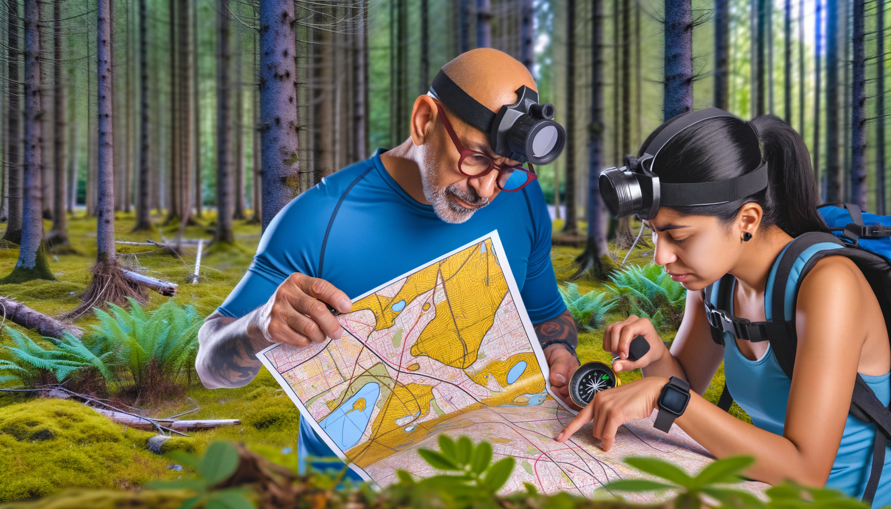
Aligning North: Using the Compass or Terrain Features
The most reliable way to orient your map is using a compass. Orienteering maps have north lines, typically blue or black lines running parallel up the map. These lines point towards magnetic north (or sometimes grid north, depending on the map details, though for typical orienteering scales the difference is negligible for map orientation). To orient the map with a compass, place the compass on the map with one edge aligned with a north line. Then, rotate the map and compass together until the compass needle aligns with the oriented arrow (often called the 'shed' or 'garage' on the compass baseplate), pointing along the north lines on the map towards the top of the map. Your map is now oriented to magnetic north.
In terrain with distinct linear features visible on the map and ground (like paths, roads, or prominent fences), you can also orient the map using these features. Find a feature you can clearly identify both on the map and in reality. Align the map so that the feature on the map runs parallel to the actual feature on the ground. For example, if you are standing on a straight path shown on the map, rotate the map until the path symbol on the map runs in the same direction as the physical path you are standing on. While this method is fast, it is less precise than using a compass and relies on accurately identifying distinct features. It is best used for quick checks or when a compass reading is difficult.
Why Orientation is Non-Negotiable for Navigation
Maintaining map orientation is crucial because it allows you to constantly relate the map to your surroundings without complex mental calculations. As you move, if your map remains oriented, you can simply look from the map to the terrain and back, verifying features and directions instantly. This continuous process of matching map to ground is key to staying found and navigating efficiently. Losing orientation means you have to re-establish your position and direction before you can proceed confidently.
In fast-paced navigation sports, you don't have time to stop and perform complex mental rotations of the map or terrain. An oriented map simplifies everything, allowing you to make split-second decisions about route choices and direction. It's the difference between effortlessly following your planned path and constantly second-guessing yourself and potentially getting lost. Make a habit of orienting your map every time you stop or change direction significantly. This simple step dramatically improves your navigation accuracy and speed.
Basic Navigation Techniques Using the Map
With a well-understood and oriented map in hand, you can start applying basic navigation techniques. These techniques combine map reading skills with practical application in the terrain to move effectively and efficiently between control points. They involve continuous interaction with the map and the environment. Mastering these techniques is the bridge between knowing how to read the map and knowing how to *use* the map to navigate a course.
Navigation is a continuous process of planning, executing, and checking. You plan your route to the next control, execute that route using the map and compass, and constantly check your position against the map using identifiable features. Basic techniques help you manage this process effectively, ensuring you stay on track and arrive precisely at your intended location. These techniques are the building blocks for more advanced navigation strategies.
Thumb Reading: Keeping Track of Your Position
Thumb reading is a fundamental technique used by almost all experienced navigators. It involves folding the map so that your current location is near the edge you are holding, and then keeping your thumb on your estimated current position on the map as you move. As you travel along your planned route, you slide your thumb along the map, marking your progress. Your thumb always indicates where you think you are.
This technique ensures that you are constantly aware of your position relative to the map and the features you are passing. It makes it easy to quickly glance at the map and see what feature you should be approaching next or what feature you just passed. If you pass a distinct feature (like a large boulder or a stream crossing) that is marked on the map just ahead of where your thumb is, you know your estimated position is accurate and you can slide your thumb forward to that feature. This continuous tracking prevents you from losing contact with the map and becoming disoriented. It makes checking your progress second nature.
Route Choice: Planning Your Path Between Controls
Orienteering is not just about following a predetermined path; it is about choosing the best route between controls. Using your understanding of map scale, colours, symbols, and contours, you evaluate different options. Should you take a longer route along a path which is fast and easy to follow, even if it involves more climbing? Or should you take a shorter, more direct route through dense forest and complex terrain, accepting slower travel speed and higher navigation difficulty?
Good route choice considers the terrain (shown by colours and contours), linear features (paths, fences, streams), potential navigation difficulties, and your own strengths and weaknesses as a runner and navigator. Before leaving a control, you should quickly assess the options to the next control, choose the one you believe is fastest and most reliable for you, and identify key features along that route that you will use for navigation. This planning happens quickly, often in seconds, and improves significantly with experience. Always have a plan before you start moving.
Visualisation: Matching Map Features to the Landscape
Visualisation is the process of translating the abstract symbols and lines on the map into a mental picture of the three-dimensional terrain, and then matching that mental picture to the actual landscape you see around you. This skill is developed through practice and experience. As you become more proficient, you can look at a cluster of contour lines and symbols on the map and anticipate exactly what the ground will look, feel, and sound like (e.g., dense bushes rustling, the sound of a stream, the feel of a steep uphill).
Conversely, when you are moving through the terrain, you are constantly observing the features around you – the shape of the hill, the type of vegetation, the presence of rocks or water – and comparing these observations to your oriented map. If the map shows you are approaching a marsh on your left and you see reeds and wet ground appearing to your left, you are confirming your position through visualisation. This continuous feedback loop between map, mind, and ground is the essence of skilled navigation. The better you are at visualisation, the less you need to stop and confirm your location; you navigate fluidly.
Common Map Reading Pitfalls
Even experienced navigators make mistakes, and often they stem from fundamental map reading errors. Being aware of common pitfalls can help you avoid them. Identifying when you might be about to make one of these errors is part of developing strong navigation awareness. Vigilance and attention to detail are key to mitigating these risks and staying on course throughout your event. Understanding these common mistakes can help you focus your attention on the most critical aspects of map interpretation.
Misinterpreting Symbols
Confusing one symbol for another is a common mistake, especially when new to orienteering maps or feeling fatigued. A small rock might be mistaken for a control point, or a depression might be confused with a small mound. This can lead to spending valuable time searching in the wrong place. Regularly reviewing the map legend and paying close attention to the precise shape and colour of symbols helps prevent this. When in doubt, double-check the legend and compare the feature on the map to the terrain very carefully.
Losing Orientation
Failing to keep the map oriented is perhaps the most frequent cause of navigational errors, especially for beginners. If the map is rotated incorrectly, all the directions on the map will be wrong relative to the ground. This can lead to confidently heading off in the completely wrong direction. Make orienting your map a constant habit – every time you check the map, briefly re-orient it using your compass or nearby features. If you feel unsure of your direction, the first step should always be to stop and re-orient the map.
Ignoring Contour Detail
Focusing only on symbols and linear features while neglecting the contour lines is another common mistake. Contour lines provide the underlying structure of the terrain, which is crucial for understanding where you are and where you are going. Ignoring contours can lead to surprises, such as encountering a steep climb you didn't anticipate or missing a key terrain feature like a reentrant that could have confirmed your position. Always consider the contours when planning your route and navigating; they are fundamental to reading the landscape.
Conclusion
Mastering the map is an ongoing journey, but by understanding its core components – scale, colours, symbols, and contour lines – and practicing fundamental techniques like orienting, thumb reading, and visualisation, you build a strong foundation for success in orienteering and other navigation sports. The map is more than just a guide; it is a detailed representation of the environment, waiting for you to unlock its secrets. Each time you step into the terrain with a map, you have an opportunity to learn more about its language and how it relates to the world around you.
Don't be discouraged by initial difficulties; every skilled navigator started as a beginner. Practice reading maps in different environments, even when not competing. Use online resources to study symbols and practice contour interpretation. The more familiar you become with the map's language, the more confident and efficient you will be on the course. Get out there, explore, and let the map be your guide to adventure. With dedication and practice, you will transform from someone who uses a map into someone who truly understands it, opening up a world of exploration and challenge in navigation sports.