


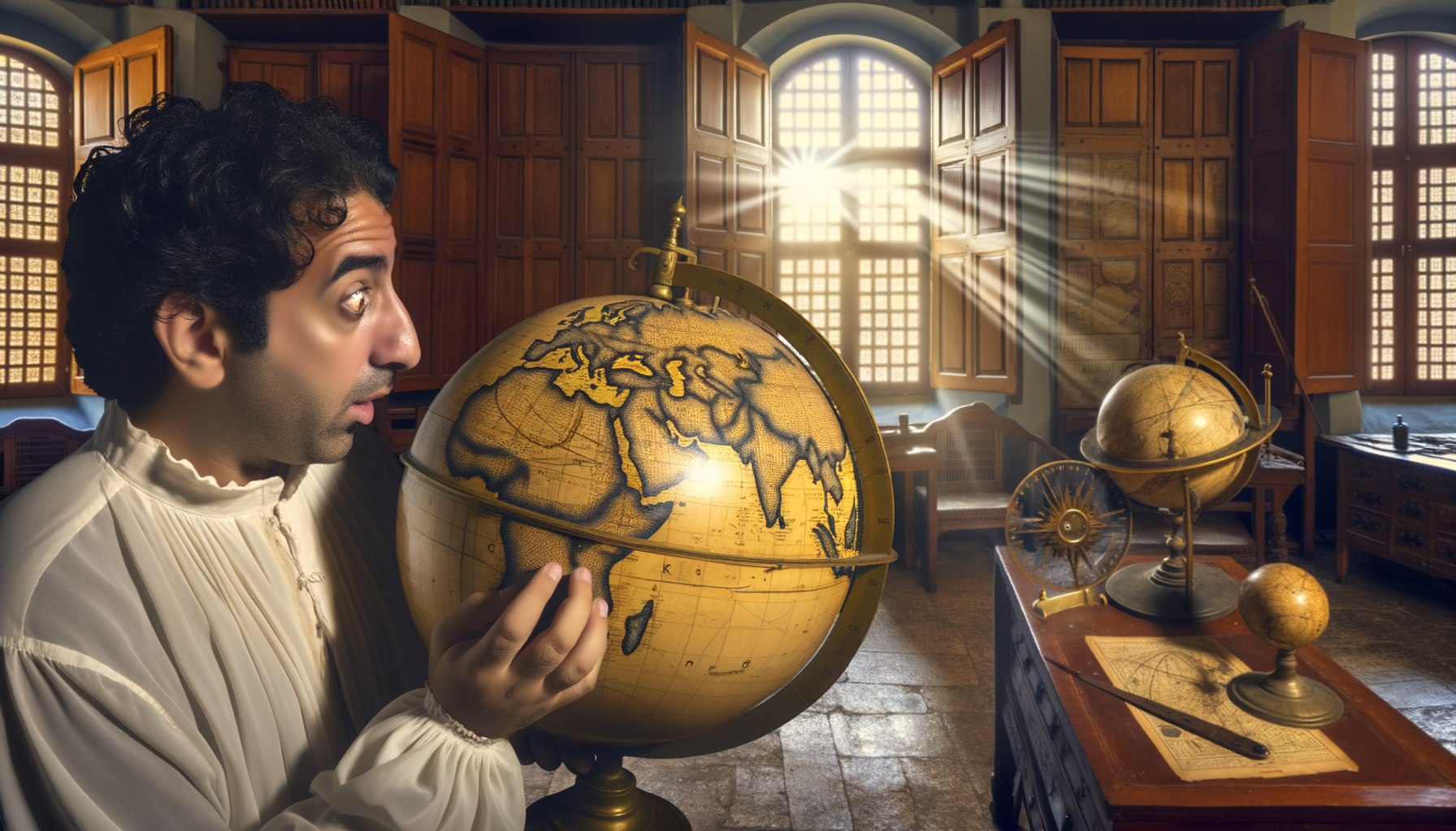
The Surprising Accuracy of Early Globes: Unlocking the Secrets of Ancient Cartography
In an era dominated by GPS, satellite imagery, and instant digital mapping, we tend to take our understanding of the world's geography for granted. We can zoom in on almost any location, see coastlines with astonishing precision, and measure distances down to the meter.
But cast your mind back centuries, to a time before reliable clocks for navigation, before aerial views, and when much of the world remained unknown to European mapmakers. One might naturally assume that attempts to depict the entire Earth would be wildly inaccurate, little more than speculative doodles based on myth and rumour.
Yet, when we look at some of the earliest surviving globes, dating back to the late 15th century, we encounter something truly surprising: a level of accuracy in depicting known regions that defies the limitations of the time. These aren't perfect representations by any means, but their successful features are remarkably insightful and speak volumes about the ingenuity of early cartographers and the extent of their accumulated knowledge.
This post delves into the fascinating world of early globes, exploring how they were made, the immense challenges their creators faced, and why their surprising accuracy in certain areas offers us a valuable window into the historical understanding of our planet. Understanding these ancient artifacts reveals not just geographical knowledge, but also the scientific methods, cultural exchanges, and exploratory spirit that shaped our view of the Earth long before the modern age. Join us as we uncover the secrets behind these captivating spherical maps and gain a new appreciation for the pioneers of cartography.
The World on a Sphere: Context of Early Globe Creation
The concept of a spherical Earth was widely accepted among scholars in Europe and the Islamic world for centuries before the Age of Exploration truly blossomed. However, translating that concept into a physical, navigable model of the entire known world was a monumental undertaking.
Early globes emerged during a pivotal period of human history, the late 15th and early 16th centuries, precisely when European explorers were pushing the boundaries of the known world. Figures like Columbus, Vasco da Gama, and Magellan were undertaking voyages that would fundamentally reshape global understanding.
These globes weren't just decorative items; they were sophisticated scientific instruments and powerful statements of knowledge, reflecting the culmination of centuries of geographical inquiry, astronomical observation, and seafaring experience. They served multiple purposes: as educational tools for understanding world geography, as aids for planning voyages, and as status symbols for wealthy patrons interested in exploration and trade.
Creating a globe required a synthesis of all available geographical information, pieced together from diverse and often conflicting sources. This included ancient texts, recent traveler accounts, astronomical data, and navigational logs. The cartographer's task was not merely to draw lines on a sphere but to critically evaluate and reconcile this disparate information to create the most accurate representation possible given the existing knowledge base.
Motivation and Purpose
The drive to create accurate globes was fueled by a combination of practical, economic, and intellectual factors. Practical needs included better tools for navigation and planning the increasingly ambitious sea voyages that characterized the era.
Economically, accurate maps and globes were essential for trade. Knowing the relative positions of continents, the shapes of coastlines, and potential trade routes was crucial for merchants and states seeking to expand their wealth and influence.
Intellectually, the Renaissance sparked a renewed interest in classical learning and the natural world. Creating a physical model of the Earth was a direct application of astronomical and geographical theories, a tangible manifestation of accumulated scientific understanding. Globes represented the forefront of geographical knowledge and were symbols of scientific progress.
The Immense Challenges of Early Cartography
Creating a globe with any degree of accuracy in the 15th or 16th century was fraught with difficulties that are almost unimaginable today. The fundamental tools and information we rely on were either non-existent or extremely limited.
Accurate measurement of distance and location across vast, unexplored areas was perhaps the single biggest hurdle. There was no global positioning system, no standardized surveying techniques that could be applied across continents and oceans, and certainly no way to get an aerial view of the Earth's surface.
Communication was slow and unreliable. Information from explorers and travelers took months or years to reach mapmakers, and the details provided were often incomplete, inaccurate, or based on rough estimations rather than precise measurements. Sailors relied on dead reckoning, estimating their position based on speed, direction, and elapsed time, which accumulated errors over long voyages.
Overcoming Technical Limitations
Measuring latitude at sea was relatively straightforward using astronomical observations, such as the angle of the sun at noon or the position of the North Star. However, accurately determining longitude was a persistent, major challenge for centuries.
Longitude requires precise timekeeping relative to a fixed point, and reliable chronometers capable of withstanding the rigors of a sea voyage were not invented until the 18th century. Early cartographers had to rely on less precise methods, like observing the timing of lunar eclipses, which were difficult to do accurately at sea and required predictable celestial events. This fundamental limitation meant that east-west distances and the relative positions of places along longitudinal lines were often highly distorted or speculative on early maps and globes.
Representing the spherical Earth on a flat map introduces distortion (the map projection problem), but creating a physical sphere also had its technical challenges. Constructing a precisely spherical object and then accurately transferring and scaling geographical data onto its surface required significant skill and craftsmanship. These were often intricate, handcrafted objects made from materials like wood, plaster, and paper.
Pioneering Efforts: Notable Early Globes
While the concept of globes existed in various forms in antiquity and the Islamic world, the spherical representations we recognize today, depicting the Earth's surface, began to appear in Europe in the late Middle Ages. The most famous and significant early example is the Erdapfel.
Created by Martin Behaim in Nuremberg between 1490 and 1492, the Erdapfel (German for "earth apple") is the oldest surviving terrestrial globe. Its creation is remarkable not just for its age but because it was completed *before* Christopher Columbus's first voyage to the Americas became widely known in Europe.
The Erdapfel therefore represents the European understanding of world geography *just before* the "discovery" of the New World. It is a fascinating snapshot of the known world, showing Europe, Asia, and Africa with varying degrees of accuracy, and a vast, empty ocean between western Europe and eastern Asia, precisely where Columbus expected to find the Indies.
Later early globes, like those produced in the early 16th century following the voyages of Columbus, Vespucci, and others, show the gradual incorporation of the Americas. These globes reveal the evolving understanding of the Earth's shape and contents as new information arrived, highlighting the dynamic nature of cartography during this period. Each new globe was a revision, an update based on the latest available (though often still incomplete or contradictory) data.
Martin Behaim's Erdapfel (1492)
Behaim's globe is a masterpiece of historical cartography, summarizing the geographical knowledge available in Europe at the very cusp of a new era of exploration. It was constructed on a wooden sphere, covered with linen and parchment, and meticulously painted.
Its accuracy varies significantly across different regions. The Mediterranean Sea and parts of Europe are depicted with relatively good fidelity, reflecting centuries of coastal navigation and mapping. Parts of Africa and Asia also show recognizable outlines, incorporating information from sources like Marco Polo's travels and Portuguese exploration along the African coast.
However, the inaccuracies are also striking. The Atlantic Ocean is shown as a vast, empty expanse with only a few mythical islands depicted. The Americas are entirely absent, as expected. The Pacific Ocean is also not shown as a separate ocean; the eastern edge of Asia is placed where the Americas would be, reflecting the prevailing belief that one could sail directly from Europe to Asia by heading west.
Despite its omissions and errors, the Erdapfel's detailed depiction of the *known* world, synthesizing classical, medieval, and contemporary sources, represents a remarkable achievement. Its mere existence as a spherical model of the Earth based on actual geographical data was a significant step forward.
Sources and Synthesis: Piecing the World Together
Given the lack of modern surveying and satellite data, early cartographers like Behaim had to act as diligent compilers and critical evaluators of information gleaned from disparate sources. Their surprisingly accurate depictions of certain areas were a result of skillfully combining and interpreting this varied evidence.
Ancient Greek and Roman geographers, particularly Claudius Ptolemy (2nd century AD), provided a foundational framework. Ptolemy's Geographia, rediscovered in Europe in the 15th century, contained lists of place names with their latitudes and longitudes (based on relative measurements and estimates), as well as instructions for mapmaking. While Ptolemy's world was limited (primarily Europe, Asia, and North Africa) and contained significant errors, his systematic approach and data were invaluable starting points.
Information from the Islamic world was also crucial. Arab geographers and cartographers had maintained and advanced geographical knowledge during the European Middle Ages, conducting surveys, writing travel accounts, and creating maps that were often more accurate than their European counterparts. This knowledge filtered into Europe through various channels, including trade and scholarly exchange.
Crucially, information from travelers and explorers provided the most up-to-date details on newly visited regions. Accounts like Marco Polo's descriptions of Asia, combined with the logs and observations from Portuguese voyages down the coast of Africa, gradually filled in the details of the world map. However, these accounts varied widely in reliability; some were based on careful observation, while others were exaggerated or incorporated mythical elements.
The Art of Compilation
The cartographer's job was akin to solving a massive, multi-dimensional puzzle with many missing or misleading pieces. They had to compare different accounts of the same region, decide which sources were most trustworthy, and attempt to fit everything onto a consistent geographical grid (even with the longitude challenges).
This required a deep understanding of astronomy for determining latitude, mathematics for scaling and projection (even onto a sphere), and critical thinking to evaluate the quality of incoming geographical data. The surprisingly accurate elements on early globes are a testament to the skill and judgment of these early information synthesizers.
They weren't just drawing maps; they were interpreting the sum total of human geographical knowledge available at the time and attempting to represent it in the most complete and coherent way possible on a spherical model. This process was iterative; as new information arrived, maps and globes would be updated, corrected, and revised.
Where Early Globes Achieved Surprising Accuracy
Despite the formidable challenges and limited technology, early globes managed to depict certain regions with a level of accuracy that is genuinely surprising when viewed through a modern lens. This was not uniform across the globe but concentrated in areas with longer histories of exploration, trade, and settlement.
The Mediterranean Sea and its surrounding coasts are consistently depicted with reasonable fidelity on early globes. This region had been extensively mapped and navigated for millennia by various cultures, including the Greeks, Romans, and Arabs. The accumulated knowledge of its coastline, islands, and relative distances was substantial and relatively accurate, based on extensive coastal sailing and portolan charts.
Similarly, the general outline of Europe, North Africa, and parts of the Middle East shows a recognizable shape. Major landmasses and significant geographical features like the Red Sea or the Persian Gulf are present and oriented roughly correctly. This reflects the long history of interaction, trade, and mapping within and between these regions.
Even parts of Asia, particularly India and the coastal regions visited by traders, show features that align with modern geography, albeit often with distorted shapes or sizes. This accuracy was derived from the careful transcription and interpretation of traveler accounts and older geographical texts that contained genuine insights into these distant lands. The details might be patchy, but the overall presence and relative location were often correct.
These areas of surprising accuracy highlight the cumulative nature of geographical knowledge. Accuracy was highest where information had been gathered over the longest period by the greatest number of observers and navigators, and where the geometry was relatively constrained (like the enclosed or semi-enclosed seas).
Why the Accuracy Was Surprising
The surprise lies in the stark contrast between the precision achieved in these known areas and the vast unknowns or complete inaccuracies elsewhere. Without the ability to confirm details from multiple, reliable sources across the *entire* globe, achieving even localized accuracy required remarkable skill in triangulating (not in the surveying sense, but in reconciling) often conflicting reports.
Furthermore, successfully transferring measurements and observations from diverse formats (sailor's logs, textual descriptions, existing flat maps) onto a spherical model introduced its own set of geometric challenges. That they managed to create a relatively coherent and recognizable representation of the known world, with correct relative positions for many major landmasses and seas (within the scope of 15th-century knowledge), is a testament to their mathematical understanding and dedication.
The fact that they could depict the general shape of continents and oceans with any degree of correctness, relying on information gathered piecemeal over centuries by various cultures using vastly different measurement systems and methods, is a significant intellectual achievement. It demonstrates a sophisticated ability to synthesize complex data and project it onto a three-dimensional model of the Earth.
Acknowledging the Inaccuracies: Where Early Globes Fell Short
While the surprising accuracy of early globes in depicting known areas is noteworthy, it is equally important to acknowledge their significant inaccuracies and omissions. These reveal the limits of geographical knowledge at the time and the challenges of exploration.
The most obvious inaccuracy on pre-Columbian globes like the Erdapfel is the complete absence of the Americas and Australia. This was not an error in mapping known features but a reflection of these continents being entirely unknown to the European cartographers at that time. Their later appearance on 16th-century globes marks a dramatic shift in global understanding.
Oceans were particularly problematic. The Pacific Ocean, the largest geographical feature on Earth, is often completely missing or depicted as a narrow sea on the earliest globes, reflecting the misconception of a relatively small distance between Europe and Asia heading west. The vast size of the Pacific was only realized after Magellan's circumnavigation in the early 16th century.
The shapes and sizes of continents and coastlines were frequently distorted. Latitude was easier to determine, leading to relatively accurate north-south placement, but the difficulty with longitude meant east-west distances were often wildly off. Continents could be stretched or compressed, and coastlines might feature speculative or entirely mythical islands and features.
Unknown or speculative landmasses, such as a large southern continent (Terra Australis Incognita), often appeared on globes for centuries based on theoretical reasoning (the idea that a southern landmass was needed to balance the northern ones) rather than actual exploration. These inaccuracies highlight the blend of empirical data, theoretical speculation, and sheer guesswork that characterized early cartography.
The Value Despite Flaws
Despite these significant inaccuracies by modern standards, early globes were far from useless. They represented the best available synthesis of global knowledge at the time and served crucial functions.
They were invaluable tools for education, illustrating the concept of a spherical Earth and providing a visual overview of known lands and seas. For explorers and navigators, while not perfect for precise plotting over vast distances (that required detailed charts), they offered a critical perspective on the relationships between continents and the overall layout of the world.
Furthermore, early globes are invaluable historical documents today. They provide a tangible record of how people in the past understood their world, showing not just what was known but also what was believed, what was unknown, and how geographical knowledge evolved over time. They are artifacts of immense scientific and cultural significance.
They also stand as remarkable works of art and craftsmanship. The detailed illustrations, calligraphy, and construction of these early globes are beautiful in themselves, reflecting the high level of skill involved in their creation. They were often commissioned by wealthy patrons and were objects of prestige.
Methods Behind the Meticulous Mapping
How did early cartographers achieve even limited accuracy with such basic tools? Their methods relied on a combination of established scientific practices, careful data compilation, and educated estimation.
**Astronomy:** As mentioned, astronomical observation was key. Determining latitude involved measuring the angle of the sun or specific stars above the horizon using instruments like astrolabes or quadrants. This was a relatively reliable method and explains why the north-south positioning of places on early globes is often more accurate than their east-west placement.
**Dead Reckoning:** Sailors estimated their position by keeping track of their speed (often measured with a log thrown overboard) and direction (using a compass). While prone to cumulative errors, especially over long voyages or in challenging weather, experienced navigators could use this to estimate distances traveled and relative positions, providing data for mapmakers.
**Coastal Navigation and Portolan Charts:** For known coastlines, accuracy was higher due to extensive experience in coastal sailing. Portolan charts, detailed navigational maps focusing on coastlines, harbours, and compass bearings, were developed from the 13th century onwards. The information from these charts, based on practical experience and relative measurements between ports, contributed significantly to the accurate depiction of areas like the Mediterranean.
**Synthesis of Written Accounts:** This was perhaps the most crucial and challenging method. Cartographers painstakingly read and synthesized information from various texts: ancient geographies, travel narratives, missionary reports, merchant logs, and diplomatic accounts. They had to interpret descriptions of landmarks, estimate distances based on travel times, and reconcile conflicting reports, attempting to fit everything into a cohesive geographical framework.
This reliance on diverse sources, combined with the cartographer's skill in evaluating and integrating them, was fundamental to creating globes that, while imperfect, contained surprisingly accurate elements based on the sum of knowledge available.
Limitations of Early Measurement
It's worth reiterating the profound impact of the inability to measure longitude accurately. This single limitation meant that even if latitudes were correct, placing places in their correct east-west relationship was largely guesswork or reliant on estimated travel times, which varied greatly depending on winds and currents.
Imagine trying to draw a map of your country where you know how far north or south every city is from the equator, but have only rough guesses about how far east or west they are from each other. This was the challenge faced by early cartographers on a global scale. The surprising accuracy in some areas is even more remarkable when considering this severe constraint on horizontal positioning.
The Legacy of Early Globes
The creation and use of early globes had a lasting impact on cartography and our understanding of the world. They were not just products of their time but also catalysts for future developments.
They popularized the concept of a spherical Earth among a wider audience, making abstract geographical ideas tangible. They provided a framework for integrating new discoveries, helping to quickly update the world picture as explorers returned with fresh information.
While flat maps were often more practical for navigation, globes served as the ultimate reference model, representing the Earth's surface without the distortions inherent in any flat projection. They spurred efforts to create better map projections that could minimize distortion for specific purposes, like Mercator's projection for navigation.
Early globes were also symbols of the Age of Exploration and the growing European understanding of global geography. They inspired further exploration by depicting the vast unknown areas of the world, beckoning navigators to fill in the blanks.
Moreover, the meticulous process of compiling and synthesizing information from diverse sources, which was essential for creating these globes, laid the groundwork for more systematic approaches to geographical data collection and representation in later centuries. They were a critical step in the long journey towards truly accurate global mapping.
Conclusion: Appreciating Historical Ingenuity
Stepping back from our modern world of instant, perfect digital maps, and examining the early globes of the 15th and 16th centuries offers a truly surprising revelation. Far from being mere curiosities or wildly inaccurate artifacts, these early attempts to model the Earth on a sphere demonstrate a remarkable level of accuracy in depicting regions that were known through centuries of accumulated experience and observation.
The challenges faced by their creators were immense: limited technology for measurement, slow and unreliable communication, and a vast, largely unexplored planet. Yet, by skillfully synthesizing information from ancient texts, traveler accounts, and astronomical observations, cartographers like Martin Behaim produced globes that were sophisticated representations of the world as it was understood at the dawn of the Age of Exploration.
The areas of surprising accuracy, particularly in well-traveled regions like the Mediterranean, stand as a testament to the ingenuity, diligence, and scientific understanding of these early pioneers. While they certainly contained significant errors and omissions (reflecting the unknown aspects of the world), their successes highlight the power of human intellect to piece together complex information and create a coherent model, even with limited tools.
Studying these historical globes offers more than just a lesson in geography; it provides a powerful reminder of how knowledge is built over time, how challenges can be overcome through innovation and synthesis, and how our understanding of the world has evolved. The surprising accuracy of early globes invites us to appreciate the incredible effort and skill that went into mapping our planet long before the age of satellites, giving us a new perspective on the history of science and exploration.