


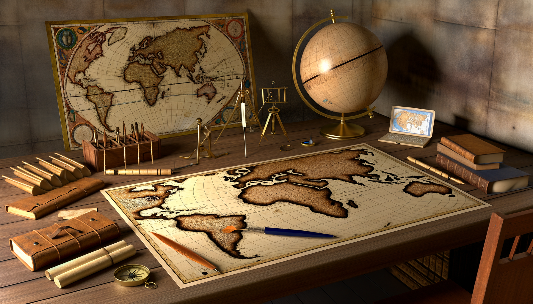
Today, we navigate the world with remarkable ease. A few taps on a smartphone screen reveal detailed maps, satellite imagery, and turn-by-turn directions to virtually any corner of the globe. This ubiquitous access to accurate geographic information is something we often take for granted. It feels entirely modern, the product of satellites, complex algorithms, and vast digital databases. Yet, the foundations for this modern mapping marvel were laid by scholars and innovators centuries ago. Their tireless efforts to understand and depict the Earth represent one of humanity's earliest and most persistent scientific endeavors.
The journey from rudimentary sketches on clay tablets to interactive global maps spans millennia, marked by periods of great innovation, loss, and rediscovery. At a pivotal point in this history stands Claudius Ptolemy, a brilliant polymath from Roman Egypt, whose work fundamentally transformed how people conceived of and created maps for over a thousand years. His systematic approach provided a blueprint that, despite its inaccuracies, became the standard until it was challenged and improved upon during the Age of Exploration. Understanding the contributions of Ptolemy and the early mapmakers is not just an academic exercise; it offers a powerful lens through which to appreciate the cumulative nature of knowledge, the human drive to explore, and the long, fascinating evolution of geographic understanding that underpins our modern, interconnected world. This post will delve into the world of early cartography, exploring Ptolemy's revolutionary ideas, the impact of his magnum opus *Geography*, its unlikely survival, its rediscovery, and ultimately, how his legacy continues to influence the maps we use today, offering a deeper appreciation for the history behind our navigational tools.
The Ancient Quest for Understanding the World
Long before Ptolemy, humans felt the urge to map their surroundings. Early attempts were often functional, serving practical needs like land ownership, navigation along coasts or rivers, and depicting local areas. The oldest known maps date back thousands of years, inscribed on materials like clay tablets in Mesopotamia. These were often schematic, focusing on specific places or routes rather than global representations.
The ancient Greeks were among the first to approach geography and cartography with a more theoretical and scientific mindset. Philosophers began contemplating the shape of the Earth, with figures like Aristotle arguing for a spherical planet based on observations like the shadow cast on the moon during an eclipse. Thinkers like Anaximander are credited with creating early world maps based on gathered information, though these were often more conceptual than geographically accurate. Hecataeus of Miletus improved upon these early Greek maps around the 5th century BC, creating a "periplus" or coastal survey of the known world around the Mediterranean and Black Seas.
Perhaps the most significant pre-Ptolemaic contribution came from Eratosthenes of Cyrene in the 3rd century BC. As chief librarian at the Library of Alexandria, Eratosthenes not only attempted to draw a world map using parallels and meridians but also made a remarkably accurate calculation of the Earth's circumference. This scientific endeavor, based on measuring angles of sunlight in different locations, demonstrated the power of geometry and astronomy in understanding the physical world and provided a foundational piece of data for later mapmakers, even if its accuracy was later unfortunately superseded by a less accurate figure that influenced Ptolemy. The stage was set for someone to synthesize this burgeoning knowledge into a comprehensive system.
Claudius Ptolemy: The Alexandria Scholar
Claudius Ptolemy was a Greek scholar who lived in Alexandria in Roman Egypt during the 2nd century AD (roughly 100 to 170 AD). He was a towering intellectual figure of his time, renowned for his contributions across several scientific fields. His work was deeply rooted in the Hellenistic tradition of Alexandria, a city that remained a vibrant center of learning long after the classical Greek period, thanks in large part to its famous library and museum. Ptolemy benefited from the accumulated knowledge preserved and studied in this environment, standing on the shoulders of giants like Hipparchus and Eratosthenes.
While he is most famous today for his geographical work and his geocentric model of the universe described in the *Almagest*, Ptolemy was a true polymath. He also wrote influential texts on astrology, optics, music theory, and mechanics. This breadth of knowledge highlights his integrated approach to understanding the cosmos and the Earth, viewing them as interconnected systems governed by mathematical principles. His work in astronomy was particularly relevant to his geography, as he used astronomical observations to determine the latitude of locations, a crucial element of his mapping system. His multidisciplinary expertise allowed him to bring a unique, rigorous, and mathematical perspective to the challenging task of mapping the known world.
Ptolemy's *Geography*: A Revolutionary Blueprint
Ptolemy's most significant contribution to cartography is his treatise *Geographia* (known in English as *Geography* or *The Geography*). This work was far more than just a collection of maps; it was a comprehensive guide on how to create maps based on scientific principles and collected data. It was a systematic attempt to represent the spherical Earth on a flat surface using mathematical techniques, a monumental step beyond simply drawing what was seen or described. The revolutionary aspect of *Geography* was its methodology – it provided the instructions and data necessary for others to construct the maps themselves, laying the groundwork for modern cartography as a scientific discipline.
The structure of *Geography* was highly organized, reflecting Ptolemy's systematic mind. It comprised eight books, with the first detailing the principles of mapmaking, including the use of coordinates and projections. The subsequent books contained a vast gazetteer, a list of thousands of places with their estimated latitudes and longitudes. The final books provided instructions and data for creating both a world map and various regional maps. This detailed approach made *Geography* incredibly valuable, providing not just the final product (the maps) but the underlying data and methods.
Establishing a Coordinate System
One of Ptolemy's most enduring legacies is the formalization of a coordinate system using latitude and longitude. Building on the work of earlier Greek astronomers and geographers like Hipparchus, Ptolemy provided a consistent framework for locating places on the Earth's surface. Latitude, based on astronomical observations of the angle of the sun or stars above the horizon, and longitude, more difficult to determine accurately in his time (often relying on estimations of travel time or observing simultaneous celestial events), provided the essential grid. This system allowed for the representation of locations independent of any specific map projection or orientation.
This mathematical approach was revolutionary because it shifted mapmaking from primarily descriptive art to a more quantitative science. Instead of simply drawing the shape of a coastline or the path of a river based on traveler accounts, mapmakers could, in theory, plot points based on their coordinates. This meant that maps could be constructed or verified based on numerical data, a concept fundamental to all mapping today. While the accuracy of his data was often questionable due to the difficulty of measurement, the *system* itself was a stroke of genius that would persist for centuries. The use of degrees, minutes, and seconds to measure angles on the sphere, established by earlier Babylonian and Greek astronomy and adopted by Ptolemy, remains the standard unit of measurement for geographic coordinates even today.
Data Compilation: The Gazetteer
A significant portion of *Geography* consists of a comprehensive gazetteer listing approximately 8,000 places known to the Roman world at the time. For each place, Ptolemy provided its name and, crucially, its estimated latitude and longitude. This was an unprecedented collection of geographic data, attempting to provide a numerical fix for known locations across Europe, Asia, and North Africa. The data was compiled from a variety of sources available to Ptolemy in Alexandria. These sources included traveler accounts, merchant logs, military itineraries, and reports from explorers.
The accuracy of this data varied widely depending on the source. Locations whose coordinates could be determined astronomically (primarily latitudes along known parallels) were often more accurate than longitudes, which were notoriously difficult to measure precisely without accurate portable timekeeping devices. Coastal outlines and interior features were often distorted, reflecting the limitations and inaccuracies inherent in the source material. Despite these limitations, the sheer volume and systematic organization of the data provided mapmakers with a starting point and a framework that had previously been unavailable. It was the first attempt at a comprehensive, numerically based geographic database of the known world.
Map Projections
Ptolemy understood that representing the curved surface of the Earth on a flat piece of parchment or paper inevitably involves distortion. He dedicated part of *Geography* to discussing the principles of map projection, the process of transforming coordinates from a sphere onto a plane. He described and provided instructions for creating maps using specific types of projections, acknowledging that different projections distort the Earth's features in different ways. He illustrated methods for constructing both a world map and regional maps, proposing two specific projections for his world map: a conic projection and a modified, or "pseudo-conic," projection.
His favored projection for the world map attempted to represent the meridians as curved lines converging at the poles and the parallels as arcs, creating a slightly curved grid. This was a sophisticated geometric approach for his time, aiming to minimize distortion within the core areas of the known world. While these projections seem simple compared to modern techniques, they demonstrated a clear understanding of the geometric challenges of cartography. Ptolemy recognized that mapmaking was not simply tracing shapes but required a mathematical transformation, a concept central to modern cartography and geographic information systems (GIS). The choice of projection, he understood, depended on the purpose of the map.
The Maps Themselves
Interestingly, no original maps drawn by Ptolemy himself have survived. The maps associated with *Geography* in later manuscripts and printed editions were reconstructed based on the instructions and the gazetteer of coordinates provided in his text. This fact underscores the primary importance of *Geography* as a *method* and *data set* rather than just a collection of pre-drawn images. The world map reconstructed from Ptolemy's data showed a world extending from the Canary Islands in the west to the eastern coast of Asia (China) in the east, and from the Arctic in the north to the sources of the Nile and the coast of "Terra Incognita" in the south. It prominently featured the continents of Europe, Asia, and Africa.
The reconstructed maps, while providing a recognizable outline of the continents, contained significant inaccuracies. As mentioned earlier, Ptolemy underestimated the size of the Earth, which led to an overestimation of the longitudinal extent of the known world (primarily Eurasia). This error had profound consequences centuries later. The Indian Ocean was depicted as an enclosed sea, surrounded by land connecting southern Africa and Asia, another significant departure from reality. Regional maps provided more detail for areas within the Roman Empire and its surroundings, but even these were subject to the limitations of the available data. Despite these flaws, these maps, derived from Ptolemy's framework, represented the most comprehensive and scientifically constructed view of the world available for well over a millennium.
The Long Shadow: Ptolemy's Influence Through the Ages
Following Ptolemy's time, the Roman Empire declined in the West, leading to a general loss of sophisticated scientific knowledge and technical skills in many areas. Mapmaking in Europe during the early Middle Ages reverted to simpler forms, often schematic "Mappa Mundi" focused more on theological or symbolic representation than geographical accuracy, and practical charts ("Portolan charts") for navigation in the Mediterranean based on compass bearings and distances rather than coordinates. Ptolemy's detailed mathematical approach and his comprehensive gazetteer became largely unknown in Western Europe.
However, Ptolemy's work, including *Geography*, was preserved and studied in the Byzantine Empire and, crucially, in the Islamic world. Arab scholars translated Greek scientific texts, including those of Ptolemy, into Arabic. They preserved, commented upon, and built upon this knowledge during the Islamic Golden Age (roughly 8th to 13th centuries AD). Geographers and astronomers in the Islamic world used Ptolemy's data and methods but also gathered new information from their own extensive travels and explorations, correcting some of his errors and expanding the known world depicted on maps. Figures like Muhammad al-Idrisi in the 12th century created remarkably detailed and advanced world maps and geographic texts, drawing on both the Ptolemaic tradition and new empirical data collected by Arab travelers and explorers. The preservation and continued development of Ptolemy's ideas in the Islamic world were vital for their eventual return to Europe.
The Renaissance Rediscovery and Rebirth of Cartography
The return of Ptolemy's *Geography* to Western Europe in the early 15th century marked a turning point in the history of cartography. Around 1400, a copy of the Greek text, likely from the Byzantine Empire, was brought to Italy. It was subsequently translated into Latin, the scholarly language of the time, by Jacobus Angelus in 1406. This translation, often accompanied by reconstructed maps based on Ptolemy's coordinates and instructions, caused a sensation among European scholars, geographers, and aspiring explorers. For centuries, European mapmakers had lacked a systematic, mathematical framework for depicting the entire known world; Ptolemy provided exactly that.
The rediscovery of *Geography* coincided with and fueled the burgeoning Age of Exploration. Explorers, navigators, and monarchs eager to find new trade routes and expand their influence quickly recognized the value of Ptolemy's detailed gazetteer and his method for constructing maps. While the maps derived from Ptolemy were initially based on his ancient data, the systematic framework encouraged the collection of new geographic information and its integration into the Ptolemaic model. This led to the creation of numerous new maps and atlases throughout the 15th and 16th centuries, all fundamentally based on Ptolemy's system of latitude and longitude and his projection principles.
The invention of the printing press in the mid-15th century played a critical role in disseminating Ptolemy's work and the maps derived from it. Printed editions of *Geography*, often containing both the text and engraved maps, became widely available, first in Italy and then across Europe. Early map publishers, such as those in Bologna, Rome, and later Venice and Basel, produced multiple editions, constantly updating the maps with new discoveries from voyages. These printed Ptolemaic maps became the standard representation of the world for decades, familiarizing scholars and the public alike with the concept of a coordinate grid and a mathematically constructed global view. The charts might still show inaccuracies, but the *method* was sound and propelled cartography forward.
Flaws in the Foundation: Criticisms and Limitations
Despite its revolutionary nature and widespread influence, Ptolemy's *Geography* was not without its significant flaws. As European explorers ventured further afield during the 15th and 16th centuries, they began to accumulate new empirical data that increasingly contradicted the Ptolemaic model. While Ptolemy's system of coordinates and projections provided a powerful framework, the data he used, compiled centuries earlier from variable sources, contained substantial errors. Recognizing and correcting these errors became a driving force in the evolution of cartography. Science, after all, progresses by identifying and correcting inaccuracies in previous models.
The Size of the Earth
One of the most impactful errors in Ptolemy's work was his adoption of a smaller figure for the circumference of the Earth than the more accurate calculation made by Eratosthenes centuries earlier. Ptolemy used a value that underestimated the Earth's size by about one-sixth. This smaller circumference meant that degrees of longitude were physically shorter than they actually are. When this error was combined with an overestimation of the longitudinal extent of the Eurasian landmass (making it seem wider than it is), it had profound implications.
Most famously, Christopher Columbus was influenced by this error. He believed that sailing west across the Atlantic to reach Asia would be a relatively short journey because, according to the Ptolemaic calculation, the Earth was smaller and Asia stretched further east. This geographical misunderstanding contributed to his conviction that he had reached the East Indies when he landed in the Americas. The realization that the Earth was larger, and that vast continents lay between Europe and Asia across the Atlantic, was a critical correction to the Ptolemaic world view. It wasn't until the voyages of circumnavigation and more accurate astronomical measurements that the true size of the Earth and the extent of the Pacific Ocean became clear.
The Extent of the Known World
Related to the Earth's size error was Ptolemy's depiction of the extent of the known world. His maps showed Eurasia stretching too far east, making the distance from the western edge of Europe (his prime meridian often ran through the Canary Islands) to the eastern edge of Asia much shorter than it is in reality. Furthermore, his depiction of the Indian Ocean as an enclosed sea, connected by land in the south, was incorrect. Vasco da Gama's voyage around Africa into the Indian Ocean proved this representation wrong and opened up new sea routes.
The discovery of the Americas by European explorers revealed entirely new continents previously unknown to the Ptolemaic world, fundamentally altering the global map. Mapmakers creating "tabulae novae" (new maps) had to grapple with incorporating these vast new landmasses into a cartographic system designed for a smaller, different world. While the Ptolemaic *framework* of latitude and longitude could accommodate the new lands, the *data* for these regions had to be built from scratch through exploration and surveying. The process of updating the world map based on empirical observation became a continuous endeavor, moving beyond the static representation offered by Ptolemy's ancient data.
Data Accuracy Issues
Beyond the systemic errors regarding the Earth's size and the extent of landmasses, the sheer accuracy of the coordinates in Ptolemy's gazetteer was often poor. As noted earlier, the data came from diverse sources of varying reliability. Measuring longitude was particularly problematic without accurate clocks; latitudes determined astronomically were usually more reliable, but even these could contain errors. Coastal outlines were often generalized, inland features sometimes misplaced, and distances between locations could be significantly distorted.
Renaissance mapmakers using Ptolemy's data often found that known locations were plotted incorrectly relative to each other. This necessitated the creation of new maps that corrected these inaccuracies based on new surveys and reports from travelers and navigators. While Ptolemy provided the blueprint, filling it in accurately required centuries of further exploration, improved instruments (like the astrolabe and later the chronometer for longitude at sea), and more sophisticated surveying techniques. The acknowledgment and correction of these data issues highlight the transition towards a more empirically driven cartography.
Building Beyond Ptolemy: The Evolution Continues
The period following the rediscovery of Ptolemy was one of intense cartographic activity. While initially relying heavily on his data and projections, mapmakers quickly began to identify its shortcomings and develop new methods and representations. The Age of Exploration generated an explosion of new geographic information that needed to be incorporated into maps, pushing the boundaries of the Ptolemaic model. The need for maps that were useful for navigation, particularly long-distance ocean voyages, spurred innovation in projection techniques.
Gerardus Mercator is a prime example of someone who built upon the foundation laid by Ptolemy while creating something entirely new and better suited for its purpose. In 1569, Mercator published his world map using the projection that bears his name – the Mercator projection. This projection, while significantly distorting areas towards the poles, had the revolutionary property of representing lines of constant compass bearing (rhumb lines) as straight segments. This made it incredibly useful for navigation, allowing sailors to plot a course by drawing a single line. The Mercator projection became the standard for nautical charts, a direct evolution from the need for better navigational tools than those derived from Ptolemy's projections.
Other mapmakers contributed by creating world maps that attempted to incorporate the new discoveries more accurately and improve upon Ptolemy's depictions. Martin Waldseemüller's 1507 world map was the first to label the new southern continent "America," in honor of Amerigo Vespucci. This period saw the rise of major mapmaking houses in places like Antwerp and Amsterdam, producing grand atlases that progressively corrected and expanded the known world, slowly moving away from the specific data points in Ptolemy's ancient gazetteer while retaining the fundamental coordinate system. This era demonstrates that Ptolemy provided a crucial evolutionary step, not the final destination, in the history of cartography.
From Parchment to Pixels: Ptolemy's Enduring Legacy Today
How is the work of a 2nd-century scholar relevant in the age of GPS, satellite imagery, and complex GIS software? The answer lies in the fundamental concepts and systematic approach that Ptolemy championed. While his maps are historically inaccurate by modern standards, the underlying principles he formalized remain central to how we understand and represent geographic space. His most obvious enduring contribution is the system of using latitude and longitude to define locations on the Earth's surface. Every time you use a GPS device or look up a location on an online map, you are relying on a coordinate system that is a direct descendant of the one codified by Ptolemy based on earlier Greek astronomical and geographical traditions. The idea of a universal grid that allows any point on Earth to be uniquely identified by a pair of numbers is one of the most powerful concepts in geography, and Ptolemy's *Geography* was instrumental in establishing this as the standard approach.
Beyond the specific coordinate system, Ptolemy's legacy lies in his insistence on a mathematical and systematic approach to mapmaking. He treated cartography as a science, requiring measurement, calculation, and the application of geometric principles (projection) to represent the world. This shift from purely descriptive or artistic representation to a quantitative method was foundational. Modern mapping, from traditional surveying to sophisticated GIS analysis, is fundamentally quantitative. It relies on precise measurements, complex spatial algorithms, and mathematical transformations – all applications of the scientific approach to geography that Ptolemy exemplified. He provided the early framework for thinking about geographic space in a structured, numerical way.
Furthermore, Ptolemy's work highlights the iterative nature of scientific progress. His *Geography* was the best model available for a long time, but it was eventually superseded by more accurate data and better techniques. However, the new models built upon his framework. Modern mapping technology, like GPS and satellite remote sensing, are continuations of the same human quest to accurately measure and represent the Earth that drove Ptolemy. They represent dramatic improvements in data collection and processing, but the core idea – fixing locations with coordinates and using mathematical projections to create usable maps – remains directly linked to the principles laid out in *Geography*. Studying Ptolemy reminds us that even seemingly finished fields like mapmaking are the result of centuries of cumulative effort, with each generation building upon and correcting the work of those who came before. It underscores that the history of science is not a linear progression of perfect discoveries, but a dynamic process of refinement and correction.
Conclusion
Claudius Ptolemy and the early mapmakers who preceded and followed him played an indispensable role in shaping our understanding of the world and the tools we use to navigate it. While his maps contained inaccuracies that would be corrected over centuries of exploration and scientific advancement, Ptolemy's *Geography* provided a revolutionary framework for cartography that endured for over 1,400 years. His systematic use of latitude and longitude, his discussion of map projections, and his compilation of a comprehensive gazetteer transformed mapmaking from an imprecise art into a scientific discipline based on measurement and mathematical principles. The survival and eventual rediscovery of his work in Europe fueled the Age of Exploration and spurred a new era of empirical mapmaking that gradually corrected his ancient data.
Today, as we seamlessly use digital maps and navigation systems, it is easy to forget the long and challenging history behind these tools. However, the principles established by Ptolemy remain fundamental. The grid of latitude and longitude that underlies GPS and all digital mapping is his enduring legacy. His systematic, quantitative approach to understanding and representing geographic space is the bedrock upon which modern cartography and geographic information science are built. By exploring the history of Ptolemy and early mapmakers, we gain a deeper appreciation for the ingenuity, perseverance, and cumulative nature of the human endeavor to map our planet. It reminds us that even the most advanced modern technologies have roots stretching back to the foundational insights of ancient scholars who first sought to bring order and system to our geographic understanding. Their work wasn't just about drawing maps; it was about defining the spatial language we still speak today.