


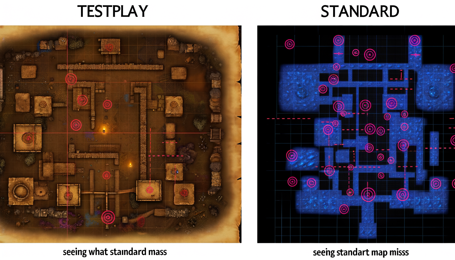
See What Standard Maps Miss: Unlocking Deeper Navigation Detail
Are you an outdoor enthusiast, a keen explorer, or someone who simply needs to understand the world around you in more depth than a basic road map allows?
If you rely solely on standard mapping applications for anything beyond getting from point A to point B on a paved road, you might be navigating with blind spots.
While incredibly convenient for daily commutes and finding nearby restaurants, these widely used maps often omit a wealth of critical information that can be the difference between a successful adventure and a frustrating, or even dangerous, experience.
Standard maps are designed for broad accessibility and general navigation, prioritizing major infrastructure and easily identifiable points of interest.
However, the real world, especially off the beaten path, is filled with subtle nuances: faint trails, changes in terrain that dictate effort or safety, hidden water sources, specific vegetation types, or historical features that tell a story.
These details are invaluable for activities like hiking, backpacking, off-road driving, hunting, fishing, urban exploration, and even emergency preparedness.
This post will reveal the crucial elements that standard maps typically miss.
More importantly, it will guide you on where and how to find the richer, more detailed map data that can transform your understanding of an area and significantly enhance your navigation, planning, and safety.
By the end of this article, you will have a clear picture of what you have been missing and possess the knowledge to access mapping resources that provide the depth and detail required for genuine exploration.
The Limits of Standard Maps: Designed for General Use
Standard mapping platforms have revolutionized how we navigate the modern world.
They provide turn-by-turn directions, traffic updates, and an incredible database of businesses and landmarks readily accessible on our smartphones.
Their primary function is efficient transportation and locating services within developed areas.
This design goal, while excellent for everyday tasks, inherently limits the scope and depth of the information they present, particularly when you venture away from roads and urban centers.
Designed for the Masses
The success of standard maps lies in their simplicity and broad appeal.
They cater to a massive global audience with diverse needs, the majority of which involve navigating roads, public transit, or pedestrian paths in populated areas.
Including highly specialized data, like detailed topographic contours, specific soil types, or every faint game trail, would clutter the interface and overwhelm the average user.
The design prioritizes clarity and ease of use for the most common navigation scenarios.
Prioritizing Roads and Points of Interest
Think about what dominates a standard map view: roads, highways, street names, and prominent buildings or businesses.
These are the core elements for vehicular and urban navigation.
While some parks and major trailheads are marked, the intricate network of trails within those areas, the subtle changes in elevation, or the nature of the ground cover are often abstracted or completely missing.
Points of interest focus on commercial or public services, not necessarily natural features or less-known historical sites that might be vital for exploration.
Data Simplification and Generalization
To manage vast amounts of geographic data and render it quickly on various devices, standard maps often rely on data simplification and generalization.
Elevation data might be smoothed out, leading to less accurate representations of slopes and hills.
Coastlines and waterways might be simplified, missing small coves, inlets, or the precise meanderings of a stream.
Vegetation might be shown as a generic green area rather than distinguishing between dense forest, open grassland, or marshland, all of which significantly impact travel off-trail.
This generalization is necessary for performance and usability at a global scale but sacrifices the granular detail crucial for specific activities.
Crucial Details Standard Maps Often Omit
Now, let's delve into the specific types of geographic information that are frequently absent or overly generalized on standard mapping platforms.
Understanding these omissions is the first step to appreciating the value of more specialized mapping resources.
Unveiling the Terrain's True Nature
One of the most significant limitations of standard maps for off-road or trail navigation is the lack of detailed terrain representation.
While some platforms offer a "terrain" layer, it's often a shaded relief that gives a general sense of mountains and valleys but lacks the precision needed for planning a route based on elevation change and slope.
Elevation, Slopes, and Contours
Detailed topographic maps use contour lines – lines connecting points of equal elevation – to depict the shape of the land.
The spacing and pattern of these lines reveal whether a slope is gentle or steep, whether a hill is rounded or cliff-faced, and the location of ridges, valleys, and saddles.
Standard maps typically lack these specific contour lines, or they are spaced too far apart to provide useful detail for navigating varied terrain.
Knowing the precise steepness of a slope is vital for estimating travel time, physical exertion required, or determining if a route is even passable, especially with a heavy pack or off-road vehicle.
The Hidden Waterways and Wetlands
Water features are critical elements of the landscape, influencing everything from potential water sources for hikers to obstacles for off-roaders and key habitats for wildlife.
Standard maps show major rivers and lakes, but often miss the smaller, yet significant, hydrological features.
Streams, Springs, and Bogs
Detailed maps often indicate perennial streams, intermittent streams (which flow only seasonally), springs, marshes, swamps, and bogs.
For a backpacker, knowing the location of a reliable spring can dictate where they camp.
For anyone traversing an area, identifying wetlands or intermittent streams is crucial for avoiding impassable terrain or planning necessary detours.
These subtle water features are frequently omitted from standard maps focused on general transportation.
Trails Beyond the Beaten Path
While popular, maintained trails in well-known parks might appear on standard maps, the vast network of less official paths often remains invisible.
These can be old logging roads, game trails, faint footpaths used by locals, or trails maintained by smaller, non-profit groups.
Unofficial and Unmaintained Routes
For explorers, hunters, or those seeking solitude, these unmapped trails can unlock access to remote areas or provide alternative routes.
Detailed maps, sometimes compiled from satellite imagery, local surveys, or crowd-sourced data, are necessary to identify these routes.
Relying only on officially marked trails limits exploration possibilities and might mean missing key access points or scenic detours.
Micro-Level Landscape Features
Beyond elevation and water, the very texture and composition of the land are often simplified on standard maps.
Features that are critical landmarks or indicators of ground conditions are frequently absent.
Rocks, Caves, and Vegetation Types
Specific rock outcrops, boulder fields, cliff lines, or cave entrances are vital details for climbers, cavers, or anyone navigating rugged terrain.
The type and density of vegetation also significantly impact travel speed and visibility off-trail.
Knowing whether an area is covered in dense, thorny brush, open forest, or tall grass helps in route planning and assessing bushwhacking difficulty.
Detailed maps and high-resolution satellite imagery can provide this crucial visual information, which is rarely symbolized on standard maps.
Understanding Land Use and Ownership
For activities like hunting, fishing, foraging, or simply exploring responsibly, knowing land ownership and designated use areas is paramount.
Trespassing is illegal and can lead to dangerous encounters or legal trouble.
Boundaries and Access Points
Standard maps may show large public land boundaries, like National Parks, but often fail to delineate smaller parcels of public land, private property lines, or specific management unit boundaries (e.g., different sections of a National Forest managed under different rules).
Detailed maps, often sourced from government land management agencies, are essential for understanding where you can legally be and what activities are permitted.
They can also show specific access points, such as unpaved roads or parking areas not listed on standard maps.
Layers of Time: Historical and Seasonal Data
The landscape is not static; it changes over time and with the seasons.
Historical features offer context and potential navigation aids, while seasonal variations impact conditions.
Historical Maps and Seasonal Conditions
Old maps can show vanished roads, settlements, or land uses that still leave traces on the landscape.
These can be fascinating for historical exploration and sometimes reveal forgotten routes.
While not strictly map *features*, understanding seasonal conditions like snow cover, water levels, or vegetation growth (which can be inferred from detailed base maps and external data) is vital for planning.
Standard maps rarely incorporate historical layers or dynamic seasonal data in a practical way for field navigation.
Why Does This Detail Matter? Practical Applications
Knowing about contour lines or intermittent streams isn't just academic; these details have direct, practical implications for various activities.
Ignoring them can lead to unexpected difficulties, wasted time, or even safety risks.
For the Outdoor Adventurer
Hikers, backpackers, trail runners, and climbers rely heavily on understanding the terrain they will traverse.
Detailed maps are their primary planning and navigation tool.
Hiking and Backpacking
Detailed maps allow hikers to accurately estimate elevation gain and loss, choose routes that match their fitness level, identify potential water sources, find suitable campsites away from prohibited areas or hazards, and navigate effectively off-trail if necessary.
Knowing the steepness of a section helps in packing the right gear and allocating sufficient time.
Climbing and Mountaineering
For climbing, detailed maps are indispensable for identifying cliff lines, talus slopes, access points to crags, and potential approach routes.
In mountainous terrain, understanding glacial features, avalanche paths (often correlated with specific slopes and aspects), and the exact position of ridges and gullies is critical for safety and route finding.
For Off-Road Exploration
Drivers of 4x4 vehicles, ATVs, and motorcycles venturing off paved roads face different challenges where detailed maps are crucial.
Understanding the ground surface, steepness, and potential obstacles is key.
Navigating Unpaved Terrain
Detailed maps can show unmaintained roads, tracks, and trails not found on standard maps.
They can indicate areas of sand, mud, or rock that might be difficult to traverse.
Analyzing contour lines helps identify steep inclines or descents that require specific driving techniques or might be impassable for a given vehicle.
Knowing the location of water crossings or potential washouts is also vital for safe passage.
For Anglers and Hunters
Both fishing and hunting are activities deeply tied to specific landscape features and environmental conditions.
Detailed mapping provides the intelligence needed to locate productive spots.
Locating Productive Areas
Anglers use detailed maps to find streams, ponds, access points, and understand the terrain around water bodies that might hold fish.
Hunters analyze terrain, vegetation, water sources, and boundaries to predict animal movements and locate prime habitat, bedding areas, or travel corridors.
Knowing land ownership is absolutely essential for legal hunting and fishing access.
For Urban and Historical Exploration
Detailed mapping isn't just for the wilderness; it enhances exploration in developed areas too.
Understanding the history and subtle geography of a town or city adds layers to the experience.
Discovering Hidden Features
Historical maps can reveal how an urban landscape has changed, showing old building footprints, vanished streets, or waterways that are now underground.
Modern detailed maps might show subtle elevation changes within a city, locate hidden parks or green spaces, or delineate different architectural periods or land use zones that standard maps gloss over.
For Emergency Preparedness and Safety
In a survival situation or emergency, having detailed knowledge of your surroundings is paramount.
The information missing from standard maps can be the most critical data you need.
Navigation and Resource Location
Detailed maps can help you find alternative routes if main roads are impassable, locate potential shelters (caves, thick forest), find water sources (springs, small streams), or understand the terrain for moving efficiently on foot.
Knowledge of land ownership can also help in assessing safety or potential resources.
Offline access to these detailed maps is also a crucial safety feature, as cell service is unreliable in many remote areas.
Finding the Missing Pieces: Sources for Detailed Map Data
Okay, you understand what you are missing.
Now, where do you find these rich, detailed maps?
Fortunately, a wealth of resources exist, ranging from traditional paper maps to sophisticated digital platforms.
Traditional Detailed Maps
Before digital mapping, paper maps were the standard for detailed navigation, and they remain invaluable today.
Topographic Maps
Perhaps the most classic example of detailed mapping is the topographic map.
Agencies like the United States Geological Survey (USGS) produce highly detailed topographic maps that use contour lines to show elevation, depict vegetation cover (often symbolized), locate springs and intermittent streams, and show various types of roads and trails.
These maps are often available for purchase or download.
Specialized Charts
For specific environments, specialized charts provide crucial detail.
Nautical charts, for example, show water depths, navigational hazards, buoy locations, and shoreline detail essential for boating and fishing.
Aeronautical charts provide information vital for pilots, including terrain, airspace restrictions, and navigation aids.
Digital Data Sources
The digital age has made accessing and layering geographic data easier than ever before.
Various platforms and databases offer detailed map layers and imagery.
High-Resolution Imagery
Satellite and aerial imagery offer a visual perspective that symbols on a map cannot fully capture.
High-resolution imagery can reveal faint trails, changes in vegetation density, rock formations, the presence of water, and recent changes to the landscape that pre-drawn maps might not show.
Many mapping platforms now include satellite views, but the resolution and currency can vary.
GIS Data Portals
Geographic Information Systems (GIS) are powerful tools for managing and analyzing spatial data.
Many government agencies (federal, state, local), universities, and environmental organizations make their raw GIS data publicly available through online portals.
This data can include detailed property boundaries, specific soil types, habitat mapping, historical land use layers, and much more, often with higher accuracy than consumer maps.
Accessing and using this data may require specialized software or platforms.
Community and Specialized Platforms
Beyond official sources, communities and commercial ventures have developed platforms specifically designed for detailed mapping needs.
Specialized Mapping Apps
Numerous mapping applications are designed for specific activities like hiking, hunting, or off-roading.
These apps often license or compile data from various sources, including topographic maps, satellite imagery, and custom layers.
They frequently offer features like GPS tracking, route planning with consideration for terrain, offline map downloads, and overlays for land ownership, weather, or other relevant data.
Platforms like Gaia GPS, onX Hunt, AllTrails (for trail data), or specialized off-road apps fall into this category, providing the "detail" that standard apps lack.
Crowd-Sourced Data (OpenStreetMap)
OpenStreetMap (OSM) is a collaborative project to create a free and open map of the world.
Because it is built and maintained by a community of mappers, it can sometimes include hyper-local details like specific footpaths, individual trees used as landmarks, or very recent changes to the landscape that may not appear on commercial maps.
The detail can vary depending on the mapping activity in a specific area, but it is a valuable supplementary source.
Temporal and Experiential Data
Some valuable mapping information comes not just from official surveys but from history and real-world experience.
Historical Maps
Archives, libraries, and online databases contain historical maps that can provide invaluable context.
Comparing old maps with current ones can reveal how the landscape has changed, helping you find forgotten features or understand the origins of existing ones.
Local Knowledge and Field Surveys
Ultimately, the most detailed map information often resides with people who know an area intimately – locals, guides, researchers, or experienced explorers.
Combining map study with local knowledge or personal reconnaissance (field surveys) is the best way to get the most comprehensive understanding of an area.
Some specialized mapping platforms allow users to contribute their own data, effectively crowd-sourcing this local knowledge.
Integrating Detailed Maps Into Your Planning
Simply having access to detailed maps is the first step.
To truly leverage them, you need to integrate them into your planning and navigation process.
This involves combining different data sources and understanding how to use the information effectively in the field.
Pre-Trip Analysis
Detailed map analysis should be a fundamental part of planning any trip off the main roads.
Spend time studying contour lines to assess climbs and descents.
Look for water sources or potential hazards like steep drop-offs or wetlands.
Identify key landmarks that you can use for navigation.
Use satellite imagery to get a visual sense of vegetation and terrain texture.
Check land ownership boundaries to ensure legal access.
This detailed preparation helps you anticipate conditions, choose the best route, and estimate timings more accurately than relying on generalized maps.
Combining Layers of Information
The power of modern digital mapping platforms often lies in their ability to display multiple layers of data simultaneously or switch between them easily.
You can view topographic lines overlaid on satellite imagery, or show property boundaries on top of a terrain map.
Learning to combine these different perspectives provides a much richer and more complete understanding of the area than any single map type could offer alone.
For example, seeing dense contours (steep terrain) overlaid on satellite imagery showing thick forest immediately tells you that bushwhacking that section will be extremely difficult and slow.
Utilizing Offline Maps
One of the most critical aspects of using detailed digital maps for remote exploration is ensuring they are available offline.
Cell service is often unavailable away from populated areas.
Specialized mapping apps allow you to download map sections to your device before you leave, ensuring you have access to detailed information and GPS functionality even without a signal.
Always download the necessary map layers and areas for your trip well in advance.
Carrying a physical copy of a detailed paper map and a compass as a backup is also a wise and often recommended safety practice.
Conclusion: Navigating with Deeper Insight
Standard maps serve us well for daily navigation and general orientation in familiar or developed areas.
However, they provide only a superficial view of the world, omitting the crucial details that define the character of the landscape and are essential for deeper exploration, safety, and success in activities like hiking, climbing, hunting, off-roading, and more.
Understanding what standard maps miss – from the subtle curves of contour lines and the presence of hidden springs to unofficial trails and precise land boundaries – is the first step in becoming a more capable and confident navigator.
Fortunately, a wealth of detailed mapping resources exists, including traditional topographic maps, high-resolution satellite imagery, specialized mapping applications, and publicly available GIS data.
By seeking out and utilizing these richer data sources, and by integrating them into your planning process, you gain a level of insight that transforms your relationship with the landscape.
You can anticipate challenges, find hidden opportunities, ensure your safety, and explore with a much deeper understanding of your surroundings.
Don't settle for the surface view; see what standard maps miss and unlock a world of detail waiting to be discovered.
Equip yourself with the right maps and the knowledge to use them, and your next adventure will be safer, more informed, and infinitely more rewarding.