


Unlocking Deeper Understanding: The Essential Role of Raised Relief Maps in Modern School Curricula
In today's dynamic educational landscape, educators are constantly seeking innovative tools and methods to engage students and foster a truly deep understanding of complex concepts. While digital resources and interactive whiteboards offer exciting possibilities, some of the most powerful learning aids are those that connect students directly with the physical world in a tangible way.
One such indispensable tool, often overlooked in the rush towards purely digital solutions, is the raised relief map. These three-dimensional representations of terrain offer a unique perspective that flat maps simply cannot replicate, providing students with a multi-sensory experience that enhances spatial reasoning, boosts engagement, and makes abstract geographical concepts concrete.
This authoritative guide explores the profound educational benefits of incorporating raised relief maps into school curricula, detailing their practical applications across various subjects, offering tips for effective classroom integration, and providing insights into selecting the right maps for your specific needs.
We aim to demonstrate why these tactile learning tools are not merely supplementary aids but essential components for building a robust understanding of our planet's physical geography and its impact on human history and science.
The Limitations of Traditional, Two-Dimensional Maps
For generations, flat maps have served as the standard tool for teaching geography and location. While they are effective for showing political boundaries, relative locations, and basic patterns, they inherently strip away a critical dimension of reality: elevation and topography.
Mountains are represented by contour lines or shading, valleys by empty spaces, and plateaus by flat areas marked at a certain height. While students can learn to interpret these symbols, the intuitive understanding of what it *feels* like to traverse mountainous terrain or the sheer drop into a canyon is completely missing.
This two-dimensional limitation can lead to a fragmented or abstract understanding of physical geography. Students may struggle to grasp why settlements developed where they did, how rivers flow, or how mountain ranges act as natural barriers or pathways because they lack a tangible sense of the landscape's vertical dimension.
Teaching concepts like watersheds, elevation's effect on climate, or the difficulty of ancient travel over steep terrain becomes significantly more challenging when the primary visual aid flattens the very features central to the discussion.
Introducing the Three-Dimensional Advantage: What Are Raised Relief Maps?
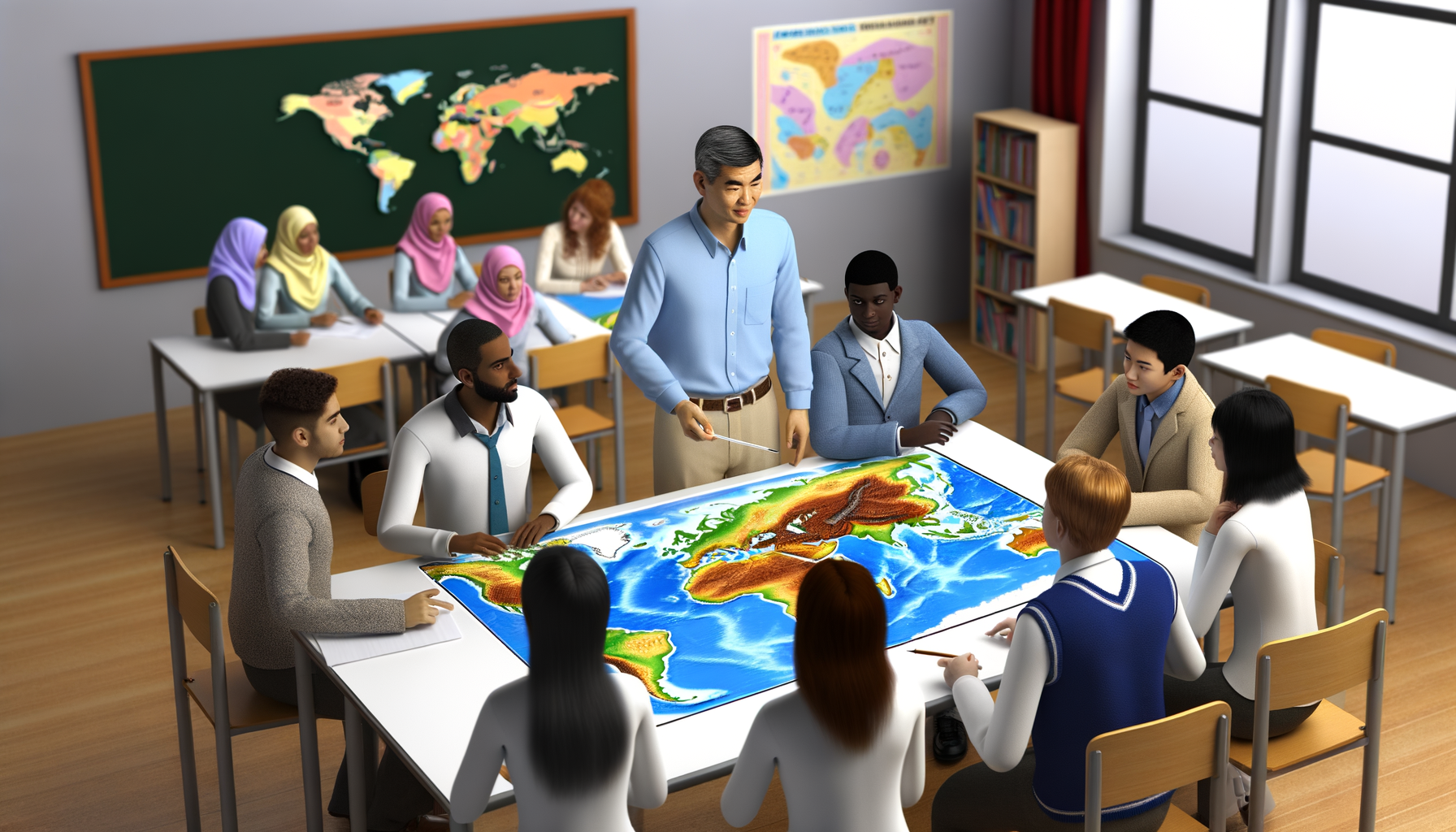
Raised relief maps, in contrast to their flat counterparts, provide a physical, three-dimensional representation of the Earth's surface. They are created using various techniques, often involving vacuum-forming plastic or layering materials, to physically elevate areas representing higher terrain and depress areas representing lower elevations.
This gives the map a tactile quality; students can quite literally feel the mountains rise, the valleys dip, and the plateaus stretch out. While the vertical scale is often exaggerated compared to the horizontal scale to make the relief more noticeable and impactful, the relative proportions and relationships between landforms are accurately depicted.
These maps typically display geographical features like mountains, hills, valleys, plains, plateaus, rivers, lakes, and oceans with their varying depths. Political boundaries, cities, and other cultural features may also be included, layered on top of the physical terrain.
The primary power of a raised relief map lies in its ability to bridge the gap between abstract visual symbols and a concrete, physical understanding of the landscape. It transforms a theoretical concept into something that can be explored with both sight and touch.
More Than Just Bumps: Defining the Physical Difference
The most obvious difference is, of course, the texture and shape. A flat map requires interpretation of abstract symbols to understand elevation, whereas a raised relief map allows for direct physical interaction with the terrain.
This physical interaction immediately communicates the concept of varying height and steepness in a way that lines on a page cannot. Students can trace the path of a river flowing downhill or feel the scale of a mountain range as their fingers move across it.
Beyond just elevation, these maps can sometimes subtly indicate other aspects of the terrain, such as the ruggedness of mountains versus the smoothness of plains, providing additional tactile information that aids comprehension.
The physical nature also makes them inherently more engaging for many students, transforming map-reading from a passive visual exercise into an active, exploratory experience.
Why Go 3D? The Core Educational Benefits of Raised Relief Maps
The advantages of using raised relief maps in the classroom extend far beyond simply making geography lessons more interesting. They tap into fundamental aspects of how students learn and understand spatial information.
Integrating these maps into the curriculum can lead to significant improvements in several key areas of cognitive development and subject comprehension.
Let's delve into the specific benefits that make these maps an invaluable addition to any educational setting, highlighting why their three-dimensional nature is so crucial for learning.
Enhancing Spatial Reasoning and Understanding
Spatial reasoning is the ability to understand, reason, and remember the spatial relationships among objects or space. It is a critical skill important for success in subjects ranging from mathematics and science to engineering and architecture, and it is fundamental to understanding geography.
Flat maps require students to mentally construct a three-dimensional image from two-dimensional data – a complex cognitive task. Raised relief maps provide that three-dimensional information directly, allowing students to develop a more intuitive sense of how landforms occupy space and relate to one another in depth and height.
By physically interacting with the varied surfaces, students build stronger mental models of terrain and geographical features. They can better visualize how a river flows from higher elevation to lower, how mountain passes offer limited routes, or how coastlines interact with varying underwater topography.
This tangible experience helps solidify spatial concepts, making it easier for students to transfer this understanding to abstract representations or real-world navigation.
Promoting Multi-Sensory Engagement
Learning is most effective when it engages multiple senses. Traditional flat maps primarily engage sight, sometimes augmented by auditory explanations.
Raised relief maps bring the sense of touch directly into the learning process. Students can feel the contours of the land, tracing rivers with their fingers or exploring the ruggedness of mountains.
This tactile interaction complements the visual information, creating a richer and more memorable learning experience. Engaging both sight and touch helps reinforce concepts and cater to different learning styles, including kinesthetic learners who benefit from hands-on activities.
The multi-sensory approach enhances retention and comprehension, making the study of geography and related subjects more dynamic and accessible to a wider range of students.
Making Abstract Concepts Tangible
Concepts like elevation, gradient, topography, and watersheds can feel abstract and difficult to grasp when only presented through diagrams or lines on a flat surface. What does a 500-foot elevation change truly mean in terms of steepness or effort to traverse?
A raised relief map makes these concepts tangible. Students can feel the steepness of a slope or the relative height difference between two points. They can place objects or figures on the map to simulate journeys and directly experience the physical challenges posed by the terrain.
Seeing and feeling the raised landforms provides a concrete reference point for understanding abstract geographical terms and processes. This tangibility is particularly valuable for younger students or those who struggle with abstract reasoning, making complex ideas immediately more relatable and understandable.
Boosting Student Engagement and Curiosity
Let's be honest: static, flat maps can sometimes fail to capture the imagination of digitally-native students. A raised relief map, however, often sparks immediate curiosity.
The opportunity to touch and explore the landscape physically is inherently engaging. It transforms passive viewing into active investigation, encouraging students to ask questions, make observations, and interact with the material.
Teachers can observe students naturally running their fingers along mountain ridges or down river valleys, demonstrating an intrinsic motivation to understand the physical layout of the area represented.
This increased engagement not only makes learning more enjoyable but also fosters a deeper interest in geography and the natural world.
Supporting Diverse Learning Needs and Accessibility
Raised relief maps are exceptionally valuable tools for supporting diverse learning needs within the classroom. They provide a crucial accessible option for students with visual impairments, who can use their sense of touch to explore geographical features that are inaccessible on a flat map.
For students with learning disabilities, particularly those who struggle with abstract concepts or symbol interpretation, the concrete, three-dimensional nature of these maps offers a more direct path to understanding spatial relationships and landforms.
Kinesthetic learners, who learn best by doing and touching, thrive when using raised relief maps. The tactile interaction helps them process and retain geographical information more effectively than visual-only methods.
Incorporating raised relief maps is an inclusive practice that provides multiple pathways to understanding, ensuring that students with a wide range of abilities and learning styles can access and engage with geographical content successfully.
Practical Applications Across the Curriculum
While geography is the most obvious subject where raised relief maps shine, their utility extends across numerous disciplines, providing a valuable interdisciplinary tool for educators.
Understanding the physical landscape is foundational to comprehending many aspects of history, science, and even mathematics.
By integrating raised relief maps into these other subjects, teachers can help students make meaningful connections between different areas of their studies, fostering a more holistic and integrated understanding of the world.
Geography: The Obvious Starting Point
In geography class, raised relief maps are unparalleled for teaching fundamental concepts. Students can identify and name major mountain ranges, river systems, and other landforms by seeing and feeling them.
They can trace watersheds, understanding how precipitation in high areas collects and flows into rivers and lakes. Teachers can use the maps to explain concepts like erosion, deposition, and plate tectonics by illustrating how these processes shape the physical surface depicted.
Studying regional geography becomes much richer when students can feel the varied terrain of a state, continent, or country, understanding why certain areas are more populated or developed than others based on the physical landscape.
Comparing different regions becomes a tactile exercise, highlighting the vast differences between, for example, the Rocky Mountains and the Great Plains.
History: Contextualizing Events
History happens in a specific geographical context, and understanding the terrain is often crucial to understanding historical events. Raised relief maps help bring historical narratives to life by providing a realistic backdrop for events.
Teachers can use maps to show students the challenges faced by pioneers crossing mountain ranges, the strategic importance of controlling high ground in battles, or why settlements developed along navigable rivers or in fertile valleys.
Understanding the geography of trade routes, migrations, and conquests is greatly enhanced when students can visualize the physical barriers and pathways that influenced these historical movements.
A lesson on the Civil War, for instance, gains depth when students can see and feel the Appalachian Mountains and how they divided the North and South, or the Mississippi River and its strategic importance.
Science: Exploring Earth Systems
Earth science, geology, and environmental science all benefit significantly from the use of raised relief maps. These maps visually represent the results of geological processes like mountain building, volcanic activity, and glaciation.
Students can see and feel the scale of geological features, helping them understand concepts related to landform creation and change over time. Discussing water cycles and ecosystems becomes more concrete when students can see the interaction between elevation, water bodies, and potential habitats.
Teachers can use the maps to discuss natural hazards like landslides and floods, showing how steep slopes and river valleys contribute to these events. Understanding climate patterns often involves understanding how mountains affect air flow and precipitation, which is clearly illustrated by the physical relief.
Studying conservation or land use planning also becomes more meaningful when students can see the physical constraints and opportunities presented by the terrain.
Mathematics: Visualizing Topography and Data
While less immediately obvious than geography, raised relief maps can also support mathematical concepts. They provide a real-world example of three-dimensional space and can be used to introduce concepts like elevation change, slope, and gradient.
Students can use rulers or strings to measure distances over varying terrain on the map, comparing straight-line distance to the actual distance following contours, introducing ideas related to curves and surfaces.
The maps can also be used to visualize data sets related to elevation, population distribution on different landforms, or resource allocation based on terrain, providing a tangible context for data interpretation and analysis.
This application helps students see mathematics not just as abstract numbers but as tools for understanding the physical world around them.
Special Education: A Powerful Tool for Accessibility
As mentioned earlier, raised relief maps are particularly impactful in special education settings. For students with visual impairments, they are often the primary means of accessing geographical information about terrain.
For students with cognitive delays or learning disabilities, the concrete and tactile nature of the maps simplifies complex spatial relationships that are difficult to grasp from flat representations.
The multi-sensory input benefits students with sensory processing disorders or attention difficulties by providing a focused, interactive way to engage with the material.
Raised relief maps empower educators to provide equitable access to geographical learning for students with a wide range of needs, promoting inclusion and success.
Integrating Raised Relief Maps into Classroom Practice
Simply having a raised relief map in the classroom is a good start, but its full educational potential is unlocked when it is actively integrated into lessons and student activities.
Thinking creatively about how students interact with the map can transform it from a display item into a powerful learning station.
Consider these practical approaches to maximize the value of your raised relief maps within the curriculum.
Lesson Ideas and Activities
Design lessons specifically around the tactile interaction offered by the map. Have students work in small groups to identify and describe different landforms by touch alone, then compare their tactile observations with visual information.
Provide students with string or pipe cleaners to trace the longest river, the path over the lowest mountain pass, or the route of a historical journey across the terrain. Ask them to explain *why* the route might follow certain features.
Use small blocks or figures to simulate population distribution or resource placement, discussing how the terrain influences where people live or where industries are located. Compare population density in mountainous versus flatter regions using the map as a visual aid.
Challenge students to hypothesize about climate or weather patterns in different areas of the map based solely on their elevation and proximity to water bodies, then research to verify their predictions.
These hands-on activities make learning dynamic and help students build a deep, intuitive understanding of geographical concepts.
Combining with Digital Resources
Raised relief maps and digital tools are not mutually exclusive; they can complement each other effectively. Use the raised relief map to introduce a region and its physical characteristics tangibly, building foundational understanding.
Then, transition to digital resources like Google Earth, online GIS maps, or historical map overlays to provide different layers of information, zoom capabilities, and interactive features. Students can compare the physical map they felt with satellite imagery or historical data sets.
This approach leverages the strengths of both formats: the raised map provides the essential, tactile understanding of 3D space, while digital tools offer vast amounts of data, flexibility, and opportunities for deeper research and analysis.
Students can locate points of interest on the physical map and then explore them in detail digitally, creating a seamless transition from concrete understanding to complex digital data interaction.
Classroom Setup and Display
Consider the map's placement for optimal use. A large, prominent map can serve as a constant reference point during lessons, but accessibility for hands-on exploration is key.
Position the map where students can gather around it, touch it, and point to features easily. If space allows, a dedicated map station or table can encourage independent exploration during free time or designated activity periods.
Ensure the map is mounted securely if it is wall-mounted, or placed on a sturdy table if it is a tabletop model. If you have multiple maps (different regions or scales), consider how they will be stored and accessed.
Clear labeling of continents, countries, major cities, and physical features on or near the map can aid student identification and vocabulary development.
Choosing the Right Raised Relief Map for Your School
Selecting the appropriate raised relief map requires careful consideration of several factors to ensure it meets the specific needs of your curriculum, students, and budget.
Not all maps are created equal, and what works well for one grade level or subject might not be suitable for another.
Thinking through these key criteria will help you make an informed decision and invest in a map that will be a valuable educational asset for years to come.
Factors to Consider: Scale, Detail, and Accuracy
The scale of the map determines how much area it covers and how detailed the representation is. A map of the world will show major mountain ranges and oceans but won't provide detail on small local hills.
A map of a specific state or region will offer much greater detail on local topography, smaller rivers, and more subtle elevation changes. Consider what regions are central to your curriculum – are you teaching world geography, US states, or focusing on your local area?
The level of detail in the relief and the information printed on the map should match the age and learning objectives of your students. Younger students might benefit from simpler maps with clear landforms and basic labels, while older students can handle maps with more intricate detail, contour lines, and additional data.
Accuracy in both the physical relief and the printed information is paramount for effective learning. Research reputable manufacturers known for their cartographic accuracy.
Durability and Materials
School environments require resources that can withstand frequent handling by many students over many years. Raised relief maps are typically made from sturdy plastic or other durable materials, but quality can vary.
Look for maps made from thick, impact-resistant plastic that can tolerate being touched, traced, and perhaps even occasionally mishandled. The printing on the map should be resistant to fading or scratching.
Consider how the map is finished – some have a protective coating that adds to their longevity. While a lower upfront cost might be tempting, investing in a well-made, durable map will save money in the long run by avoiding frequent replacements.
Read reviews or ask for recommendations from other schools to gauge the real-world durability of different options.
Curriculum Alignment and Regional Focus
Ensure the map you choose aligns directly with your curriculum. If you teach US history focusing on westward expansion, a detailed relief map of North America or the American West is essential.
If your science curriculum includes studying local watersheds, a high-detail map of your specific region's topography is invaluable. World maps are great for global context, but regional maps provide the necessary depth for specific studies.
Consider if the map includes political boundaries and city labels in addition to physical features, as this is often necessary for integrating geography with history and current events.
Plan your map purchases strategically to build a collection that covers the key geographical areas addressed across different grade levels and subjects in your school.
Cost and Budgeting
Raised relief maps represent an investment compared to flat paper maps, but their long-term educational value justifies the cost. Prices can vary significantly based on size, detail, materials, and the region covered.
Explore options from different suppliers and compare prices for maps with similar features and quality. Look for educational discounts or grant opportunities that might help fund the purchase.
Consider purchasing maps gradually over several budget cycles if funding is limited, prioritizing the most essential maps for your core curriculum needs.
Frame the cost not just as an expense, but as a lasting asset that enhances learning and accessibility for many student cohorts.
Overcoming Potential Challenges
While the benefits are clear, incorporating raised relief maps might present a few practical challenges for schools, primarily related to storage and initial cost.
However, with thoughtful planning and creative solutions, these obstacles can be effectively managed, ensuring that the maps are readily available and fully utilized.
Addressing these potential hurdles proactively makes the integration process smoother and helps maximize the return on your investment in these valuable learning tools.
Storage Solutions
Unlike flat maps that can be rolled or folded and stored in tubes or drawers, raised relief maps require more dedicated space due to their three-dimensional form. Large wall-mounted maps are less of a storage issue once installed, but smaller tabletop maps or maps that are occasionally taken down need careful planning.
Vertical storage systems designed for large charts or maps can work if the relief is not too pronounced. Custom-built racks or shelving units designed to accommodate the map's dimensions can also be a solution.
Designating a specific, easily accessible cupboard or area in the classroom or resource room for map storage is crucial to ensure they are protected and easy to retrieve for lessons.
If space is extremely limited, prioritize smaller, high-detail maps of specific regions over very large maps, or consider acquiring maps on a lending basis from a central school district resource center if available.
Initial Investment
The initial cost of purchasing high-quality raised relief maps can be higher than that of traditional maps, which may pose a challenge for schools with limited budgets.
Explore various funding options. Look for educational grants specifically for classroom resources or STEM (Science, Technology, Engineering, and Mathematics) education, as these maps support all these areas. Parent-teacher organizations might also be a source of funding for specific classroom needs.
Consider purchasing one or two key maps initially and then add to your collection over time as funds become available. Partner with other teachers or departments to share resources and costs.
Highlighting the long-term benefits – durability, multi-sensory learning, accessibility – can help justify the investment to administrators and funding bodies.
Ensuring Accessibility for All Students
While the tactile nature inherently benefits students with visual impairments, ensure that the physical placement and size of the map accommodate all students, including those who use wheelchairs or have other mobility challenges.
If a map is wall-mounted, ensure it is at a height where students of varying heights can comfortably reach and explore it. Tabletop maps should be placed on stable tables at an appropriate height.
Provide clear instructions and guidance on how to interact with the map respectfully to ensure its longevity while allowing all students to engage fully.
Train staff on how to effectively use the maps with students who have diverse needs, leveraging the tactile and visual information in tandem or separately as required.
The Future of Topographic Learning Tools
As technology continues to evolve, we may see exciting integrations of raised relief map technology with digital tools. Imagine augmented reality overlays projecting data onto a physical relief map, or 3D printing technology making customized topographic models more accessible.
However, the fundamental benefit of the tactile experience provided by a physical raised relief map remains irreplaceable by purely digital representations.
The direct, physical connection to the concept of elevation and terrain provides a foundational understanding that enhances the use of digital tools, rather than being replaced by them.
Raised relief maps are not relics of the past; they are timeless educational tools that continue to offer unique and powerful learning opportunities in the modern classroom.
Conclusion: Investing in Deeper Understanding
In conclusion, incorporating raised relief maps into school curricula offers a multitude of significant educational benefits that directly address limitations inherent in two-dimensional learning resources. These tactile, three-dimensional tools enhance spatial reasoning, promote multi-sensory engagement, make abstract concepts tangible, and significantly boost student curiosity and participation.
Their applicability spans across geography, history, science, mathematics, and are particularly powerful for supporting students with diverse learning needs, including those with visual impairments. While there may be practical considerations regarding storage and initial cost, the long-term value they add to the learning experience is undeniable.
By providing students with a physical way to interact with the landscape, educators can unlock deeper levels of understanding and create more memorable and impactful lessons. Investing in raised relief maps is an investment in a richer, more accessible, and more engaging educational experience for all students.
Embrace the power of touch and dimension to transform how students see and understand the world.