


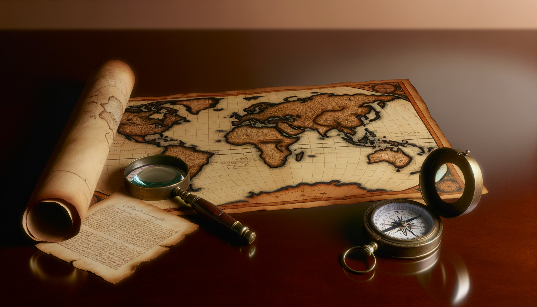
Beyond Google Maps: The Enduring, Essential Value of Physical Maps
In our increasingly digitized world, the smartphone has become an indispensable tool for navigating from point A to point B.
Mapping applications like Google Maps, Apple Maps, and others offer real-time directions, traffic updates, and points of interest at our fingertips, making spontaneous travel and daily commutes incredibly convenient.
They have revolutionized how we move through familiar cities and explore new ones, providing a level of accessibility and immediacy that was unimaginable just a few decades ago.
However, this heavy reliance on digital tools raises an important question: in an age where turn-by-turn voice prompts guide our every step, what is the continuing relevance and value of the traditional physical map?
Are these folded paper rectangles, with their intricate lines and symbols, merely nostalgic relics of a bygone era, or do they still offer something fundamental and perhaps even superior that digital maps cannot replicate?
This post will explore the enduring value of physical maps, arguing that far from being obsolete, they provide unique cognitive benefits, practical advantages, and experiential depth that are crucial for developing a robust understanding of geography and our place within it.
We will delve into how engaging with a physical map can sharpen our spatial reasoning, foster a deeper connection to places, offer unparalleled reliability in challenging conditions, and serve as vital tools for planning and exploration.
By understanding these unique contributions, we can see that the "solution" isn't abandoning digital maps entirely, but rather recognizing and integrating the distinct, essential strengths of physical maps back into our lives for a richer, more capable approach to navigation and understanding the world around us.
The Modern Navigation Landscape: Acknowledging Digital Dominance
Before championing the physical map, it is only fair to acknowledge the remarkable achievements and undeniable utility of digital navigation platforms.
They have democratized access to geographic information, allowing virtually anyone with a smartphone to explore even the most complex urban environments or find the fastest route to a destination.
Features like real-time traffic updates, estimated arrival times, public transit information, and user-generated reviews of businesses are genuinely transformative and incredibly useful for daily life and certain types of travel.
The ability to search for specific addresses or place names and receive immediate directions is a convenience that few would argue against, particularly for routine trips or navigating unfamiliar, densely populated areas.
Furthermore, digital maps can be updated instantly, reflecting new road construction, changes in routes, or temporary closures, providing a level of current information that a printed map can never match.
Their integration with other digital services, such as ride-sharing apps or restaurant booking platforms, creates a seamless digital experience for many users.
However, it is precisely this ease of use and automation that highlights the areas where digital maps fall short and where the value of physical maps shines brightest.
While they tell you *where* to turn, they often do not teach you *why* or *how* to understand the broader geographic context, potentially leading to a passive reliance that diminishes our innate navigational abilities and connection to the physical world.
Why Physical Maps Hold Unique and Enduring Value
Cognitive Enhancement: Sharpening the Mind's Compass
One of the most profound, yet often overlooked, benefits of using physical maps lies in their impact on our cognitive abilities, particularly related to spatial reasoning and memory.
Navigating with a physical map is an active process that requires interpretation, calculation, and synthesis, engaging different parts of the brain compared to simply following a voice prompt or a line on a screen.
This active engagement helps build a stronger mental model of the environment.
Enhancing Spatial Awareness and Reasoning
When you use a physical map, you are required to orient the map to your surroundings, understand scale, interpret symbols representing elevation, terrain, roads, and landmarks, and mentally project your position onto the map.
This process actively exercises your spatial reasoning skills, helping you understand the relationships between different places and features.
You learn to judge distances, recognize patterns in the landscape depicted on the map, and develop an intuitive sense of direction relative to your location.
Unlike digital maps that often abstract the world into a simplified, constantly reorienting view focused only on your immediate path, a physical map presents the entire area simultaneously, forcing your brain to process and connect disparate pieces of information into a coherent whole.
This fosters a deeper understanding of geographic space and improves your ability to navigate even without the map itself, as you build a more robust internal representation of the area.
Fostering Memory and Recall
The active engagement required by physical maps also significantly aids memory and recall.
Because you are actively looking at the map, making decisions about routes, and constantly re-orienting yourself, you are much more likely to remember the path taken and the landmarks encountered.
This contrasts with passive navigation using digital maps, where the user often focuses solely on the next instruction and does not process the surrounding environment in a meaningful way, leading to a poorer memory of the journey and the geography traversed.
The effort involved in reading and interpreting the map solidifies the information in your memory, creating a more lasting impression of the route and the area.
This improved memory is not just about recalling a specific route; it contributes to building a cumulative understanding of a region over time.
Grasping the "Big Picture" and Context
Perhaps one of the most significant cognitive advantages of physical maps is their ability to provide the "big picture" view.
You can see the entire planned route from origin to destination on a single page, or unfold a large map to see how different cities, states, or even countries relate to each other geographically.
This comprehensive perspective is difficult to achieve with digital maps, which typically show only a limited area around your current location or destination.
Seeing the whole picture allows for better route planning, understanding alternative paths, and appreciating the geographical context of your journey.
It helps you understand how different areas connect, the scale of distances, and the overall layout of a region, fostering a much deeper and more nuanced understanding than a turn-by-turn interface ever could.
This holistic view is essential for developing geographic literacy and a true sense of place.
Practical, Real-World Advantages
Beyond the cognitive benefits, physical maps offer tangible, practical advantages that make them indispensable tools in certain situations, often where digital technology fails.
Their reliability, durability, and user-friendliness in specific contexts highlight their continuing relevance in the modern world.
Unwavering Reliability: Independent of Technology
The most obvious practical advantage of a physical map is its complete independence from technology.
Physical maps do not require battery power, cellular signal, or GPS connectivity to function.
This makes them inherently reliable in situations where digital devices might fail – think remote wilderness areas with no signal, prolonged power outages, or simply forgetting to charge your phone.
A physical map provides a fail-safe navigation option that is always available as long as you have it in your possession.
This reliability is not just a convenience; in emergency situations, it can be a matter of safety and survival.
Durability and Resilience
While a paper map might seem fragile, many modern physical maps, especially those designed for outdoor use, are printed on waterproof, tear-resistant materials that can withstand harsh weather conditions, rough handling, and frequent folding.
They can be used in pouring rain, extreme temperatures, or dusty environments without issue, unlike many electronic devices which are susceptible to damage from moisture, temperature extremes, or physical impact.
You can unfold a physical map in the wind (though it might require some effort to hold down!) or mark on it with a pencil in damp conditions, tasks that would be difficult or impossible with a touchscreen device.
Their robust nature makes them ideal companions for rugged adventures and unpredictable travel scenarios.
Enhanced Planning and Personal Annotation
Physical maps are unparalleled tools for trip planning.
Laying out a large map allows you to visualize entire routes, identify potential stops, estimate travel times based on distances and road types, and explore alternative paths easily.
You can mark your route with a pen or pencil, highlight points of interest, jot down notes, or track your progress directly on the map.
This hands-on interaction personalizes the map and makes it a dynamic planning document, something cumbersome or impossible with most digital maps.
The ability to annotate freely allows for a level of detailed planning and on-the-go adjustment that is intuitive and efficient.
It turns the map from a static representation into a working document for your journey.
The Experiential and Emotional Dimensions
Beyond the practical and cognitive benefits, physical maps offer a richer, more tangible, and often more rewarding experience of exploration and connection to the world.
There is an inherent charm and sense of adventure associated with unfolding a map and charting your own course.
The Joy of Discovery
Browsing a physical map is an act of discovery in itself.
Your eyes wander over regions, noticing place names, geographical features, and potential routes you might not have considered if simply searching for a single destination on a digital map.
You might spot a small town off the main highway, a national park boundary, or a winding river that sparks curiosity and invites further investigation or a detour.
This serendipitous discovery is a core part of the exploratory spirit that physical maps embody.
It encourages curiosity about the spaces between destinations, not just the destinations themselves.
A Tangible Connection to Place
Holding a physical map in your hands creates a tangible connection to the place it represents.
The feel of the paper, the visual density of information, the scale laid out before you – all contribute to a sensory experience that digital maps cannot replicate.
A physical map feels like a real artifact of the world, a key to unlocking its geography.
This tangibility can foster a deeper emotional connection to the places you explore or plan to visit.
It's a physical object that represents a physical space, creating a more direct link in our minds.
Cultivating a Sense of Adventure and Self-Reliance
Successfully navigating with a physical map provides a profound sense of accomplishment and self-reliance.
Instead of passively following instructions, you are actively engaging with the map, making decisions, and trusting your interpretation and judgment.
This process builds confidence in your own abilities to understand and move through the world.
There is an inherent sense of adventure in unfolding a map, orienting yourself, and setting off based on your own calculations and observations.
It taps into a more fundamental human instinct for exploration and navigation that can be dulled by over-reliance on automated guidance.
This feeling of being capable and independent is a powerful motivator for exploration and learning.
Where Physical Maps Truly Excel: Specific Use Cases
While digital maps are excellent for many everyday navigation needs, certain scenarios distinctly highlight the superiority and enduring value of physical maps.
Understanding these specific use cases further underscores why physical maps are far from obsolete.
Outdoor Adventures and Wilderness Navigation
This is perhaps the most critical area where physical maps remain the gold standard and an essential safety tool.
Hiking, camping, backpacking, mountaineering, and backcountry skiing often take place in areas with no cellular service and where GPS signals can be unreliable due to terrain or weather.
A detailed topographic map and a compass are fundamental tools for safe navigation in the wilderness.
They allow you to understand elevation changes, identify water sources, recognize landforms, and plan routes off established trails.
In these environments, a dead phone battery or a lack of signal can quickly turn a minor inconvenience into a dangerous situation, making a reliable, battery-free physical map indispensable.
Orienteering, a sport based entirely on navigation using maps and compasses, is a perfect example of the skills physical maps cultivate and require in outdoor settings.
Here, the ability to interpret terrain features on a map and relate them to the actual landscape is paramount.
Travel Planning, Exploration, and Immersion
For planning complex trips, especially those involving multiple stops or exploration of a large region, a physical map provides a superior overview.
Spread across a table, a large map allows you to see the entire scope of your journey, identify logical routes, calculate distances, and discover points of interest along the way in a way that scrolling and zooming on a screen simply cannot replicate.
When exploring a new city or region, using a physical map encourages you to look up from your phone and engage with your surroundings.
You reference the map, look around to identify landmarks, and orient yourself within the urban or natural landscape.
This active engagement fosters a deeper connection to the place, helping you build a mental map of the area more effectively than passively following GPS prompts.
Getting intentionally "lost" with a physical map can lead to unexpected discoveries and a more authentic travel experience, encouraging spontaneity and exploration beyond pre-programmed routes.
Education, Learning, and Geographic Literacy
Physical maps are foundational tools in education, particularly for teaching geography, spatial concepts, and critical thinking skills.
Children and adults alike benefit from learning to read and interpret maps, understand scale, latitude and longitude, political boundaries, and physical features.
Working with physical maps helps develop a fundamental understanding of how the world is organized spatially.
It provides a concrete representation of abstract geographic concepts that can be harder to grasp solely through digital interfaces that often prioritize immediate function over foundational understanding.
Schools continue to use physical maps and globes because they offer a tangible, accessible way to teach fundamental geographic principles and cultivate geographic literacy, which is crucial for informed global citizenship.
Emergency Preparedness and Off-Grid Scenarios
In any emergency scenario where power grids might be down, cellular networks overloaded, or GPS satellites affected, having a physical map and compass can be absolutely critical.
Natural disasters, widespread power outages, or other crises can render digital navigation tools useless.
A physical map of your local area, state, or potential evacuation routes provides a reliable means of navigation when all else fails.
It is an essential component of any comprehensive emergency preparedness kit, offering peace of mind and a vital capability for finding your way or reaching safety without relying on vulnerable technology.
This is not just theoretical; countless situations have demonstrated the critical need for reliable, non-electronic navigation in times of crisis.
Integrating the Best of Both Worlds: Physical and Digital Navigation
The discussion of physical maps versus digital maps should not be viewed as an either/or proposition.
In reality, the most effective approach to navigation and geographic understanding in the 21st century involves leveraging the strengths of both tools.
Leveraging Both Tools for Optimal Results
Digital maps excel at real-time information, quick searches, and turn-by-turn guidance, which are invaluable for daily commutes and navigating complex road networks.
Physical maps excel at providing a comprehensive overview, promoting spatial understanding, ensuring reliability in challenging conditions, and facilitating detailed planning and exploration.
The optimal strategy is often to use digital tools for the immediate, real-time aspects of navigation while using physical maps for planning, gaining a macro perspective, and as a reliable backup.
For example, you might use a digital map for live traffic updates on a highway journey but use a physical road atlas to plan the overall route, identify interesting towns along the way, and understand the geography of the states you are traversing.
For a hiking trip, you would use a detailed topographic map and compass for wilderness navigation and safety, while potentially using a GPS app on your phone (if signal is available and battery allows) as a supplementary tool for checking your location against the map.
Knowing When and Why to Choose a Physical Map
Developing the wisdom to know when to rely on a physical map is key.
Here are some guiding principles:
1. When navigating off-grid or in remote areas: Where signal and power are uncertain, a physical map is essential.
2. For comprehensive trip planning: To visualize the entire journey and explore options broadly.
3. To enhance spatial reasoning and build mental maps: Actively using a physical map improves cognitive skills.
4. As a reliable backup: Always carry a physical map for emergency situations.
5. For educational purposes: To teach fundamental geography and map-reading skills.
6. When exploring without a fixed destination: To encourage serendipitous discovery and appreciation of the landscape.
Choosing a physical map in these situations allows you to tap into its unique strengths and avoid the vulnerabilities inherent in relying solely on technology.
Conclusion: Re-Discovering the World with a Physical Map
In an era dominated by instant information and automated guidance, it is easy to view physical maps as obsolete artifacts.
However, as we have explored, the enduring value of physical maps extends far beyond nostalgia; it is rooted in tangible cognitive benefits, practical reliability, and a richer, more engaged experience of the world.
Physical maps challenge us to think spatially, enhance our memory of places, provide a crucial backup in challenging conditions, facilitate deeper planning, and foster a sense of adventure and self-reliance.
They offer a comprehensive view of geography that digital interfaces, optimized for immediate navigation, often fail to provide.
Instead of seeing physical maps as competitors to digital tools, we should view them as complementary instruments, each with distinct strengths that, when used together, create a more capable and insightful navigator.
Integrating physical maps back into our lives – whether for planning a road trip, preparing for a hike, educating our children, or simply exploring our local area – can enrich our understanding of geography and deepen our connection to the places we inhabit and visit.
So, the next time you plan a journey or find yourself wondering about a nearby area, consider unfolding a physical map.
You might just discover not only a new route or a hidden gem, but also a renewed sense of wonder and competence in navigating the physical world.
The enduring value of physical maps is not just in showing you the way; it is in teaching you how to find it yourself, fostering skills and a connection to place that digital tools alone cannot provide.