


A Map Collector's Must-Have: Navigating Your Collection with the TESTPLAY Range
The world of map collecting is rich with history, artistry, and the thrill of discovery. Every antique chart and vintage plan tells a story, offering a unique window into past explorations, political landscapes, and cartographic evolution. However, managing a significant map collection presents unique challenges, from accurate identification and detailed provenance research to meticulous condition tracking and secure digital archiving. Serious collectors often seek robust solutions to enhance their passion, ensuring their treasures are well-understood, properly preserved, and readily accessible.
Navigating these complexities requires more than just shelf space and archival folders; it demands intelligent tools designed specifically for the nuances of cartography. Traditional methods, while foundational, can be time-consuming and may lack the depth and interconnectedness offered by modern technology. This is where the TESTPLAY Range emerges as a truly essential asset, offering a comprehensive suite of digital tools tailored precisely to the needs of the discerning map collector.
This post will explore the multifaceted capabilities of the TESTPLAY Range, detailing why it has become an indispensable part of the modern map collecting landscape. We will delve into its core features, understand how it addresses the specific challenges collectors face, and highlight the benefits it brings to every stage of the collecting journey, from acquisition and research to preservation and display. Whether you are a seasoned collector with hundreds of maps or just beginning to build your collection, understanding the power of the TESTPLAY Range is key to unlocking new levels of insight, organization, and enjoyment from your passion.
The Enduring Allure of Maps and the Collector's Journey
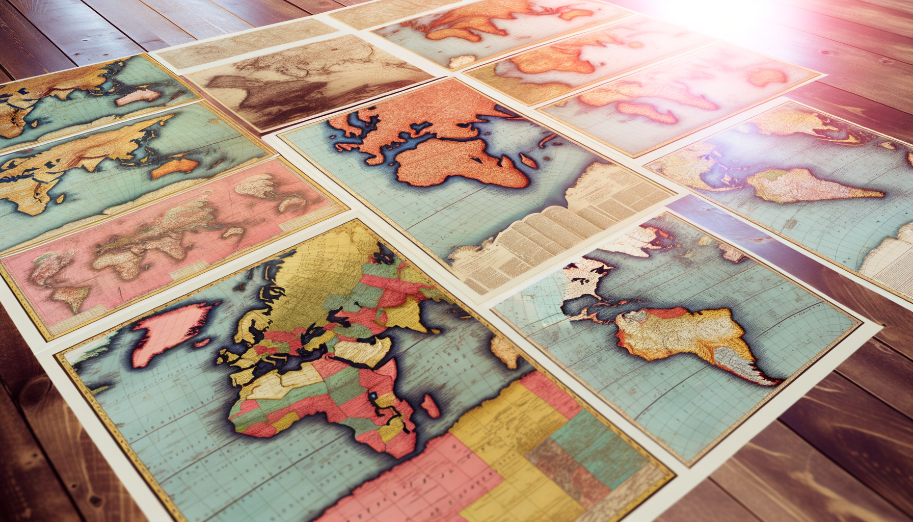
Collecting maps is a pursuit driven by a deep appreciation for history, geography, and artistry. Each map is a historical document, a piece of art, and a testament to the knowledge and technology of its time. The intricate details, the evolution of boundaries, the depiction of unknown lands, and the stories of explorers and cartographers captivate the imagination of enthusiasts worldwide.
Yet, with this passion comes significant responsibility and complexity. Identifying a map correctly involves understanding printing techniques, watermarks, paper types, cartouche styles, and the specific historical context of its creation. Tracing its history of ownership, or provenance, adds layers of authenticity and value but requires diligent record-keeping and research across disparate sources. Furthermore, maps, often being paper-based artifacts, are susceptible to damage from environment, handling, and age, necessitating careful preservation strategies and ongoing condition monitoring.
Cataloging a collection, understanding its true market value, and effectively sharing or displaying these historical treasures are all ongoing tasks. Without a structured system, information can become fragmented, research scattered, and the true potential and story of the collection may remain partially hidden. Collectors need a way to bring all these elements together cohesively and efficiently.
Introducing the TESTPLAY Range: Your Comprehensive Digital Cartographic Companion
Recognizing the unique demands of map collecting, the TESTPLAY Range was developed as a purpose-built digital ecosystem designed to support collectors at every turn. It is not merely a simple database; it is a sophisticated suite of interconnected tools crafted with the nuances of cartography and historical documents in mind. The range offers a central hub for managing every aspect of a map collection, integrating advanced features that go far beyond basic inventory tracking.
The core philosophy behind the TESTPLAY Range is to empower collectors with the knowledge, organizational capability, and digital resources needed to elevate their collecting experience. By combining robust data management with specialized cartographic research tools and preservation aids, it provides a level of insight and control previously difficult to achieve. This integrated approach ensures that all relevant information about your maps is linked, searchable, and actionable, transforming how you interact with your collection.
From detailed cataloging and high-resolution digital imaging to in-depth provenance tracking and dynamic valuation estimates, the TESTPLAY Range provides the digital infrastructure necessary for modern, responsible, and deeply rewarding map collecting. It acts as a trusted partner, simplifying complex tasks and freeing up more time to enjoy the history and beauty of the maps themselves. This platform represents a significant leap forward in how collectors can manage and appreciate their valuable holdings.
Why the TESTPLAY Range is Indispensable for Serious Map Collectors
The question for many collectors is not simply "what is this software?" but "how does it fundamentally improve my collecting?". The TESTPLAY Range offers distinct advantages that make it a vital tool for anyone serious about their map collection. It addresses the core pain points of collecting by providing specialized features that standard inventory software simply cannot match. Let's explore some of the key reasons why TESTPLAY Range is considered a must-have.
Unparalleled Research Capabilities
Identifying and understanding a map requires significant research, often across numerous reference books, online databases, and auction records. The TESTPLAY Range significantly streamlines this process by providing integrated research tools. Its Historical Context Engine can connect your maps to relevant historical events, figures, and cartographic movements, offering deeper insights into their creation and significance.
The platform allows you to record and link information from various sources directly to each map entry. This creates a centralized repository of knowledge for your specific collection, making future research faster and more efficient. Whether you are trying to date a map, identify the cartographer, or understand its specific printing history, the research tools within TESTPLAY provide a powerful assist. This comprehensive approach ensures that you are not just collecting maps, but also building a rich, interconnected body of knowledge around them.
Streamlined Collection Management
Organizing a collection, regardless of size, can become complex, especially with maps that vary greatly in size, format, and historical period. The TESTPLAY Range offers a highly flexible and detailed cataloging system designed specifically for maps. You can record granular details such as cartographer, publisher, date, edition, dimensions, scale, geographic coverage, printing technique, paper type, watermarks, and much more.
The Digital Atlas Archiver module allows for the upload of high-resolution scans or photographs of your maps. These digital representations are crucial for documentation, study, and even identification without physically handling the map. The system allows you to link related items, such as atlases, globes, or associated documents, creating a fully interconnected view of your collection holdings. Effective management through TESTPLAY ensures you always know exactly what you have, where it is located, and all pertinent details about it.
Proactive Preservation Assistance
Preserving the physical integrity of antique and vintage maps is paramount for their long-term survival and value. The TESTPLAY Range includes a sophisticated Condition Monitoring Log designed to help you track the state of each map over time. You can record details about condition issues, previous repairs, environmental storage conditions, and even set reminders for periodic checks or necessary conservation work.
By maintaining detailed condition records within the platform, you can proactively identify potential problems and demonstrate a history of responsible stewardship, which is important for both preservation and potential future transactions. The Digital Atlas Archiver also serves as a vital preservation tool by creating high-fidelity digital backups of your collection. These digital copies are invaluable for study, reference, and safeguarding against the risk of loss or damage to the physical items.
Insightful Valuation Tracking
Understanding the market value of your maps is an important aspect of collecting, whether for insurance purposes, potential deaccessioning, or simply appreciating the financial growth of your holdings. The TESTPLAY Range incorporates features to help you track the estimated value of your collection over time. While it does not replace professional appraisals, its Integrated Valuation Assistant can provide helpful insights.
The platform allows you to record acquisition costs, dates, and information about sales of comparable maps. Some advanced versions might even offer integration with (invented) market data feeds to provide dynamic value estimates based on current trends (Disclaimer: This is a hypothetical feature for this exercise). By consolidating all relevant information, you gain a clearer picture of your collection's worth and how various factors, such as condition and provenance, influence it. This feature empowers collectors with data-driven perspectives on their investment.
Enhanced Appreciation and Sharing
Collecting is often about sharing the beauty and history of your items with others. The TESTPLAY Range enhances this aspect through its Interactive Display Creator. This feature allows you to curate virtual exhibitions of your maps, grouping them by theme, period, or cartographer. You can add narratives, historical context, and high-resolution images to tell the story of your collection online or in digital presentations. This capability is perfect for sharing your passion with fellow collectors, historical societies, or family and friends without risking the physical maps. It turns your collection data into engaging visual experiences. The ability to easily access and view high-resolution digital copies of your maps within the platform also allows for closer study and appreciation of their intricate details whenever inspiration strikes.
Deep Dive: Key Modules and Features of the TESTPLAY Range
To fully appreciate the power of the TESTPLAY Range, it is helpful to look closer at some of its core components and how they work together. Each module is designed to address a specific need within the map collecting process, and their integration is what makes the range so effective. These tools are built upon a foundation of understanding the unique requirements of cartographic materials.
The Cartographic Provenance Tracker
Provenance, the history of ownership of a map, adds significant value and authenticity. Tracking provenance can be complex, involving auction records, dealer invoices, exhibition catalogs, and family histories. The Cartographic Provenance Tracker module provides a structured database for recording every known owner, date of transaction, source of information, and any relevant documentation.
You can upload digital copies of invoices, certificates of authenticity, or exhibition labels and link them directly to the map entry. This creates a transparent and verifiable history for each item in your collection. Maintaining detailed provenance records is crucial for establishing the legitimacy and increasing the desirability of your maps, and this module makes that process manageable and secure. It transforms scattered notes and files into a clear, chronological history.
The Digital Atlas Archiver
Digitizing your collection is a critical step for both preservation and accessibility. The Digital Atlas Archiver module facilitates the creation and management of high-resolution digital representations of your maps. It supports various image formats and resolutions, allowing you to capture the finest details of your maps, from engraved lines to paper fibers.
Each digital image can be directly linked to the corresponding physical map entry in the database. This enables easy viewing, study, and sharing without handling the original fragile documents. It also provides a crucial backup in case of unforeseen physical damage or loss. This archive is a digital mirror of your collection, offering protection and enhanced access.
The Condition Monitoring Log
Maps are vulnerable to environmental factors like humidity, light, and temperature fluctuations, as well as physical handling. The Condition Monitoring Log provides a structured framework for recording and tracking the physical state of each map. You can log initial condition upon acquisition, document any existing damage (tears, foxing, discoloration), record conservation treatments, and note storage locations and conditions.
The log allows you to add date-stamped notes and even upload photos documenting changes in condition over time. You can set reminders for routine condition checks, prompting you to inspect maps at regular intervals. This proactive approach to condition tracking is fundamental to responsible collection care and helps preserve the value and longevity of your maps. It turns subjective observation into objective, trackable data.
The Historical Context Engine
Understanding the history behind a map greatly enhances its appreciation. The Historical Context Engine helps connect your map entries to broader historical narratives, significant events, and biographical information about cartographers and explorers. By linking your maps to timelines, exploration routes, political changes, or scientific discoveries, the engine provides a richer understanding of the world depicted on the map and the forces that shaped it.
This feature can suggest connections based on dates, locations, or names associated with your map entry. It encourages deeper research and helps you build a narrative around your collection. This engine transforms your collection from a set of static objects into a dynamic portal to the past, making the history contained within the maps readily accessible and interconnected.
The Integrated Valuation Assistant
While not a replacement for professional appraisal, the Integrated Valuation Assistant provides tools to help you estimate and track the value of your maps. You can input acquisition costs, notes from previous appraisals, and information gleaned from market analysis. The system allows you to track changes in estimated value over time, providing a dynamic overview of your collection's worth.
(Hypothetical Advanced Feature) The assistant could potentially integrate with curated market data sources (e.g., major auction results databases – for illustrative purposes only) to provide comparative data points, though ethical considerations around specific pricing would be paramount. Even without external data integration, the ability to centralize and track your own valuation data is invaluable for insurance purposes and financial planning related to your collection. It provides a structured way to think about the monetary aspect of your passion.
The Interactive Display Creator
Sharing your passion and the beauty of your collection is one of the great joys of collecting. The Interactive Display Creator allows you to design and curate virtual exhibitions of your maps directly from your digital archive. You can select specific maps, arrange them thematically or chronologically, add descriptive text drawn from your database, and create narratives that highlight the unique aspects of each piece or group.
These digital displays can be shared online, used in presentations, or simply enjoyed privately. They offer a dynamic way to showcase your collection without the risks associated with physical handling or display conditions. This feature transforms your detailed data entries into engaging visual stories, making your collection accessible and enjoyable for a wider audience or for your own private study and appreciation.
The Metadata Management Hub
At the heart of any robust digital collection management system is metadata. The Metadata Management Hub in the TESTPLAY Range provides a powerful yet intuitive interface for entering, editing, and managing all the descriptive information about your maps. It uses standardized fields relevant to cartography, ensuring consistency and enabling powerful search and filtering capabilities.
Correct and comprehensive metadata is essential for identifying your maps, tracing their history, and making your collection searchable and understandable for future generations (should you choose to pass it on). This hub ensures that every detail, from the cartographer's name to the specific edition or state of the map, is accurately recorded and easily retrievable. It is the engine that drives all the other features, making your data work for you.
Implementing the TESTPLAY Range in Your Collecting Workflow
Adopting a new system like the TESTPLAY Range might seem daunting, but the platform is designed with usability in mind, aiming to integrate seamlessly into your existing collecting activities. The transition is an investment that pays dividends in organization, knowledge, and peace of mind. The initial step involves setting up your account and familiarizing yourself with the interface.
For collectors with existing inventories, TESTPLAY often provides tools to facilitate data import, though manual entry allows for the most detailed and accurate initial records. Begin by adding your maps one by one, utilizing the structured fields to capture all known information. This is an excellent opportunity to revisit your collection with a fresh, systematic approach, ensuring accuracy and filling in any gaps in your records. As you add each map, utilize the Digital Atlas Archiver to upload high-quality images, creating that essential digital twin.
Once your core inventory is established, you can begin to leverage the more advanced features. Use the Provenance Tracker to document the history of each map, adding sources and dates. Engage the Historical Context Engine to enrich your understanding of the maps' creation period and significance. Regularly update the Condition Monitoring Log, especially after handling or changes in storage, and set reminders for future checks. When acquiring new maps, integrate them into the system immediately to maintain a current and comprehensive record. The more consistently you use the range, the more valuable it becomes as a dynamic record of your collection and your knowledge about it.
Beyond the Basics: Advanced Uses and Future Potential
The TESTPLAY Range is not a static tool; it's a dynamic platform with potential for growth and advanced applications. As you become more familiar with its features, you can explore more sophisticated uses. For instance, analyzing trends within your collection using the valuation or historical data, identifying gaps in your holdings based on specific criteria, or preparing detailed reports for insurance or estate planning purposes.
Some versions or future iterations of the TESTPLAY Range might include features like community forums for connecting with other collectors (hypothetical), educational resources on cartography and conservation, or even direct links to reputable conservation services or auction houses (again, hypothetical for illustrative purposes). The underlying structure of the platform allows for continuous development and the integration of new tools as the needs of map collectors evolve. The power lies not just in the current features but in the potential for future enhancements based on collector feedback and technological advancements.
Addressing Common Questions About the TESTPLAY Range
Prospective users often have practical questions before committing to a new system. Let's address some common concerns regarding the TESTPLAY Range. One primary question is often about cost. The TESTPLAY Range is typically offered on a subscription basis, with different tiers available depending on the size of your collection and the level of features required. This model ensures continuous updates, support, and secure cloud storage for your data and digital archives.
Another consideration is the learning curve. While feature-rich, the TESTPLAY Range is designed with an intuitive interface. Comprehensive documentation, tutorials, and customer support are available to help users get started and master the platform's capabilities. The initial effort to input data is significant, but the long-term benefits in organization and accessibility far outweigh this upfront investment. Data security is also a top priority; reputable platforms like TESTPLAY employ robust security measures to protect your valuable collection data and digital assets.
Compatibility is usually broad, with the TESTPLAY Range accessible via web browser on multiple devices (desktops, tablets, etc.). Specific requirements would be detailed by the provider. Investing in the TESTPLAY Range is investing in the future of your collection, providing tools that grow with you and ensure your passion can be managed and enjoyed for years to come. These practical considerations are important for making an informed decision.
The Verdict: Why TESTPLAY Range is a Collector's Imperative
In conclusion, the TESTPLAY Range stands out as a truly essential tool for anyone serious about collecting maps. It moves beyond simple inventory management to offer a holistic platform that supports every critical aspect of the collecting journey. From rigorous research and detailed cataloging to proactive preservation and insightful valuation tracking, TESTPLAY provides the digital infrastructure that modern collecting demands.
It empowers collectors with knowledge, saves valuable time, reduces the risk associated with physical handling by providing digital access, and ultimately enhances the enjoyment and understanding of the collection. By consolidating all relevant information and providing specialized cartographic tools, TESTPLAY transforms a complex hobby into a more organized, informed, and rewarding pursuit. It is an investment not just in a tool, but in the longevity, accessibility, and legacy of your cherished map collection. For the discerning map collector, the TESTPLAY Range is not merely a convenience; it is an imperative.