


Maps and globes are fundamental tools that shape our understanding of the world around us. From the classroom wall to the GPS device in our pocket, they guide us, inform us, and spark our imagination about distant lands.
We interact with geographical representations daily, often taking them for granted, yet the history and science behind maps and globes are incredibly rich and full of surprises.
Have you ever stopped to think about who made the first map, why Greenland looks so huge compared to Africa, or if maps have ever been used for purposes beyond simple navigation?
If you're curious about the hidden stories and surprising complexities woven into the fabric of cartography, you're in the right place.
This post will unveil ten fascinating facts about maps and globes that you likely didn't know, offering a fresh perspective on these ubiquitous objects.
Prepare to see the world, and the way we represent it, in a whole new light as we delve into the surprising history and science of maps and globes.
Unveiling the World: The Enduring Fascination with Maps and Globes
Humans have an innate drive to explore and understand their environment. This desire dates back to prehistoric times, long before written history.
Early humans needed to know where food and water sources were located, how to navigate between settlements, and how to avoid dangers.
Maps, in their most basic form, are visual answers to these fundamental questions, externalizing our spatial knowledge.
Globes, representing the Earth's sphere, offer a unique perspective, allowing us to grasp the planet's interconnectedness and relative sizes of landmasses and oceans without the distortions inherent in flat maps.
Together, maps and globes represent a centuries-long journey of discovery, technological innovation, and evolving perspectives on our place in the universe.
Let's embark on our own journey of discovery by exploring some truly mind-bending facts about these essential tools.
Dive into Discovery: 10 Surprising Facts
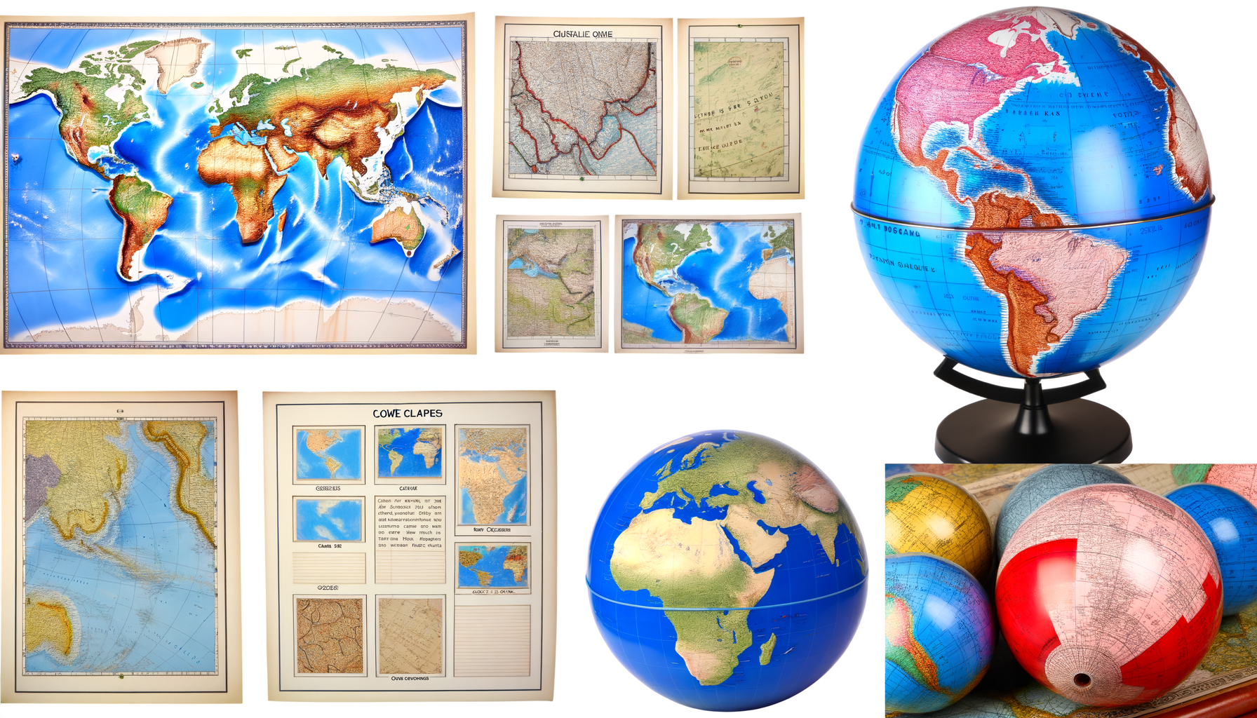
Fact 1: The Mercator Projection's Secret: It Grossly Distorts Size
When you picture a world map, chances are you're seeing a Mercator projection. This is the standard map used in many classrooms, atlases, and online mapping services.
Created in 1569 by Gerardus Mercator, its primary purpose was for nautical navigation.
The brilliant feature of the Mercator projection is that lines of constant bearing (rhumb lines or loxodromes) are straight lines on the map, which was incredibly useful for sailors using a compass.
However, this navigational convenience comes at a significant cost: severe distortion of areas as you move further away from the equator.
Lands near the poles appear vastly larger than they are in reality.
For example, Greenland looks roughly the same size as Africa on a Mercator map, when in reality, Africa is about 14 times larger than Greenland.
Alaska appears larger than Brazil, but Brazil is significantly bigger.
This distortion has often led to a skewed global perspective, subtly influencing how we perceive the relative importance or size of different continents and countries.
While indispensable for sailors for centuries, understanding the Mercator's limitations is key to interpreting world maps accurately and appreciating alternative projections like the Gall-Peters or Winkel Tripel, which aim to represent areas more accurately.
Fact 2: Maps Are Older Than You Think – Much Older
When we think of ancient maps, we might picture classical Greek or Roman cartographers, but the art of mapping predates written history.
Some of the oldest known maps are not on paper or parchment, but carved into stone or clay.
The Babylonian Map of the World, dating back to the 6th century BCE, is one of the earliest known examples of a world map.
Carved on a clay tablet, it shows Babylon at the center, surrounded by land, with outer regions represented as triangles.
Even older examples exist, such as depictions on cave walls or carved stones that seem to represent local landscapes, paths, and resources, dating back potentially tens of thousands of years.
These early attempts at spatial representation weren't just navigational tools; they served spiritual, administrative, or storytelling purposes.
They demonstrate that the human need to map and understand space is a fundamental and enduring part of our cognitive makeup.
From simple scratchings in the dirt to complex digital overlays, the tradition of mapping is one of humanity's oldest intellectual pursuits.
Fact 3: The Largest Globe is as Big as a House (or Bigger!)
While classroom globes are handy desk-sized models, the world's largest rotating and revolving globe is a monumental structure.
Located at the DeLorme mapping company headquarters in Yarmouth, Maine, this colossal globe is named Eartha.
Eartha measures over 41 feet (12.5 meters) in diameter, making it truly massive.
Constructed in 1998, it is built to a scale of 1:1,000,000, meaning one millimeter on its surface represents one kilometer on Earth.
The level of detail on Eartha is extraordinary, featuring intricate topography, bathymetry (ocean depths), and even city lights at night.
Walking around Eartha provides a unique and awe-inspiring perspective of our planet, allowing visitors to appreciate the true scale and interconnectedness of geographical features.
It serves as a powerful reminder that even our largest rooms are dwarfed by the sheer size of the Earth it represents.
This engineering marvel is a testament to both cartographic ambition and the human fascination with visualizing our planet.
Fact 4: Maps Were Tools of Power and Propaganda
Maps are often perceived as objective representations of reality, but throughout history, they have frequently been used to assert power, claim territory, and influence perception.
Colonial powers, for instance, used maps to define and legitimize their claims over newly "discovered" lands, often ignoring or erasing the presence of indigenous populations.
Borders were drawn based on distant political agreements, sometimes arbitrarily splitting ethnic or cultural groups.
During times of conflict, maps could be used to highlight strategic advantages, downplay opponents' territories, or rally patriotic sentiment by emphasizing national borders and symbols.
Even the choice of projection, as seen with the Mercator map's potential to exaggerate the size of Northern Hemisphere countries, can subtly influence global perspectives.
By controlling how the world was mapped, authorities could control narratives about who owned what and who was important.
Therefore, looking at historical maps requires a critical eye, recognizing that they often reflect the political agendas and biases of their creators, not just geographical facts.
Maps are not merely neutral documents but cultural artifacts shaped by history, politics, and power dynamics.
Fact 5: North Isn't Always Up: The Arbitrary Nature of Map Orientation
We are so accustomed to seeing North at the top of a map that it feels like a natural law. However, this orientation is purely a convention, not a geographical necessity.
Many historical maps were oriented differently.
Some medieval Christian maps, for example, were oriented with East at the top, pointing towards the location of the Garden of Eden.
Many Islamic maps were oriented with South at the top, as major cities like Mecca were often located south of the cartographer's position.
Ancient Egyptian maps sometimes oriented towards the source of the Nile.
The convention of North being at the top became prevalent largely due to the widespread adoption of the compass in navigation and the dominance of European cartography during the Age of Exploration.
The magnetic compass needle points roughly north, making a north-up orientation practical for aligning a map with the real world.
While functionally useful for global navigation, remembering that "up" is just a choice reminds us that maps are human constructs, not inherent truths of direction.
You can technically orient a map or globe in any direction you choose and it remains geographically correct, as long as the relative positions are maintained.
Fact 6: The Age of Discovery was Fueled by (and Created) New Maps
The period known as the Age of Discovery (roughly 15th to 18th centuries) saw unprecedented European exploration of lands across the globe. This era was profoundly intertwined with advances in cartography.
As explorers like Columbus, Magellan, and Cook ventured into unknown waters, they relied on the best available maps, however inaccurate they might have been.
Crucially, their voyages also provided vital new information that allowed mapmakers back home to update, correct, and expand the world map.
Ships carried cartographers or navigators who meticulously recorded coastlines, latitudes, and notable landmarks.
This feedback loop – exploration enabled by maps, which in turn produced more accurate maps, enabling further exploration – was a key driver of global understanding and, unfortunately, colonization.
Early maps from this era are fascinating records of rapidly expanding knowledge, often showing tentative coastlines, vast empty spaces labeled "Terra Incognita" (Unknown Land), and speculative features.
The race to create accurate and detailed maps was also a race for economic and political advantage, making cartography a highly valued and often secretive profession during this transformative period.
Fact 7: Mapmakers Used to Draw Sea Monsters and Mythical Lands
Look at maps from the 16th and 17th centuries, particularly those depicting oceans, and you might be surprised to find elaborate illustrations of fantastical creatures.
Sea monsters, mythical beasts, and even strange humanoids often populated the vast, unexplored expanses of the seas on these old charts.
These weren't just artistic flourishes; they served multiple purposes.
They filled in areas where geographical knowledge was sparse or nonexistent, visually representing the dangers and mysteries of the unknown.
Legends of giant squid, sea serpents, and other creatures were widespread among sailors, and these illustrations reflected contemporary beliefs and fears.
Sometimes, they might also have been intended as warnings to sailors, encouraging caution in unfamiliar waters.
Additionally, depictions of exotic or mythical lands, like the fabled kingdom of Prester John or the island of California (often depicted as an island), reflected contemporary myths and limited geographical knowledge.
As exploration progressed and knowledge increased, the monsters and mythical lands gradually disappeared from maps, replaced by more accurate coastlines, soundings, and navigational data.
These fascinating additions are a vivid reminder of the blend of art, science, myth, and fear that characterized early modern cartography.
Fact 8: Not All Globes Show the Earth – Celestial Globes Map the Stars
When we hear the word "globe," we typically envision a sphere depicting the Earth's surface. However, globes have long been used to map the heavens as well.
Celestial globes are models of the celestial sphere, mapping the positions of stars, constellations, and other astronomical objects as seen from Earth.
Instead of continents and oceans, they show constellations like Ursa Major, Orion, and the signs of the zodiac, often depicted with intricate and beautiful illustrations of the mythical figures or animals they represent.
These globes were important tools for astronomers, navigators, and astrologers for centuries.
They allowed observers to visualize the positions of stars and understand celestial movements without needing to crane their necks.
Some celestial globes were paired with terrestrial globes, allowing scholars to study the relationship between the Earth and the night sky.
The history of celestial globes is as long and rich as that of terrestrial globes, demonstrating humanity's equally strong desire to map and understand the cosmos above us.
They serve as beautiful artifacts of scientific and artistic history, illustrating how our ancestors perceived the structure of the universe.
Fact 9: Phantom Islands and Errors: Maps Are Not Immune to Mistakes
Despite the best efforts of mapmakers, historical maps are rife with errors, and sometimes these errors persisted for centuries.
Perhaps one of the most intriguing types of error is the "phantom island" – islands that appeared on maps for decades or even centuries but did not actually exist.
Examples include Sandy Island near Australia, which appeared on maps until 2012 when scientists definitively proved it was not there.
Another famous phantom was the Island of California, often shown as an island separate from the North American mainland on maps from the 16th to 18th centuries.
These errors often arose from misinterpretation of observations, inaccurate longitude calculations in the age before reliable chronometers, or simply the unquestioning copying of features from older, flawed maps.
Once an error entered the cartographic record, it could be frustratingly difficult to remove, as later mapmakers assumed the older maps were accurate.<
br>While modern mapping technology like GPS and satellite imagery has drastically reduced the likelihood of such large-scale errors, the history of cartography reminds us that maps are human creations, susceptible to the limitations of the knowledge and technology of their time.
The slow disappearance of phantom islands from charts is a fascinating chapter in the ongoing process of refining our geographical understanding.
Fact 10: Modern Mapping is Constantly Updating with Satellites and GIS
While paper maps and physical globes still hold value, modern cartography has been revolutionized by technology, particularly satellites and Geographic Information Systems (GIS).
Satellites provide incredibly accurate and up-to-date imagery of the Earth's surface, allowing mapmakers to track changes like deforestation, urban growth, and melting glaciers in near real-time.
GPS (Global Positioning System) technology, relying on a network of satellites, allows for precise location tracking and navigation, fundamentally changing how we travel and interact with maps.
GIS is a powerful framework for gathering, managing, and analyzing spatial data.
It allows mapmakers and researchers to layer different types of information – population density, elevation, land use, infrastructure – onto a map, revealing complex patterns and relationships that would be impossible to see otherwise.
Unlike static paper maps, digital maps powered by GIS and satellite data are dynamic, constantly updated, and interactive.
This technology is used in countless applications beyond navigation, from urban planning and environmental monitoring to disaster response and resource management.
The evolution from hand-drawn charts to dynamic, layered digital maps represents one of the most significant technological shifts in the long history of cartography.
It's a testament to how maps continue to evolve as our understanding of the world and our technological capabilities expand.
More Than Just Lines and Colors: The Living History of Cartography
As we've explored these ten fascinating facts, it becomes clear that maps and globes are far more than just geographical diagrams. They are historical documents, artistic creations, political tools, and technological marvels.
They tell the story of human exploration, scientific progress, cultural beliefs, and the evolving relationship between humanity and the planet.
From ancient clay tablets to sophisticated satellite imagery, the drive to map the world reflects our fundamental need to understand where we are and how we fit into the larger picture.
The distortions of projections, the ghosts of phantom islands, the power dynamics embedded in borders, and the sheer scale of a globe like Eartha all offer unique insights.
They remind us that the maps and globes we use today are the result of thousands of years of observation, calculation, error, and innovation.
So the next time you look at a map or spin a globe, take a moment to appreciate the rich history and surprising complexity contained within.
These fun facts are just a glimpse into the incredible world of cartography, a field that continues to shape our perspective and guide our journey through the world.
May your own explorations, whether in person or on a map, be filled with discovery and wonder.