• Apr 27, 2025
  • 0 comments

Raised Relief Maps for Search and Rescue Operations

```html Raised Relief Maps: Essential Tools for Enhanced Search and Rescue Operations

Raised Relief Maps: Essential Tools for Enhanced Search and Rescue Operations

The call comes in – someone is lost or injured in rugged, remote terrain. For search and rescue (SAR) teams, every second counts, and the environment itself often poses the greatest challenge. Navigating steep slopes, dense forests, treacherous canyons, or unpredictable waterways demands not just skill and courage, but also an unparalleled understanding of the landscape. While modern technology like GPS and digital mapping is invaluable, there is a foundational tool that offers a distinct, tactile, and immediate understanding of terrain that two-dimensional maps cannot fully replicate: the raised relief map.

This post delves into why raised relief maps are far more than just educational tools; they are critical, tactical assets for SAR operations. We will explore the unique challenges faced by rescuers, highlight the limitations of traditional mapping in visualizing complex topography, and demonstrate precisely how raised relief maps provide a tangible advantage in planning, navigation, communication, and overall mission success. For SAR professionals, volunteers, and anyone involved in wilderness safety, understanding the power of these three-dimensional maps offers a clear path to improving operational effectiveness and enhancing the safety of both the rescuers and those they seek.

Ultimately, we will show why incorporating raised relief maps into training and active missions is not merely an option, but a vital enhancement for any SAR team operating in challenging terrain. They offer a level of clarity and shared understanding that can make the difference between a successful rescue and a prolonged, difficult search.

The Unique Demands of Search and Rescue Navigation

Search and rescue operations present a unique set of navigational challenges that differ significantly from recreational hiking or even military maneuvers. Rescuers are often working under immense time pressure, frequently in low-light conditions or poor weather, and always with the primary goal of locating and aiding someone in distress as quickly and safely as possible.

The terrain itself is a major factor. Many rescues occur in wilderness areas characterized by extreme variations in elevation, dense vegetation, water obstacles, and unstable ground. Accurately interpreting the subtle (or not so subtle) nuances of this terrain is paramount to effective movement and search pattern implementation.

Unlike a planned trek along a marked trail, SAR requires navigating off-trail, often across difficult or even dangerous ground. Rescuers must constantly assess not just their location, but the feasibility and safety of the path ahead for themselves and their team members, potentially while carrying heavy gear or even a subject stretcher. This requires an intuitive understanding of how the landscape flows and changes.

Challenges Posed by Rugged Terrain and Environmental Factors

Operating in rugged terrain means dealing with steep ascents and descents that drastically affect travel time and energy expenditure. Deep valleys can channel weather, limit visibility, and complicate communication. Ridges can offer vantage points but may also lead to impassable cliffs or dense, slow-going brush.

Environmental factors like fog, heavy rain, snow, or darkness further reduce visibility and make relying solely on visual cues impossible. Team members may become separated, and the ability to pinpoint locations accurately becomes even more critical. Navigating these conditions requires robust tools and a deep understanding of the underlying geography, independent of transient conditions.

Limitations of Traditional 2D Maps in Visualizing Complex Topography

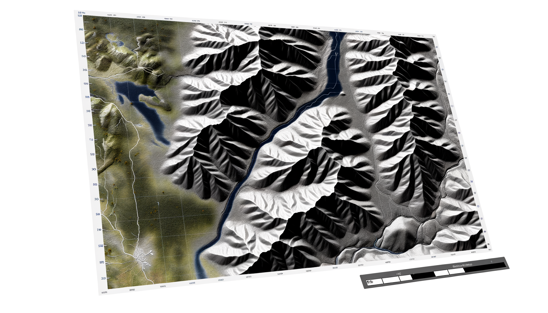
Standard two-dimensional topographic maps are the cornerstone of wilderness navigation, and their importance cannot be overstated. They provide essential information like trails, roads, waterways, boundaries, and, crucially, elevation represented by contour lines. However, interpreting contour lines to build a complete mental picture of complex, three-dimensional terrain requires significant skill and practice.

For someone less experienced, or under stress, visualizing how closely spaced contour lines translate into a sheer cliff face versus a gradual slope can be difficult. Understanding the shape of a complex drainage system or identifying a subtle saddle point between two peaks from flat lines on paper takes time and cognitive effort. This translation from 2D representation to 3D reality is where traditional maps have inherent limitations, particularly in dynamic, high-stakes situations like SAR.

The flat perspective can also be misleading, making features appear closer or less significant than they are in reality. When time is critical, any delay or misinterpretation due to difficulty in visualizing the terrain can have serious consequences for the search effort and the safety of the team. This highlights the need for tools that bridge the gap between abstract representation and tangible reality.

Introducing Raised Relief Maps

Raised relief maps offer a powerful solution to the challenges of visualizing terrain. Unlike flat maps, these maps physically replicate the elevation contours of the land, allowing users to see and touch the hills, valleys, and mountains in miniature form.

They provide an immediate, intuitive understanding of the landscape's shape that is simply not possible with lines on a page. This tactile and visual representation makes complex topography accessible to everyone, regardless of their experience level with map reading.

Seeing the actual physical rise and fall of the land makes it easy to identify prominent features, understand the steepness of slopes, and visualize how different parts of the terrain relate to each other. This fundamental difference makes them uniquely valuable in situations where rapid, accurate terrain assessment is vital.

What They Are: Definition and Core Concept

A raised relief map is a three-dimensional model of a geographic area, where the elevation contours are represented physically. The vertical scale is often exaggerated compared to the horizontal scale to make the elevation changes more apparent, especially in areas with subtle topography.

They are typically made from durable materials like plastic or resin, often with a printed topographic map layer applied to the surface, showing features like trails, roads, water bodies, and boundaries overlaid onto the physical relief. This combination of physical form and overlaid information creates a highly informative and intuitive navigational tool.

The core concept is to take the abstract data of elevation and present it in a concrete, physical form that the human brain is naturally equipped to process and understand spatially. You don't just read the elevation; you *feel* it and *see* it as a physical shape.

How They Are Made: A Brief Overview

The creation of raised relief maps involves translating digital elevation data into a physical form. One common method for mass production is vacuum forming. A flat sheet of plastic is heated and then pulled by vacuum pressure over a mold that has the relief pattern.

Another method, especially for custom or detailed maps, is 3D printing. Digital elevation models (DEMs) are used to create a digital 3D model, which is then printed layer by layer. More traditional methods involve sculpting or casting.

After the physical relief is created, a printed topographic map is often carefully applied to the surface, aligning the geographic features with the underlying physical elevation. This combination of physical form and overlaid geographic detail is what makes the map so effective for visualization and planning.

Key Features and Information Presented

Raised relief maps combine the information found on a standard topographic map with the added dimension of physical height. They typically include:

1. Topographic Contours: Represented by the physical rise and fall of the map surface.

2. Geographic Features: Rivers, lakes, streams, and other water bodies are clearly depicted.

3. Cultural Features: Roads, trails, buildings, boundaries, and place names are printed on the surface.

4. Elevation and Scale Information: Often included in legends, though the vertical exaggeration is usually noted.

The key distinction is that while all this information is present, the physical relief provides an immediate context for the two-dimensional data. You can see how a trail crosses a ridge, how a river flows through a valley, or how steep the approach to a peak truly is, simply by looking at and touching the map.

The Tactical Advantage: Why Raised Relief Maps Excel in SAR

The benefits of using raised relief maps in search and rescue operations are numerous and directly impact the effectiveness and safety of the mission. They move beyond simple navigation to become powerful tools for planning, coordination, and communication.

In the high-stress, dynamic environment of a SAR mission, having a tool that facilitates rapid and accurate terrain assessment provides a significant tactical advantage. They help teams make better decisions faster, allocate resources more effectively, and ensure everyone involved has a clear and shared understanding of the operational area.

Let's delve into the specific ways these three-dimensional maps enhance SAR capabilities, from initial planning stages to field execution and post-mission analysis. Their unique ability to make complex terrain easily comprehensible translates directly into improved operational outcomes.

Enhanced Situational Awareness: Immediate Terrain Understanding

One of the most critical aspects of SAR is achieving high situational awareness – understanding everything happening around you, including the environment. Raised relief maps provide an unparalleled level of environmental situational awareness regarding terrain.

Instead of mentally processing abstract contour lines, team members can see and feel the shape of the land immediately. This allows for rapid identification of key terrain features like prominent ridges that could serve as navigation handrails, deep drainages that might hinder movement, or steep faces that must be avoided.

This instant understanding helps rescuers orient themselves within the landscape and quickly grasp the relative difficulty and characteristics of different areas within the search zone. It's a holistic view that standard maps struggle to convey as effectively or as quickly to a diverse team.

Identifying Key Terrain Features Quickly

With a raised relief map, identifying features like saddles, draws, spurs, and cliff bands becomes intuitive. You can run your hand along a ridge to follow its line or trace the path a stream takes through a valley.

This physical interaction makes the map feel real and helps solidify the mental model of the terrain. Being able to instantly locate these features aids in navigation, position reporting, and understanding the potential flow of water or movement within the area. It makes the abstract concept of terrain tangible.

Visualizing Elevation Changes and Steepness

The most obvious benefit is the ability to directly visualize the steepness of slopes and the magnitude of elevation changes. A glance at the physical map immediately shows which areas are relatively flat, which are moderately sloped, and which are prohibitively steep.

This is far quicker and often more accurate than trying to gauge steepness from the spacing of contour lines, especially for complex or irregular slopes. Understanding steepness is crucial for estimating travel time, assessing physical effort required, and identifying potential hazards like scree fields or areas prone to rockfall.

Improved Navigation and Route Planning

Effective route planning is vital for SAR teams to move efficiently and safely through the search area. Raised relief maps significantly enhance this process by providing a realistic representation of the ground.

Planners can visualize the feasibility of potential routes, identify optimal paths along ridges or through valleys, and anticipate areas where travel will be particularly challenging. This leads to more realistic time estimates and better allocation of resources.

In the field, using the raised relief map alongside a traditional map and GPS helps rescuers confirm their location relative to prominent terrain features and make better on-the-spot navigation decisions. It provides a larger context than a small GPS screen can offer.

Visualizing Ingress and Egress Points

Selecting safe and efficient entry and exit points into a search area is a critical planning step. Raised relief maps make it easier to identify natural access routes like gentle slopes, established trails (if present), or openings in cliff bands.

Conversely, they highlight areas that would be difficult or impossible to traverse, allowing planners to avoid potential bottlenecks or hazards from the outset. This contributes to smoother operations and reduces the risk of teams becoming stuck or encountering unexpected obstacles.

Predicting Difficulty and Avoiding Hazards The physical representation of terrain directly helps in predicting the difficulty of a given route. Extremely steep areas are immediately visible, indicating slow progress and high physical demand.

Raised relief maps can also help identify potential hazards associated with terrain, such as narrow canyons prone to flash floods, the tops of cliffs, or the run-out zones of potential avalanche paths in winter conditions. Seeing the terrain in 3D allows for a more intuitive risk assessment compared to abstract contour lines alone.

Planning Search Patterns Based on Terrain

Effective search patterns are often designed to follow or cross specific terrain features. For example, a search might follow a drainage downhill, sweep across a series of ridgelines, or focus on likely areas like the bottoms of cliffs or dense brush in sheltered valleys.

With a raised relief map, planners can visually lay out search sectors and patterns directly on the terrain, ensuring they align logically with the geography. This helps optimize coverage and ensures teams are searching the most probable areas effectively, taking advantage of or mitigating the challenges posed by the land.

Effective Briefings and Team Coordination

Clear communication is essential for successful SAR missions, especially when multiple teams are involved. Raised relief maps are invaluable tools for pre-mission briefings and ongoing coordination.

Presenting the operational area on a physical, three-dimensional map allows everyone, regardless of their map-reading expertise, to quickly grasp the layout of the land. Planners can point directly to areas, routes, and features, ensuring all team members have a shared mental model of the environment they will be operating in.

This shared understanding minimizes confusion, improves coordination between ground teams and command, and ensures everyone is literally on the same page regarding the mission plan and the geography of the search area.

Clear Visual Aid for Communicating Plans

During a briefing, pointing to a location on a flat map and describing it using coordinates or contour features can still leave some ambiguity. Pointing to the actual miniature mountain or valley on a raised relief map is unambiguous.

This concrete visual aid helps team members quickly identify their assigned search sectors, understand their relationship to adjacent teams, and visualize their planned routes. It fosters a sense of confidence and clarity before heading into the field.

Ensuring All Team Members Understand the Terrain

SAR teams often consist of individuals with varying levels of navigation and map-reading experience. Raised relief maps level the playing field by making complex terrain understandable to everyone.

Even someone new to wilderness navigation can look at a raised relief map and immediately see "oh, that's a steep hill" or "that river runs through that deep cut." This broadens accessibility to crucial terrain information and ensures that even less experienced members can contribute effectively and safely within their assigned areas.

Training and Simulation

Raised relief maps are exceptionally useful tools for training SAR personnel. They provide a realistic and tangible environment for practicing navigation skills, route planning scenarios, and terrain interpretation.

Simulating missions using a raised relief map allows trainees to work through challenges in a safe environment, making mistakes on the tabletop rather than in the field. This hands-on learning approach reinforces theoretical knowledge and builds practical skills.

Trainers can use the maps to demonstrate concepts like line of sight, understanding watersheds, or planning strategies for searching specific types of terrain. The physical nature of the map makes these abstract concepts much easier to grasp and apply.

Integration with Other Tools

While powerful on their own, raised relief maps are even more effective when integrated with other modern navigation tools. They complement, rather than replace, GPS devices, digital mapping applications, and aerial imagery.

For example, a team might use GPS to pinpoint their exact location and then find that location on the raised relief map to understand their immediate surroundings and the terrain ahead in a broader context. Digital maps on tablets can display real-time position and data, while the raised relief map provides the essential understanding of the physical landscape underneath.

Aerial imagery can show vegetation and ground cover, but the raised relief map shows the underlying shape of the land that dictates movement and visibility. Used together, these tools provide a comprehensive picture for navigators and planners.

Use in Incident Command

At the Incident Command Post (ICP), where the overall search strategy is developed and managed, a large raised relief map of the search area can be an indispensable planning and briefing tool.

Command staff can use the map to visualize the entire operational area, allocate resources to different sectors based on terrain difficulty, and track the progress of multiple teams. Briefings for incoming teams or cooperating agencies are made clearer and more effective with the physical terrain model.

The map serves as a central visual reference point for all planning discussions, ensuring everyone involved in the command structure has a consistent and accurate understanding of the geographic challenges and opportunities within the search zone. It facilitates better decision-making at the strategic level.

Practical Considerations for SAR Teams

While the benefits are clear, adopting raised relief maps requires SAR teams to consider practical aspects related to their use and management. These considerations include durability, coverage, cost, and the necessary training to maximize their effectiveness.

Choosing the right maps and integrating them seamlessly into existing operational protocols is key. It is not just about acquiring the maps, but about making them a functional part of the team's toolkit and workflow.

Addressing these practical points ensures that the investment in raised relief maps translates into tangible improvements in SAR capabilities. Teams must plan for their acquisition, storage, maintenance, and the training required for their optimal use in the field and at the command post.

Durability and Portability

SAR environments are often harsh, involving exposure to weather, rough handling, and difficult travel. Raised relief maps used in the field must be durable enough to withstand these conditions.

Most modern raised relief maps are made from robust plastics that are resistant to tearing and moisture. However, care must still be taken to protect them from excessive bending or crushing, which could damage the relief.

Portability is also a factor. Large, detailed maps are excellent for command posts but less practical for carrying in a field pack. Teams may need different scales or sectioned maps for field use versus planning use, balancing detail with manageable size and weight.

Coverage Areas and Availability

Raised relief maps are not available for every location. Their production requires detailed elevation data and specialized manufacturing processes. Teams need to identify reputable sources and check for coverage of their typical operational areas.

Some manufacturers offer custom mapping services, but these can be expensive. Teams should prioritize maps for their most frequently searched or most challenging local areas first. Availability can sometimes be limited to specific national parks, popular recreational areas, or regions where there is high demand.

Researching available coverage and potentially collaborating with neighboring SAR teams or land management agencies to procure maps for shared operational zones can be beneficial. Planning ahead for map acquisition is important.

Cost and Acquisition

Raised relief maps are generally more expensive than standard paper or even laminated two-dimensional maps due to the specialized production process. The cost can vary significantly based on size, detail, and manufacturer.

SAR teams, often relying on grants, donations, or limited budgets, need to factor the cost of these maps into their planning. While an initial investment may be required, the long-term benefits in terms of improved planning, safety, and mission effectiveness can easily justify the expense.

Exploring options for funding, seeking donations specifically for mapping tools, or phasing in the acquisition of maps for different areas over time are strategies teams can employ to build their inventory of these valuable resources.

Maintenance and Care

Like any piece of equipment, raised relief maps require proper care to maintain their condition and usability. They should be stored flat or rolled carefully to prevent damage to the raised surfaces.

Cleaning instructions should be followed, especially if they become dirty during field use. Protecting them from extreme heat or direct sunlight during storage can also help preserve the plastic material.

Regular inspection for damage ensures that the map remains accurate and reliable when needed. Proper maintenance extends the life of the map and protects the investment made in acquiring it.

Training Requirements for Use

While raised relief maps are intuitively easier to understand than contour lines alone, effective integration into SAR operations still requires training. Team members need to be trained on how to use the maps in conjunction with other navigation tools, how to reference locations, and how to use them effectively during briefings.

Training scenarios can incorporate the use of raised relief maps to simulate mission planning and execution. Practicing pointing out features, describing routes, and coordinating movements using the 3D model enhances teamwork and proficiency.

Ensuring that key personnel, especially navigators, team leaders, and command staff, are fully comfortable and skilled in utilizing raised relief maps maximizes their impact on operational success. Training reinforces the value of this unique mapping tool.

Integrating Raised Relief Maps into SAR Operations

The true value of raised relief maps is realized when they are fully integrated into the standard operating procedures of a SAR team. They should be used throughout the lifecycle of a mission, from the initial planning phase through field operations and even into post-mission analysis.

This integration ensures that the benefits of enhanced terrain understanding are leveraged at every step, leading to more informed decisions, better coordinated efforts, and ultimately, a higher probability of success in locating and assisting the subject.

Making raised relief maps a standard part of the SAR toolkit requires commitment from leadership, provision of adequate training, and ensuring the maps are readily available when needed for planning sessions and deployed with field teams as appropriate for the mission's complexity and terrain.

Pre-mission Planning and Analysis

The planning phase is arguably where raised relief maps offer the most significant up-front advantage. Before any team is deployed, planners analyze the search area to develop strategies, define search sectors, and anticipate challenges.

Using a raised relief map during this phase allows planners to gain a rapid and detailed understanding of the terrain. They can visualize the flow of drainages, identify potential travel corridors, assess the difficulty of different areas, and make informed decisions about resource allocation.

The map facilitates discussions among the planning team, making it easier to agree on strategies and communicate the rationale behind the search plan. It helps answer critical questions like "Where is the subject most likely to be given the terrain?" and "What are the safest and most efficient ways for teams to access those areas?"

Field Use: Navigation, Confirmation, and Adjustment

While large raised relief maps are best suited for the command post, smaller, sectioned, or folded versions can be carried into the field by navigators or team leaders. These provide a tangible reference point that complements digital tools.

In the field, the raised relief map helps rescuers confirm their location relative to prominent terrain features, especially when visibility is poor or electronic navigation is unreliable. It aids in staying oriented and understanding the immediate surroundings.

If the mission plan needs to be adjusted due to unexpected terrain or new information, the raised relief map allows the team leader to quickly visualize alternative routes or search strategies based on the actual physical landscape, facilitating informed decisions on the ground.

Post-mission Analysis and Training Review

After a mission concludes, raised relief maps can be used in debriefings and analysis sessions. Reviewing the search area and the paths taken by teams on the 3D map provides valuable insights.

Teams can visualize where they searched in relation to the terrain, identify areas that were particularly difficult or slow-going due to topography, and understand why certain routes were successful or challenging. This analysis helps refine future planning and improve training.

Using the map during training review sessions helps reinforce lessons learned about navigating specific types of terrain or implementing search patterns effectively within a given landscape. It provides a concrete reference for discussing performance and identifying areas for improvement.

Real-World Impact and Case Considerations

While specific, publicly detailed case studies highlighting *only* the use of a raised relief map can be hard to isolate from the overall mission success factors, the underlying principle is universally recognized in challenging environments. Any SAR operation in mountainous, hilly, or deeply incised terrain benefits exponentially from a clear understanding of the three-dimensional landscape.

Consider a scenario where a subject is lost in a vast, forested mountain range. Traditional maps show contour lines, but a raised relief map immediately shows the network of deep, steep drainages and the long, winding ridgelines that define the area. Planners using the relief map can immediately see that searching the valley bottoms will be slow and difficult due to dense brush and stream crossings, while searching along the ridge tops might offer better visibility and travel, but requires significant ascent.

This visualization allows command to make informed decisions: prioritize searching along specific, accessible drainages first, assign teams with specific skills (e.g., technical rope rescue) to investigate areas with steep cliffs, or allocate more time and resources to areas with particularly difficult terrain. A briefing using the raised relief map ensures that ground teams understand *why* they are being sent to a particular area and what the terrain challenges there will be.

While technology like drones can provide aerial views, and GPS gives precise points, the raised relief map ties it all together with the fundamental reality of the land's shape. It is this foundational geographic understanding, made intuitive by the 3D form, that enhances every other aspect of the search and increases the probability of a positive outcome. The impact is not in replacing technology, but in making its application more informed and effective by providing the essential geographic context.

Conclusion: Elevated Understanding for Critical Missions

Search and rescue operations demand the highest levels of skill, preparation, and environmental understanding. While technological advancements continue to provide valuable tools, the foundational ability to visualize and comprehend the physical terrain remains paramount. Raised relief maps offer a unique, tangible solution to the inherent difficulty of interpreting complex topography from two-dimensional representations.

These maps provide SAR teams with enhanced situational awareness, dramatically improve the accuracy and efficiency of navigation and route planning, and serve as indispensable tools for clear communication and team coordination during critical briefings. Their value extends from strategic planning at the incident command post to tactical decision-making in the field, and even into post-mission analysis and essential training exercises.

Integrating raised relief maps into standard SAR protocols provides a significant tactical advantage, helping teams to operate more safely and effectively in challenging environments. While practical considerations like durability, coverage, and cost must be addressed, the benefits they offer in terms of improved understanding, better planning, and enhanced safety make them a worthy investment for any team serious about optimizing their wilderness search and rescue capabilities.

For SAR professionals and volunteers dedicated to saving lives in the wilderness, incorporating raised relief maps is a proactive step towards elevated performance and greater mission success. They are not just maps; they are powerful tools for seeing the world the way the search subject experiences it – in three dimensions – enabling rescuers to navigate, plan, and communicate with unparalleled clarity.
```