


Globes have long served as indispensable tools for understanding our planet, offering a tactile and intuitive representation of Earth's spherical form. From the earliest models to the detailed political and physical globes of the past century, they have shaped our geographic understanding.
However, creating a truly accurate physical model of a dynamic, complex world is an immense technical challenge. Representing the intricate details of topography, coastlines, and political boundaries on a sphere requires overcoming significant hurdles in data acquisition, processing, and physical production.
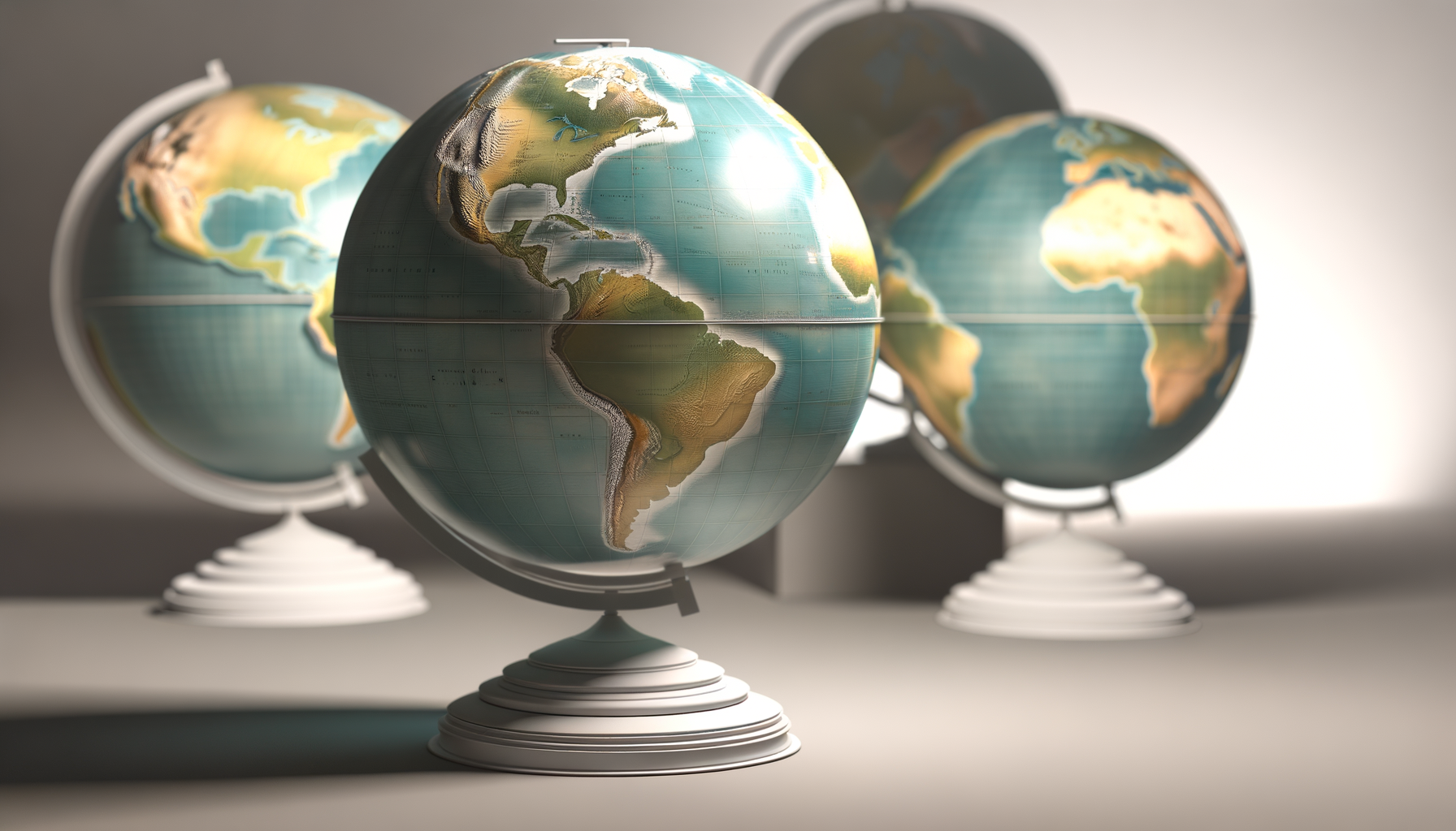
This post delves into the fascinating world of modern globe-making, specifically focusing on the revolutionary technical advancements and sophisticated data sources that distinguish the most accurate globes available today. We will explore the journey from raw satellite data and ground surveys to the final, breathtakingly detailed physical sphere, revealing how cutting-edge technology provides an unparalleled view of our planet.
The Quest for Unprecedented Accuracy
For centuries, globe makers relied on relatively crude surveying methods and astronomical observations to plot features onto a sphere. While these early globes were remarkable achievements for their time, they were inherently limited by the technology available and the partial understanding of global geography.
The advent of aerial photography and later satellite imaging vastly improved the data available for mapping, but transferring this flat, often distorted information accurately onto a spherical surface remained complex. Traditional manufacturing processes, often involving printing flat gore sections and manually applying them, introduced inaccuracies and limited the level of detail achievable, especially concerning subtle topographic variations.
The modern quest for the "most accurate globe" represents a paradigm shift. It moves beyond simple visual representation to a scientific endeavor focused on data fidelity, geometric precision, and the seamless integration of diverse information types. This requires embracing the digital revolution at every stage, from data collection in space to the final touches in manufacturing.
Foundation of Precision: Data Acquisition
The accuracy of any map or globe is fundamentally limited by the quality and resolution of the data used to create it. The most accurate modern globes are built upon a foundation of incredibly rich, multi-sourced geographic data, collected using the most advanced remote sensing and surveying technologies available.
Satellite Imagery and Remote Sensing
Satellites orbiting Earth are the eyes in the sky that provide the vast majority of the raw data for modern global mapping. High-resolution optical imagery captures detailed visual information about the land surface, including vegetation, urban areas, rivers, and coastlines, with resolutions down to mere centimeters per pixel in some cases.
Beyond visual light, radar and lidar (Light Detection and Ranging) satellites provide data crucial for understanding topography and surface structure. Radar can penetrate clouds and work day or night, providing consistent data for elevation models and surface features, while lidar uses laser pulses to create highly precise 3D point clouds, offering unparalleled accuracy for elevation and canopy structure.
Multiple satellite missions, operated by national space agencies and commercial companies, contribute to this massive global dataset. Combining data from different sensors and different acquisition times allows for a more comprehensive and up-to-date picture of the Earth's surface than ever before possible, forming the cornerstone of accurate physical representation.
Terrestrial Surveys and Ground Truth Data
While satellites provide a global overview, ground-based surveys offer critical detail and validation. GPS (Global Positioning System) data and traditional surveying techniques are used to establish precise control points on the ground, which are essential for accurately georeferencing and correcting satellite data.
Field data collection, involving direct observation and measurement, provides "ground truth" that verifies the information captured by remote sensors. This is particularly important for mapping features like political boundaries, specific infrastructure, or areas with complex terrain that might be ambiguous in satellite imagery alone, ensuring the globe represents verified reality.
The integration of space-based and ground-based data creates a powerful synergy. Satellite data provides broad coverage and context, while terrestrial surveys add fine detail and ensure the absolute positional accuracy required for a truly precise globe, marrying the global perspective with local reality.
Bathymetry Data
A significant portion of Earth's surface is covered by water, and accurately representing the ocean floor is crucial for a complete physical globe. Bathymetry data, collected using sonar and other hydrographic surveying techniques, maps the depths and topography of oceans, seas, and lakes.
While obtaining high-resolution bathymetry for the entire ocean floor is an ongoing challenge, sophisticated algorithms and datasets like GEBCO (General Bathymetric Chart of the Oceans) provide increasingly detailed models of undersea terrain. Incorporating this data allows the most accurate globes to depict not just the landmasses but also the hidden landscapes beneath the waves.
Elevation Models
Perhaps the most defining feature of a physically accurate globe is its representation of topography – the hills, mountains, valleys, and plains that shape the land. Digital Elevation Models (DEMs) are fundamental datasets for achieving this, providing elevation values for every point on the Earth's surface.
DEMs are derived from various sources, including radar interferometry (like the SRTM mission), lidar data, and photogrammetry from satellite or aerial imagery. These models capture the subtle undulations and dramatic variations in terrain with remarkable precision, moving beyond stylized representations to physically accurate relief.
Sophisticated globes utilize high-resolution DEMs, sometimes enhanced with Digital Surface Models (DSMs) that include the height of buildings and vegetation, to create a textured surface that reflects the true form of the Earth. This data is not just used for visual mapping but is often physically incorporated into the globe's structure.
Processing the Deluge: From Raw Data to Refined Surface
Acquiring vast amounts of diverse geographic data is only the first step. This raw data is often noisy, inconsistent, and comes in different formats and projections. Transforming this complex data into a coherent, accurate model ready for physical production requires sophisticated processing techniques and powerful software.
Data Integration and Fusion Techniques
Creating a seamless global dataset from sources with varying resolutions, projections, and accuracy levels is a significant technical challenge. Data integration involves bringing these disparate datasets together, ensuring they align correctly both spatially and thematically.
Data fusion goes further, combining the information from different sources to create a richer, more informative dataset. For instance, combining high-resolution optical imagery with precise lidar elevation data allows for the creation of detailed, textured 3D models of the Earth's surface that capture both visual appearance and physical form.
Advanced algorithms are used to weight data sources based on their known accuracy, resolve discrepancies, and fill in gaps where data is missing. This meticulous process ensures the final dataset used for the globe is internally consistent and reflects the best available information from all sources.
Advanced Mapping Software and GIS
Geographic Information Systems (GIS) are the backbone of modern mapping and are indispensable for processing the data used in high-accuracy globes. GIS software allows for the storage, management, analysis, and visualization of geographic data, providing the tools needed to manipulate and prepare the complex datasets.
Highly specialized mapping software is used to process satellite imagery, DEMs, and other spatial data, performing operations like mosaicking multiple images, reprojecting data to a common coordinate system suitable for a sphere, and generating derivative products like slope or aspect maps that can inform the globe's texture and coloring.
These software packages handle enormous datasets, often terabytes in size, requiring significant computing power. The expertise of GIS professionals is crucial in navigating the complexities of the data and applying the correct processing steps to maintain accuracy throughout the workflow.
Orthorectification and Georeferencing
Raw satellite and aerial images contain geometric distortions caused by the sensor's perspective, terrain relief, and the Earth's curvature. Orthorectification is a process that removes these distortions, creating an image that is geographically accurate and can be used as a true map.
This process requires a precise DEM and the sensor's orbital or flight path information. Georeferencing involves tying the imagery and other spatial data to known ground control points (often from GPS or surveys) to ensure it is accurately positioned on the Earth's surface, correcting for any shifts or rotations.
For globe production, the processed data must also be transformed from a flat map projection (like Mercator or UTM) into a spherical coordinate system suitable for wrapping onto a sphere. This involves complex mathematical transformations that preserve spatial relationships as accurately as possible on the spherical surface, minimizing distortions inherent in any flat-to-sphere mapping.
Filtering and Smoothing
Even high-quality datasets can contain noise, anomalies, or small errors. Filtering and smoothing techniques are applied during processing to remove these inconsistencies and create a cleaner, more visually appealing dataset for the globe.
For elevation data, smoothing might be used to reduce minor sensor noise while carefully preserving significant topographic features like mountain peaks or valley depths. For imagery, filtering can enhance details or remove unwanted artifacts while maintaining the overall clarity and accuracy of the scene.
This step requires a careful balance – too much smoothing can erase fine details, while too little leaves the data looking messy or unnatural. The goal is to produce a refined dataset that is both accurate to the source information and optimally prepared for physical representation on a globe.
Visualizing the Unseen: Technical Advancements in Production
Translating the processed digital data into a high-fidelity physical globe requires equally sophisticated manufacturing techniques. The days of simply printing flat maps and pasting them onto a sphere have been surpassed by processes that allow for direct representation of data, including topography.
High-Resolution Printing Technology
Modern globe production utilizes ultra-high-resolution printing technology capable of reproducing incredibly fine detail. Large-format printers can output the global map surface with astonishing clarity and color accuracy, ensuring that features visible in the source satellite imagery or mapping data are faithfully rendered on the globe's surface.
These printers often use multiple ink colors, including specialized varnishes, to achieve rich textures and vibrant, accurate color palettes that reflect the natural appearance of different regions on Earth. The precision of the print head movement and ink placement is critical for aligning the map data perfectly across the globe's complex curvature.
Some techniques involve printing directly onto the sphere or printing onto materials that are then precisely applied. The ability to print at extremely high DPI (dots per inch) ensures that even small features like individual buildings in cities or narrow river channels are discernible, bringing the map to life with photorealistic detail.
Advanced Material Science
The physical materials used for the globe sphere and its surface layer play a crucial role in its accuracy, durability, and aesthetic appeal. Modern globes often use high-quality plastics, composites, or metals for the sphere itself, chosen for their dimensional stability under varying temperature and humidity conditions.
The surface material onto which the map is printed or molded must be receptive to high-resolution inks, durable enough to withstand handling, and capable of accurately rendering textures. Specialized coatings and laminates are often applied to protect the printed surface from UV light, scratches, and moisture, ensuring the globe remains accurate and beautiful over time.
In globes with physical relief, the material must also hold its shape precisely according to the elevation data. Techniques might involve casting, molding, or even 3D printing the spherical form, using materials that can capture the subtle variations in height dictated by the DEM data with minimal distortion.
Precision Manufacturing Processes
Translating the digital elevation data into a physical, textured surface is a complex manufacturing feat. Techniques often involve computer numerical control (CNC) milling to create highly precise molds or tools based directly on the DEM.
These molds are then used to form the globe sphere or its surface layer, ensuring that the physical relief perfectly corresponds to the digital elevation data. This differs significantly from older methods that used generalized or exaggerated relief; modern processes aim for a scale model of the actual terrain.
Assembly of the globe, including mounting the sphere, adding bases and stands, and integrating any internal lighting or mechanical components, also requires precision engineering. Each component must be carefully aligned to ensure the globe is balanced, rotates smoothly, and the map projection remains accurate when viewed from any angle.
Calibration and Quality Control
Throughout the production process, rigorous calibration and quality control are essential to ensure the final globe faithfully represents the source data. This involves checking the geometric accuracy of the printed map against the digital file, verifying the physical relief against the DEM, and inspecting the overall quality of the materials and assembly.
Sophisticated measurement tools and visual inspections are used at various stages. For high-end globes, each unit might undergo individual checks to confirm its adherence to strict tolerance levels, ensuring that the final product is not just visually appealing but also a metrologically sound representation of the Earth.
This commitment to quality control throughout the technical workflow guarantees that the information gathered from satellites and surveys is accurately transferred through processing and manufacturing onto the final spherical product, resulting in unparalleled fidelity.
Beyond the Surface: Incorporating Dynamic Data
While primarily focused on the static physical representation of Earth's surface, the underlying data and technology used for accurate globes open possibilities for incorporating dynamic information.
Representing Topography with Fidelity
A key technical achievement is representing true-scale topography or accurately scaled relief. Older globes often exaggerated vertical elevation dramatically to make mountains visible.
Using high-resolution DEMs and precision manufacturing, modern accurate globes can depict relief with a much higher degree of fidelity to the actual scale, or with a consistent, minimal exaggeration factor that is clearly stated. This provides a more realistic understanding of the Earth's physical geography and the relative heights of features.
Mapping Features with Geometric Accuracy
Beyond topography, accurate globes ensure that other geographic features – coastlines, rivers, lakes, cities, and political boundaries – are positioned with high geometric accuracy relative to each other and the underlying terrain. This is achieved through the precise georeferencing and processing of the source data.
Every point on the globe's surface corresponds accurately to its real-world latitude and longitude, given the globe's scale. This allows the globe to be used not just for visualization but also for taking meaningful measurements of distance and direction, mirroring the capabilities of advanced digital maps.
The technical precision ensures that the relationship between different geographic elements is maintained across the spherical surface, providing a reliable and accurate spatial context for understanding global geography.
Why Does This Level of Accuracy Matter?
Given the complexity and cost involved in producing these technically advanced globes, one might ask why such a high level of accuracy is important. The answer lies in the enhanced understanding and functionality that precision enables across various applications.
Educational Value
For education, an accurate globe is an invaluable tool. It provides students with a tangible, correctly proportioned model of the Earth that helps them grasp concepts like latitude, longitude, distances, relative sizes of continents, and the relationship between physical features and political boundaries far better than flat maps.
Seeing true-scale or accurately scaled relief helps students understand the impact of mountain ranges, river systems, and coastlines on human activity and natural processes. The fidelity to real-world data makes the globe a more reliable and engaging learning resource, fostering a deeper appreciation for geography.
Professional Applications
In professional settings, accurate globes can serve as powerful visualization tools. Urban planners, geologists, environmental scientists, and military strategists can use these globes to analyze spatial relationships, visualize data layers (if interactive), and communicate complex geographic information in an intuitive, three-dimensional format.
While digital tools like Google Earth and GIS provide immense analytical power, a physical globe offers a unique, shareable perspective that can facilitate discussion and understanding among teams. The accuracy ensures that insights gained from the globe are based on reliable geographic data.
Aesthetic and Artistic Value
Beyond practical utility, highly accurate globes are also objects of incredible beauty and artistry. They are sophisticated pieces of engineering that combine scientific precision with exquisite craftsmanship.
The ability to faithfully reproduce the Earth's details, from the texture of its mountains to the subtle blues of its oceans, results in a stunning representation of our planet. As decorative items or centerpieces, they inspire wonder and serve as a constant reminder of the beauty and complexity of the world we inhabit, grounded in factual accuracy.
Conclusion
The most accurate globes ever made are not merely decorative items or simple educational aids; they are sophisticated products of modern technology and meticulous data science. Their creation relies on a complex interplay of cutting-edge satellite remote sensing, rigorous ground surveying, advanced GIS data processing, and precision manufacturing techniques.
From the initial acquisition of terabytes of raw data from space and land, through the intricate processes of integration, georeferencing, and refinement, to the final steps of high-resolution printing and physical molding, every stage is governed by the pursuit of unparalleled accuracy.
These technical advancements culminate in a physical representation of Earth that is more detailed, more geometrically precise, and more faithful to the true form of our planet than anything previously possible. They offer a profound connection to global geography, serving as invaluable tools for education, professional insight, and simply appreciating the stunning reality of Earth.
The journey from raw data to a perfectly formed sphere is a testament to human ingenuity and our enduring desire to understand the world around us with ever-increasing clarity. The result is a globe that is not just a model, but a scientifically accurate snapshot of Earth's intricate surface, a true masterpiece of geographic representation powered by technology.