


Raised Relief Maps in Art: Unlocking Creative Uses and Techniques
Maps have long served as essential tools for navigation, exploration, and understanding our world. They provide a visual representation of complex geographical data, transforming vast landscapes into comprehensible forms.
But beyond their functional purpose, maps possess an inherent aesthetic quality, featuring intricate lines, captivating color palettes, and often, beautiful typography.
Raised relief maps elevate this aesthetic appeal by adding a crucial third dimension, offering a tactile and visually compelling representation of elevation and terrain that flat maps simply cannot replicate.
For artists, designers, educators, and anyone with a passion for both geography and creativity, these dimensional maps present a unique and exciting canvas.
This post delves into the fascinating world of using raised relief maps creatively in art, exploring various applications, essential techniques, and the profound potential they hold for artistic expression.
Whether you are an experienced artist seeking new materials or a newcomer curious about integrating geography into your creative projects, you will find inspiration and practical guidance here to unlock the artistic possibilities of raised relief maps.
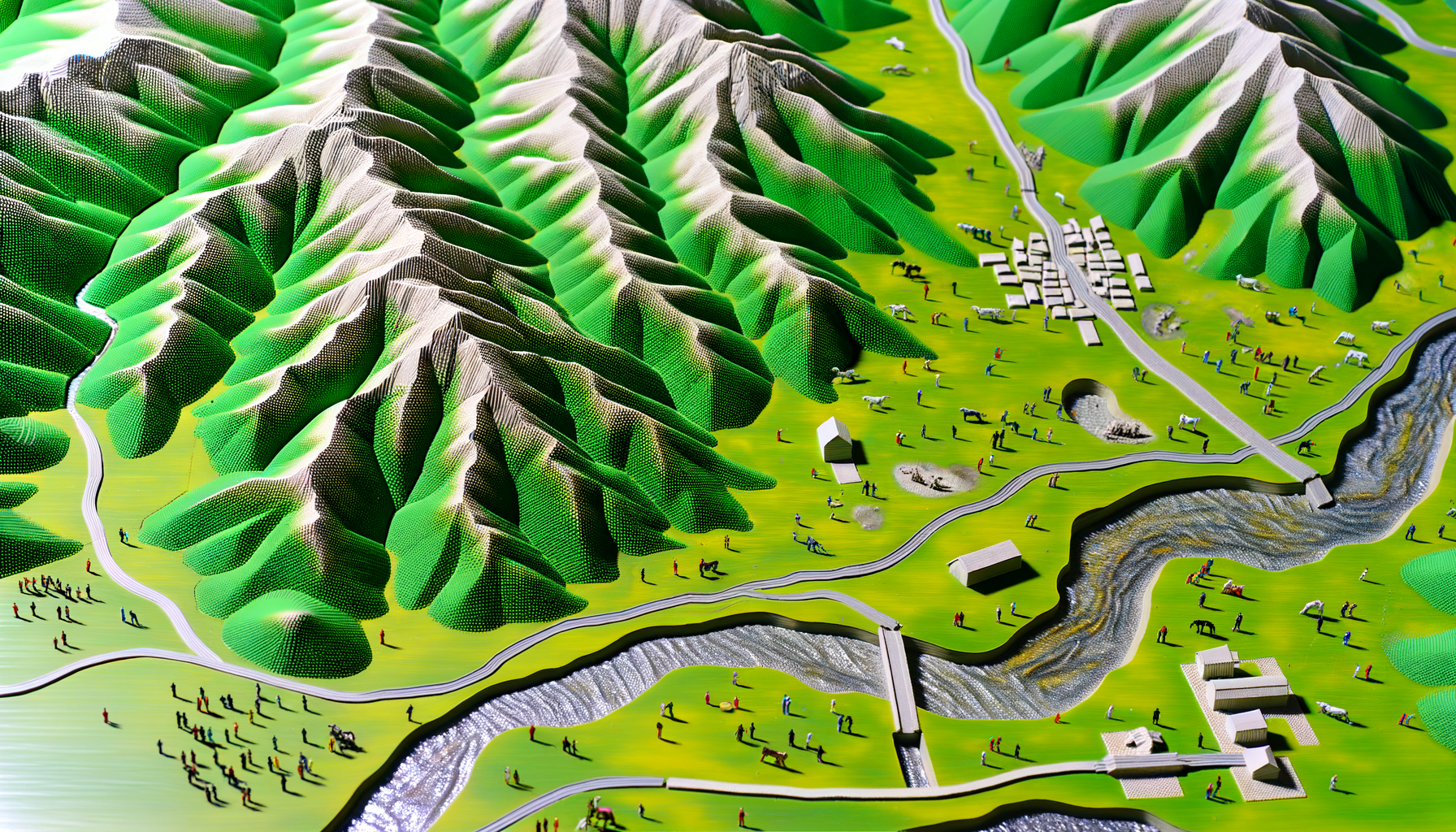
Understanding the Canvas: What Are Raised Relief Maps?
Before diving into creative applications, it is helpful to understand what makes raised relief maps distinct. These maps are typically created through a process called vacuum forming or thermoforming.
A flat sheet of plastic is printed with geographical data, then heated and molded over a master form that replicates the topography of the area being mapped.
The result is a durable, lightweight map with tangible hills, valleys, and mountains that you can see and feel.
Unlike digital elevation models or shaded relief on flat maps, the dimensionality is physical, allowing light and shadow to play across the surface in a way that highlights contours naturally.
Some older or specialty raised relief maps might be made from molded plaster or other materials, adding variations in weight and texture.
This physical relief is their defining characteristic and the source of much of their artistic appeal and potential.
Beyond Geography: The Artistic Potential of Raised Relief Maps
While their primary function is to display geographical information accurately, raised relief maps inherently possess artistic qualities that make them compelling as a medium. Their complex surfaces offer a ready-made texture and form that artists can leverage.
The lines representing political boundaries, rivers, and roads intersect with the natural contours of the land, creating visually interesting patterns.
Furthermore, maps carry significant conceptual weight.
They connect us to place, memory, travel, and identity, making them powerful symbols that can add layers of meaning to artwork.
Using a raised relief map of a specific region can evoke personal connections to that place or explore themes of home, migration, exploration, or environmental change.
The interplay of printed detail and physical form also invites exploration of perspective and the representation of reality, blending scientific data with artistic interpretation.
This unique combination of inherent form, texture, visual detail, and symbolic depth positions raised relief maps as a remarkably versatile and inspiring medium for creative expression.
Creative Applications: Transforming Maps into Art
The possibilities for using raised relief maps in art are as vast and varied as the landscapes they depict. Artists can employ them as the primary material, integrate them into mixed-media pieces, or even use their forms as inspiration for abstract works.
Here, we explore some of the most exciting avenues for creative application, demonstrating how these dimensional maps can be transformed from informative tools into captivating works of art.
Each approach offers unique challenges and opportunities, inviting artists to experiment and push the boundaries of traditional art forms.
Mixed Media Masterpieces
One of the most common and effective ways to use raised relief maps is within mixed-media artworks. The map serves as a textured base or a distinct element integrated alongside paint, collage, textiles, or found objects.
An artist might paint directly onto the map's surface, using the contours to guide brushstrokes or enhance the depiction of water and land.
Collage elements can be applied to specific regions, perhaps adding historical images to cities or botanical illustrations to natural areas.
Fabrics, fibers, or even natural materials like sand or small stones can be adhered to the surface to further emphasize texture or represent specific geological features.
Using resin can create simulated bodies of water or highlight particular areas with a glossy, protective layer.
The key here is the interaction between the map's pre-existing form and texture and the added materials, creating a rich, multi-layered piece that engages both visually and tactilely.
Experimenting with different adhesives and surface preparation techniques is crucial when combining various materials with the map's plastic surface.
Sculptural Integration and Transformation
Raised relief maps possess an inherent sculptural quality due to their three-dimensionality, making them ideal for integration into or transformation into sculptures. A map section can serve as the base for a sculpture, with figures or objects emerging from or interacting with the terrain.
Alternatively, pieces of maps can be cut, shaped, and joined together to create entirely new sculptural forms that reference landscapes without necessarily depicting specific geographical locations.
Heating certain types of map plastics carefully can allow for reshaping and bending, opening up possibilities for more fluid or abstract sculptural forms.
Combining map pieces with other sculptural materials like wood, metal, or clay can lead to fascinating contrasts in texture and form.
Consider using sections of maps to build up layers, creating exaggerated or fictional topographies, or incorporating them into assemblage pieces that comment on environmental issues or the relationship between humans and the land.
Structural integrity and the bonding of different materials are key technical considerations in this application.
Large-Scale Installations
For artists working on a larger scale, raised relief maps can become components of immersive installations. Entire walls can be covered with interconnected map sections, creating vast, continuous landscapes that visitors can walk alongside.
Maps can wrap around corners, extend onto the floor, or be suspended from the ceiling, transforming the exhibition space into a geographical environment.
Lighting plays a critical role in map installations, as carefully directed light can dramatically enhance the shadows and highlights of the relief, making the topography appear more dynamic and alive.
Adding sound elements, projections onto the map surface, or interactive components can further engage the audience and deepen the conceptual impact of the piece.
Installations allow artists to explore themes of scale, perspective, human impact on the environment, or the interconnectedness of global landscapes in a truly enveloping way.
Abstract Explorations of Form and Texture
Not all art using raised relief maps needs to be overtly geographical. Artists can abstract the material, focusing solely on the textures, forms, and colors inherent in the maps to create non-representational works.
Sections of maps can be cut into abstract shapes and arranged in dynamic compositions, emphasizing line and form over location.
The raised surface itself can be treated purely as a textured canvas, applying paint or other media to create patterns and effects that utilize the relief without acknowledging the underlying geography.<
Focusing on close-ups of specific topographical features, like a mountain range or a river delta, can reveal intricate patterns and textures that lend themselves to abstract interpretation.
Color palettes derived from map legends can be used in new, abstract ways, or entirely new color schemes can be applied to transform the map's visual identity.
This approach liberates the map from its informational purpose, allowing artists to explore its material qualities purely for their aesthetic and formal potential.
Functional Art and Design
Raised relief maps can also be incorporated into functional art pieces and design objects, blending utility with geographical beauty. Imagine a coffee table with a raised relief map of a significant region embedded in its surface, protected by glass or resin.
Map sections can be used to create unique wall panels, room dividers, or screens, adding texture and visual interest to interior spaces.
Smaller pieces can be incorporated into decorative items like lamp bases, picture frames, or even custom furniture.
When creating functional art, durability and protection are key considerations, requiring appropriate sealants, finishes, and structural support.
This application allows people to interact with and appreciate the tactile quality of raised relief maps in their daily lives, turning geographical data into a part of their living environment.
It offers a way to celebrate a connection to place or a love for cartography in a practical and artistic manner.
Mastering the Medium: Techniques and Considerations
Working with raised relief maps as an artistic medium involves understanding their material properties and adapting standard art techniques. While the specific techniques will vary depending on the chosen application, some general considerations apply.
Proper preparation and handling of the map material are essential for achieving desired results and ensuring the longevity of the artwork.
Experimentation is key, as different maps may be made from slightly different types of plastic or material, requiring adjustments in technique.
Working with the Materials
Most modern raised relief maps are made from a type of flexible plastic, often styrene or vinyl. This plastic can be cut using various tools, including craft knives, utility knives, or even fine-toothed saws for thicker sections.
Precision cutting can be challenging due to the uneven surface, requiring careful planning and steady hands.
Some plastics may be heat-sensitive; controlled heating can be used to gently reshape sections, but excessive heat can cause distortion or melting.
Bonding map pieces together or attaching them to other materials requires selecting appropriate adhesives designed for plastics or the specific materials being combined.
Epoxy, plastic cements, or strong contact adhesives are often effective, but testing on a scrap piece is always recommended.
Understanding the material's flexibility or rigidity is crucial when planning how to support and display the finished piece.
Surface Preparation and Painting
The glossy or smooth surface of plastic maps often requires preparation to ensure paint or adhesives adhere properly. Cleaning the surface with a mild soap and water solution or isopropyl alcohol can remove oils and dirt.
Applying a primer specifically designed for plastics is highly recommended before painting. This provides a surface that acrylic paints or other media can grip onto effectively.
Once primed, the map can be painted using brushes, sponges, or even airbrushing techniques.
The relief offers natural opportunities for using techniques like dry brushing to highlight elevated areas or washes to deepen shadows in valleys.
Artists can choose to follow or completely disregard the original map colors, opting for realistic palettes, abstract color schemes, or monochromatic approaches.
Multiple thin coats of paint are often better than one thick coat to avoid obscuring the fine details of the relief.
Adding Other Elements and Integration
Integrating other materials like paper, fabric, metal, or found objects requires careful consideration of weight and adhesion. Lightweight elements can often be attached with standard craft glues or mediums.
Heavier objects may require stronger adhesives, mechanical fasteners (like small screws or rivets, carefully used), or support structures built into the artwork.
When collaging onto the map, flexible mediums designed for uneven surfaces work well.
For sculptural integration, planning how the map sections will connect with other materials and ensuring structural stability is paramount.
Think about how the added elements interact conceptually and visually with the map's form and symbolism.
The goal is often a harmonious integration where the different components enhance rather than detract from each other.
Preservation and Display
Like any artwork, pieces incorporating raised relief maps need appropriate preservation and display methods. Protecting the surface from dust, dirt, and physical damage is important, especially given the raised texture.
Framing can help, but it must accommodate the map's depth; shadow box frames are often suitable.
If the artwork is exposed, periodic gentle cleaning with a soft brush or compressed air can help remove dust from crevices.
Exposure to direct sunlight should be minimized, as UV rays can cause the plastic to become brittle or the colors (either original or added) to fade over time.
For functional pieces, applying a durable, non-yellowing sealant or varnish can protect the surface from wear and moisture.
Proper display not only protects the artwork but also enhances its presentation, allowing viewers to appreciate the interplay of form, texture, and color.
Sourcing Your Terrain: Finding Raised Relief Maps for Art
Raised relief maps can be sourced from various places, each offering different possibilities in terms of age, scale, and subject matter. New maps can be purchased from educational suppliers or specialty map retailers, offering pristine condition and specific geographical areas.
Vintage or used maps can often be found in antique shops, second-hand stores, or online marketplaces.
These older maps may have interesting coloration, unique printing styles, and a sense of history that can add character to an artwork.
However, vintage maps may also show signs of wear, damage, or fading, which might be incorporated into the artwork's concept or require careful handling.
Consider the scale of the map relative to your planned artwork; large maps offer extensive surface area, while smaller maps are suitable for more intricate pieces or studies.
Sometimes, damaged maps can be acquired at a lower cost and offer sections that are still usable for collage or abstract work.
Respecting the source material, especially for older or historically significant maps, is an important ethical consideration for artists.
The Journey Begins: Tips for Artists and Enthusiasts
Ready to embark on your own creative journey with raised relief maps? Here are a few tips to help you get started and explore the vast potential of this unique medium.
Begin by acquiring a map that excites you, perhaps of a place you love or a landscape you find visually compelling.
Start small; experiment with a section of a map to test different techniques like cutting, painting, and gluing before committing to a larger piece.
Gather appropriate tools and materials, ensuring you have adhesives suitable for plastic and primers if you plan to paint.
Look at the work of other artists who incorporate maps or explore texture and dimensionality to spark your own ideas.
Do not be afraid to experiment and embrace unexpected outcomes; the process of working with a new material is often one of discovery.
Consider the narrative or concept behind your piece; what story do you want the map to help you tell? Let the inherent qualities of the map inspire your creative choices, whether it is its specific geography, its texture, or its symbolic meaning.
Conclusion: Maps as Muses
Raised relief maps are far more than just geographical tools; they are fascinating objects with immense artistic potential. Their unique combination of visual information, tactile texture, and three-dimensional form provides a rich foundation for creative exploration.
From intricate mixed-media pieces and compelling sculptures to immersive installations and abstract studies of form, artists are discovering exciting new ways to transform these maps into powerful works of art.
Working with raised relief maps offers a unique opportunity to bridge the worlds of geography, science, and art, creating pieces that are not only visually engaging but also conceptually resonant.
Whether you are an artist seeking a new challenge or simply an enthusiast captivated by the beauty of maps, the world of raised relief map art is waiting to be explored.
Embrace the contours, follow the lines, and let these remarkable representations of our planet become your next artistic muse.
The landscape of possibility is truly unlimited.