


The Transformative Power of Maps and Globes in the Modern World: From Navigation to Data Visualization
Introduction: Unlocking the Expanded Potential of Geographic Tools
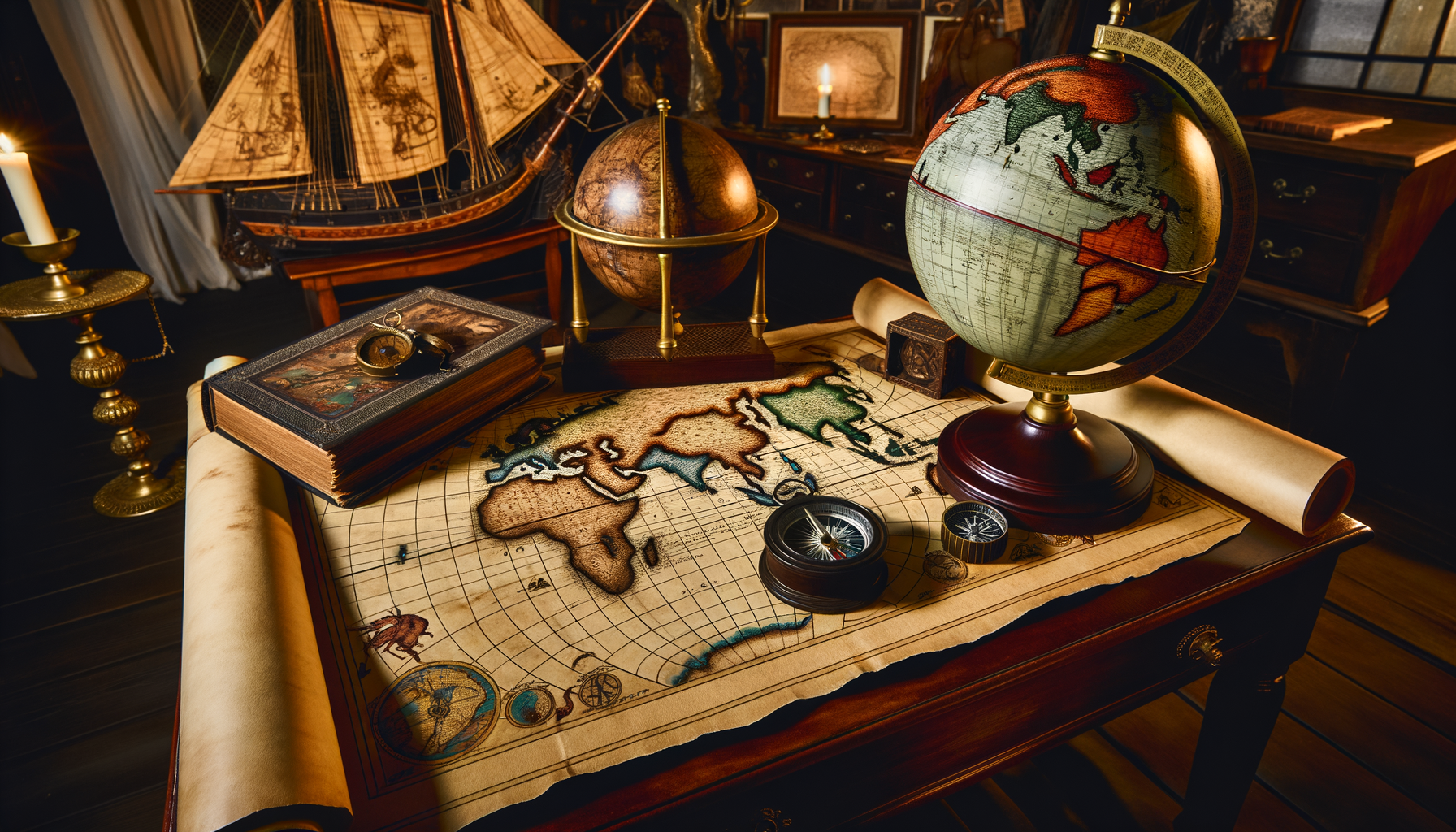
For centuries, maps and globes have stood as powerful symbols, representing humanity's drive to explore, understand, and document the world around us. They were the indispensable companions of explorers, scholars, and navigators, embodying both accumulated knowledge and the allure of adventure. However, in our increasingly digital landscape, many might view these traditional tools as relics of the past, their primary function seemingly superseded by ubiquitous digital mapping applications.Perhaps you feel overwhelmed by the sheer volume of digital information available, or maybe you're simply unaware of the sophisticated ways geographic tools are used today beyond basic route planning. You might wonder how physical maps and globes retain value, or how digital versions contribute to deeper knowledge and broader applications than simply showing you how to get from point A to point B. It's a common perspective to see modern mapping primarily through the lens of turn-by-turn directions on a smartphone screen, potentially missing the incredible depth and breadth of their current capabilities and influence.
This post aims to bridge that gap in understanding by revealing the transformative power of maps and globes in the modern world. We will delve into how these tools have evolved beyond simple navigation aids to become fundamental instruments for visualizing complex data, informing critical decisions, fostering education, and inspiring a continued sense of discovery and adventure. By exploring their multifaceted roles today, you will gain a richer appreciation for their enduring importance and learn how to leverage their full potential in both physical and digital forms for deeper knowledge and more informed interaction with the world.
Beyond Basic Navigation: The Multifaceted Role of Modern Maps
Modern maps are vastly more than static diagrams showing streets and landmarks; they are dynamic, layered information systems essential across countless disciplines. While navigation remains a core function, its methods and applications have been revolutionized by technology. Furthermore, maps have emerged as unparalleled tools for making sense of complex spatial data, revealing patterns and insights that are otherwise invisible.Their utility now spans far beyond plotting a course across the ocean or finding a local address. Contemporary maps are integral to scientific research, urban management, environmental conservation, public health initiatives, economic analysis, and even storytelling. Understanding their expanded role is key to appreciating their continued relevance and power in a data-driven society.
Navigation in the Digital Age: Real-Time Routes and Beyond
The advent of Global Positioning System (GPS) technology fundamentally reshaped how we navigate, moving from relying solely on paper maps and compasses to receiving precise, real-time location data. This technology, initially developed for military purposes, quickly transitioned into civilian use, powering the satellite navigation systems in our cars and eventually the mapping applications on our smartphones. Today, digital navigation is a seamless part of daily life for billions of people worldwide, dramatically altering travel habits and logistics.Mapping applications like Google Maps, Apple Maps, and Waze integrate GPS data with vast databases of geographic information, traffic conditions, public transit schedules, and points of interest. They offer not just static routes but dynamic guidance, adjusting directions based on real-time traffic updates, road closures, and even user-reported incidents. This real-time capability has made travel more efficient, reduced congestion in certain areas, and enabled services like ride-sharing and on-demand deliveries to scale globally.
Furthermore, digital navigation is no longer confined to roads. It extends to pedestrian routes with accessibility information, cycling paths, hiking trails, and even indoor navigation systems for large buildings like airports and shopping malls. The precision and accessibility of digital navigation tools have empowered individuals to explore new areas with confidence, plan complex journeys effortlessly, and make spontaneous travel decisions based on immediate information feeds. This evolution underscores how navigation, while still fundamental, has become smarter, more integrated, and incredibly responsive thanks to the power of digital mapping platforms.
Maps as Data Visualisation Tools: Making Sense of Complex Information
One of the most significant transformations in the role of maps has been their evolution into sophisticated platforms for data visualization. Geographic Information Systems (GIS) technology allows users to layer various types of data onto maps, revealing spatial patterns, correlations, and trends that would be difficult or impossible to discern in tables or charts alone. This capability has unlocked powerful analytical possibilities across diverse fields, turning maps into engines of insight rather than just static references.Consider demographics: mapping population density, income levels, age distribution, or ethnic diversity across a city or region provides a clear visual representation of social structures and potential needs. Businesses use this to identify optimal locations for new stores, marketers target advertising more effectively, and governments allocate resources for services like schools and healthcare based on where populations are concentrated or growing. The map becomes a narrative, telling stories about communities and their characteristics in a visually compelling way.
Similarly, maps are invaluable for visualizing environmental data. Climate scientists map rising sea levels, deforestation rates, temperature anomalies, and the spread of pollution. Ecologists track wildlife migration patterns and habitat changes. Disaster management agencies map the predicted path of hurricanes, the extent of flood zones, or the location of earthquake fault lines, crucial information for planning evacuations and coordinating emergency response efforts. Visualizing this data geographically makes complex environmental issues understandable and actionable for researchers, policymakers, and the public.
Visualizing Public Health Data
Public health is another critical area where maps have become indispensable tools for data visualization and analysis. Mapping the incidence and spread of diseases, for instance, can help identify outbreaks, trace transmission routes, and target public health interventions to affected areas. During pandemics, interactive maps showing case counts, vaccination rates, and testing sites become essential communication tools for informing the public and guiding policy decisions.Healthcare providers and researchers use maps to understand geographic disparities in health outcomes, access to care, or the distribution of specific health conditions. By visualizing health data spatially alongside demographic and environmental information, they can uncover potential contributing factors and develop targeted strategies to improve community well-being. This shows how maps empower data to tell a geographically specific story about the health of populations.
Maps in Urban Planning and Development: Shaping Our Cities
Urban planners rely heavily on maps and spatial analysis to design, manage, and improve cities. Maps provide the foundational layer for understanding the existing urban landscape – zoning regulations, infrastructure networks (roads, utilities, public transit), land use patterns (residential, commercial, industrial), and the location of public spaces. This detailed geographic inventory is the starting point for any planning initiative, allowing planners to see the city as a complex, interconnected system.GIS allows planners to analyze how proposed developments will impact traffic flow, strain existing infrastructure, or affect access to public services. They can model the effects of different zoning changes, assess the feasibility of new transit lines, or identify areas suitable for parks or affordable housing projects. By visualizing population growth projections, demographic shifts, and economic activity on maps, planners can anticipate future needs and plan strategically for sustainable urban development, ensuring cities remain livable and functional as they grow.
Public participation in urban planning is also enhanced by mapping tools. Online interactive maps allow residents to view proposed plans, provide feedback on specific locations, and contribute local knowledge about their neighborhoods. This democratizes the planning process, making it more transparent and responsive to community needs and preferences.
Maps in Environmental Science and Conservation: Tracking a Changing Planet
Environmental scientists and conservationists use maps extensively to study the natural world and monitor the impacts of human activity. Remote sensing data from satellites and drones is often processed and visualized on maps to track changes over time, such as deforestation, glacier retreat, urban sprawl into natural habitats, and shifts in vegetation cover. These maps provide critical evidence of environmental change and help identify areas in need of protection or restoration efforts.Conservation planning relies on maps to identify biodiversity hotspots, analyze habitat connectivity, map species distribution, and design protected area networks. By mapping ecological data alongside land ownership, resource extraction activities, and climate projections, conservationists can develop strategies to minimize threats and maximize the effectiveness of conservation interventions. Maps are indispensable tools for understanding the complex spatial relationships between ecosystems, human activities, and environmental health, enabling more effective stewardship of the planet's natural resources.
Globes in the Digital Age: More Than Just a Sphere
While flat maps excel at showing detailed local areas or specific data layers, globes offer a unique perspective on the Earth as a whole, preserving accurate representations of continents, oceans, and spatial relationships without the distortion inherent in flat projections. In the digital age, the concept of a globe has been expanded and transformed, moving from physical objects to interactive virtual experiences that offer unprecedented ways to explore our planet and visualize global phenomena. Digital globes, often incorporating vast amounts of data, provide a powerful tool for education, research, and gaining a holistic understanding of Earth's systems.Virtual Globes and Satellite Imagery: Interactive Exploration
Virtual globe software, most notably Google Earth, has democratized access to high-resolution satellite imagery and geographic data for the entire planet. These digital platforms allow users to pan, zoom, and tilt the view, seamlessly transitioning from a global perspective down to street-level detail in many areas. This provides an immersive and intuitive way to explore any location on Earth from the comfort of a computer or mobile device, fostering a sense of connection to distant places.Beyond satellite imagery, virtual globes integrate various data layers, including terrain models that show elevation and topography, 3D models of buildings in urban areas, historical imagery showing how places have changed over time, and user-contributed content like photos and information about landmarks. They serve not just as exploration tools but also as platforms for creating and sharing geographic stories and data visualizations, allowing users to map their own data onto the virtual globe. This interactive, multi-layered approach makes geographic exploration engaging and informative for users of all ages and backgrounds.
Globes as Educational Tools: Visualizing Global Phenomena
Both physical and digital globes are invaluable educational tools for teaching geography, environmental science, and global studies. A physical globe provides a tangible model of the Earth, helping students grasp concepts like the relative sizes of continents, the curvature of the Earth, time zones, and the relationship between latitude and longitude in a way that flat maps cannot fully convey. Interacting with a physical globe provides a fundamental spatial understanding.Digital globes enhance this educational potential by allowing visualization of dynamic global phenomena. Students can view real-time weather patterns swirling across continents, track the paths of hurricanes, observe the movement of tectonic plates, or see the distribution of climate zones and ecosystems. They can overlay historical data to understand climate change, visualize global migration patterns, or explore demographic data across different countries. This ability to visualize complex, dynamic systems on a global scale makes learning about the Earth and its interconnected systems far more engaging and intuitive, bringing abstract concepts to life through interactive visual exploration.
Globes for Global Connectivity and Understanding: Geopolitics and Culture
Globes inherently emphasize the interconnectedness of the world. They are powerful tools for understanding global politics, economics, and culture by providing a clear visualization of borders, capital cities, trade routes, and the geographic context of international relations. Seeing countries in their true relative size and position on a sphere helps to correct misperceptions that can arise from the distortions of flat map projections and provides a more accurate mental model of the world.Analyzing global issues like resource distribution, conflict zones, international migration, or the spread of communication networks is facilitated by viewing these phenomena on a globe. It helps to understand geopolitical relationships, economic dependencies, and cultural diffusions in their spatial context. Digital globes further enhance this by allowing the overlay of various datasets related to global affairs, making it possible to visualize and analyze international trends and connections in a highly intuitive way.
The Synergy: Integrating Physical and Digital Mapping
In the modern world, the choice between using a physical map or a digital mapping tool is often not an either/or proposition, but rather a matter of selecting the most appropriate tool for a specific task, or even combining their strengths. Both formats offer unique advantages, and the most effective approach often involves leveraging the benefits of each. Understanding when and why to use a physical map versus a digital tool, or how they can complement each other, is key to getting the most out of geographic resources today.The Enduring Value of Physical Maps: Tangibility and Context
Despite the rise of digital alternatives, physical maps retain significant value and possess unique advantages. There is a tangible quality to unfolding a large paper map that provides a comprehensive overview of an area, allowing you to see the "big picture" and understand the context of your location within the surrounding landscape. This broad view is often harder to replicate on a small digital screen, which typically focuses on a limited area and requires constant scrolling or zooming.Physical maps are also reliable in situations where digital technology might fail, such as in remote areas with no signal, when device batteries die, or in harsh weather conditions. They require no power source and are generally robust. Furthermore, studying a physical map can encourage a different kind of engagement – a slower, more contemplative process of planning and spatial reasoning that is less prone to the distractions and information overload sometimes associated with digital interfaces. They offer a sense of permanence and a direct connection to the craft of cartography.
How Digital Enhances Physical: Planning and Augmentation
Digital tools can significantly enhance the use and understanding of physical maps. For example, a digital mapping application is excellent for initial route planning, calculating distances and travel times, researching points of interest, and viewing up-to-date information like road closures or temporary hazards before embarking on a journey. This detailed planning can then be transferred to a physical map for use during travel, providing both the detailed plan and the broader geographic context.Augmented Reality (AR) is beginning to bridge the gap between the physical and digital. AR applications layered onto physical maps can overlay digital information like historical details, points of interest information, or even navigation arrows onto the physical map itself when viewed through a smartphone camera. This creates a hybrid experience, combining the tangibility of the physical map with the dynamic, layered information capabilities of digital technology, offering innovative ways to interact with geographic information.
Choosing the Right Tool for the Task: Combining Approaches
Selecting the best tool depends entirely on the specific need and context. For daily urban navigation with real-time traffic updates, a digital app is usually superior. For detailed backcountry hiking or sailing where connectivity is unreliable, a physical map and compass are essential safety tools. For understanding global climate patterns, an interactive digital globe or specialized online map viewer offers unparalleled data visualization capabilities.Often, the most effective approach is a combination. Use digital tools for initial research, planning, and accessing real-time data. Use physical maps for gaining broad context, maintaining situational awareness in the field, and as a reliable backup. Educational settings can benefit from both physical globes for foundational understanding and virtual globes for interactive data exploration. Recognizing the unique strengths of each allows individuals to be more effective navigators, learners, and analysts of the world around them.
Maps and Globes as Tools for Learning and Discovery
Beyond their practical applications in navigation and data analysis, maps and globes play a fundamental role in education and personal discovery. They are catalysts for curiosity, fostering geographic literacy, inspiring exploration, and developing critical thinking skills about spatial information. Engaging with maps and globes is not just about learning where places are; it is about understanding relationships, systems, and the stories embedded within the landscape.Fostering Geographic Literacy: Understanding Spatial Relationships
Geographic literacy is increasingly vital in our interconnected world. It involves understanding not just place names and locations, but also spatial concepts such as distance, scale, direction, and the relationships between different places and phenomena. Maps and globes are the primary tools for developing this literacy, helping individuals build a mental model of the world and their place within it. They teach us how human and physical features are distributed across the Earth's surface and how they interact with each other.Understanding map projections, for example, teaches us about the inherent challenges and compromises involved in representing a spherical world on a flat surface, fostering an appreciation for the complexities of cartography. Learning to read different types of maps – topographic, thematic, political – develops skills in interpreting diverse visual languages and extracting specific kinds of information. This foundational understanding of spatial concepts is essential for navigating not just physical space but also understanding complex global issues that have a geographic dimension.
Inspiring Curiosity and Adventure: Planning and Exploration
Maps have an innate power to ignite the imagination and inspire a sense of adventure. Poring over a map, whether physical or digital, can spark curiosity about distant lands, different cultures, or hidden natural wonders. They are the starting point for planning journeys, tracing routes, and dreaming of exploration, whether it is a grand expedition across continents or a simple hike in a local park. The map becomes a portal to potential experiences.Even without leaving home, maps and globes offer a form of "armchair travel." We can explore remote mountains, dive into the depths of the ocean, wander through the streets of unfamiliar cities using virtual globes, or trace the paths of historical explorers on antique maps. This fosters a sense of wonder about the diversity of the planet and encourages lifelong learning about geography, history, and cultures. They remind us that there is always more to discover and explore, both near and far.
Critical Thinking with Maps: Understanding Bias and Representation
Engaging deeply with maps also develops critical thinking skills. Maps are not neutral, objective representations of reality; they are creations influenced by the choices of the cartographer, the purpose of the map, and the technology used. Understanding concepts like projection distortion, symbolization choices, data selection for thematic maps, and even the political motivations behind border depictions encourages critical analysis of geographic information.Learning to ask questions about a map – What is being shown? What is being left out? Who made this map and why? What projection is used and how does it distort the world? – helps individuals become more discerning consumers of geographic information. This critical approach is essential in an age where maps are widely used to present arguments, visualize data that can be manipulated, and frame perspectives on local and global issues. Maps teach us to look beyond the surface and consider the power of representation.
The Future of Mapping: AI, Big Data, and Immersion
The evolution of maps and globes is far from over; it is accelerating rapidly, driven by advancements in technology like artificial intelligence (AI), the proliferation of big data, and the development of immersive technologies like virtual and augmented reality. These innovations are pushing the boundaries of what geographic tools can do, making them more dynamic, intelligent, and integrated into our digital and physical lives. The future of mapping promises even more powerful ways to understand, navigate, and interact with our complex world.Predictive Mapping: Using AI for Smarter Insights
Artificial intelligence is being applied to geographic data to create predictive maps that forecast future conditions based on current and historical patterns. AI algorithms can analyze vast datasets – including traffic flows, weather patterns, social media activity, and infrastructure status – to predict congestion hotspots, anticipate environmental changes, model urban growth scenarios, or even forecast the spread of diseases. This moves maps from simply showing what *is* or *was* to predicting what *might be*, providing invaluable insights for proactive planning and decision-making across various sectors.Real-time and Dynamic Mapping: Live Integration
The integration of real-time data streams from sources like GPS devices, sensors (Internet of Things - IoT), social media feeds, and satellite imagery is making maps increasingly dynamic. Maps can now display live traffic conditions, track the location of vehicles and assets, monitor environmental conditions like air quality or water levels, and visualize rapidly changing events as they unfold. This constant flow of information transforms static maps into living dashboards of activity and conditions, crucial for logistics, emergency response, and monitoring dynamic systems.Immersive Mapping (VR/AR): Experiencing Places Virtually
Virtual Reality (VR) and Augmented Reality (AR) technologies are creating new forms of immersive geographic experiences. VR allows users to step into a virtual environment modeled on real-world locations, offering virtual tours, simulations of future developments, or a sense of 'being there' in distant places. AR overlays digital information onto the real world as seen through a device's camera, enabling interactive experiences like digital navigation arrows layered onto your view of the street, information about buildings displayed as you look at them, or historical maps superimposed onto modern landscapes. These technologies promise to make geographic information more intuitive, interactive, and deeply integrated with our perception of the physical world.Conclusion: Enduring Symbols in a Changing World
From ancient clay tablets to interactive 3D models and AI-powered predictive visualizations, maps and globes have undergone a remarkable transformation. Yet, their fundamental role as symbols of knowledge and adventure endures. They remain essential tools for understanding our physical environment, navigating complex systems, and connecting with the wider world. Far from being obsolete, they are more powerful and versatile than ever before, adapting to new technologies and finding critical applications in nearly every facet of modern life.Whether used for personal navigation, global data analysis, urban planning, environmental monitoring, or educating the next generation, maps and globes continue to unlock insights, inspire exploration, and provide an essential framework for understanding our planet and the myriad phenomena that occur upon it. They empower us to make informed decisions, appreciate the beauty and complexity of Earth, and embark on journeys of discovery, both intellectual and physical.
Embrace the power of these transformative tools. Look beyond the simple navigation app on your phone and explore the rich layers of information available on modern mapping platforms. Consult a physical map to gain perspective or inspire your next adventure. Use interactive globes to visualize global connections and environmental processes. By actively engaging with maps and globes in their diverse forms, you gain not just practical skills but a deeper, more nuanced understanding of the world around you, reaffirming their timeless significance as symbols of both knowledge and adventure.